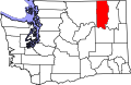
Curlew is located at the confluence of Long Alec Creek and the Kettle River. Its elevation is 1,800 feet (550m) above sea level.[4] Via State Route 21, it is 21 miles (34km) north of Republic, the Ferry County seat, and 10 miles (16km) south of the Canadian border.
One of the most popular sites on the Kettle River in summer is "the Old Swimming Hole" near the center of town. Curlew was a pick-up point for moonshine that was dropped in the Kettle River. The tradition is still celebrated on the first Sunday in June each year during the Curlew Barrel Derby Days. A barrel is set adrift in the Kettle River at the Job Corps Bridge, and local citizens bet on when it will reach town.[5]
History
Early community
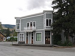
In 1896, two traders, Guy S. Helphry and J. Walters, set up a general store at an old ferry crossing near the junction of Curlew Creek and the Kettle River. The site around the store grew into a collection of log buildings and other stores. In 1898, a post office was established and the town was named "Curlew". Miners, railroad workers, natives, and others passed through the region and by 1901, a bridge was built across the Kettle River and the community had grown to a population of 200. Nearby mines such as Drummer, Lancaster and Panama grew. Curlew's population and expansion peaked at this time, and the town contained two general stores, two saloons, a hotel, two livery stables, a dry goods store and several other businesses.[6]
The Curlew Air Force Station, part of the network of Air Defense Command radar stations, was near the area and was operational in the 1950s. As of 2023[update], the radar site no longer exists, and the base, 10 miles (16km) northwest of Curlew up the Kettle River valley, is in use by Job Corps.
Railroads
In fall 1901, the Republic and Kettle Valley Railway, and Spokane Falls and Northern Railway, a subsidiary of the Great Northern Railway, were building competing Grand Forks, British Columbia to Republic, Washington lines.[7] About a mile north of Curlew, the Republic and Kettle Valley grade passed over the Great Northern one. In January 1902, Great Northern construction crews were unsuccessful in pulling down the Republic and Kettle Valley trestlework that crossed the Great Northern track.[7] Law enforcement officers diffused a series of subsequent confrontations.[8] Republic and Kettle Valley Railway, which began the Grand Forks to St. Peter's Creek passenger service in March 1902, extended the line to five or six miles north of Republic in April, and held a symbolic last spike ceremony.[9] That July, the Great Northern Marcus, Washington to Republic via Grand Forks passenger service began.[9] Great Northern began Curlew to Midway, British Columbia passenger service in December 1905.[10]
In 1919, the Republic and Kettle Valley Railway, then known as the Spokane and British Columbia Railway was officially declared bankrupt with all services ceasing that year, and the track being subsequently abandoned. In 1935, Great Northern abandoned the Curlew to Molson route.[11] In 2006, the Kettle Falls International Railway, the Great Northern successor, abandoned the 28.5mi (45.9km) San Poil Lake to Danville, Washington section, ending all railroad service through Curlew.[12]
↑ "Vancouver Sun, 5 Mar 1935". www.newspapers.com. p.15. The last train was run over the Curlew–Molson branch of the Marcus–Republic line of Great Northern Railway last week, the U.S. Railway Commission having given authority to tear up the tracks some months ago.
Turner, Robert D.; Wilkie, J.S. David (2007). Steam Along the Boundary: Canadian Pacific, Great Northern and the Great Boundary Copper Boom. Sono Nis Press. ISBN978 1-55039-158-9.
This page is based on this Wikipedia article Text is available under the CC BY-SA 4.0 license; additional terms may apply. Images, videos and audio are available under their respective licenses.