Orsara di Puglia

Last updated
Orsara di Puglia
Comune di Orsara di Puglia
Orsara-di-Puglia.jpg
Location of Orsara di Puglia
Orsara di Puglia
Italy provincial location map 2016.svg
Red pog.svg
Orsara di Puglia
Location of Orsara di Puglia in Italy
Italy Apulia location map.svg
Red pog.svg
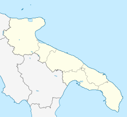
Orsara di Puglia
Orsara di Puglia (Apulia)
Coordinates: 41°17′N15°16′E / 41.283°N 15.267°E / 41.283; 15.267
Country Italy
Region Flag of Apulia.svg  Apulia
Province Foggia (FG)
Frazioni Giardinetto, Torre Guevara
Area
[1]
  Total82 km2 (32 sq mi)
Elevation
[2]
635 m (2,083 ft)
Population
 (2018-01-01) [3]
  Total3,268
  Density40/km2 (100/sq mi)
Demonym Orsarese
Time zone UTC+1 (CET)
  Summer (DST) UTC+2 (CEST)
Postal code
71027
Dialing code 0881
Patron saintS. Michele Arcangelo
Saint daySeptember 29 and May 8
Website Official website

Orsara di Puglia is a small town and comune in the province of Foggia, Apulia, southern Italy.

Contents

Named as Orsara Dauno-Irpina between 1861 and 1884, the town was part of the province of Avellino until 1927. [4]

History

The origins of Orsara date back to antiquity, as can be deduced from some archaeological findings that attest to the contacts with the Osci and the Irpini. In Roman times it was affected by the Second Punic War while the Via Traiana, a variant of the more ancient Via Appia, passed along the course of the Sannoro stream.

In the 8th century, a community of Basilian monks settled there, dedicated to the cult of the archangel Michael, who was venerated in the cave that today takes his name. In the Middle Ages the town, named Castrum Ursariae, was equipped with walls, which protected it from foreign incursions. [4] During Norman times, the court of Ripalonga [5] were in defense of the Via Francigena. [6] The knights of Calavera settled here during the mid 1200s and early 1300s.

Symbol

The coat of arms of the Municipality of Orsara di Puglia was granted by decree of the President of the Republic on 8 March 2006. [7]

"In blue, to the bear placed on the left , accompanied by his cub, faced, both in black, upright and with the left paw raised, supported by the golden plain , all trained by the oak of green, whipped to the natural, nodrita in the plain. Exterior ornaments from the Municipality. "

Demographics

Dialect & Language

Alongside the Italian language, the Dauno-Irpino dialect is also spoken in the commune.

Religion

Like most of Italy, the commune is largely Catholic. However there has been a large Waldensian presence, perhaps from Occitan people and American immigrants since 1900. A Waldensian church in the Saint Nicola parish was opened in 1934.

Economy

The economy is essentially based on agriculture, with crops of wheat, broad beans, maize and sunflowers; there are poultry, sheep and goat farms. In recent years, food and wine tourism has had a strong boost, sealed by the recognition as a Slow Food city in 2007.

Places of interest

Festivals

The following are festivals celebrated in the town:

Related Research Articles

<span class="mw-page-title-main">Canosa di Puglia</span> Comune in Apulia, Italy

Canosa di Puglia, generally known simply as Canosa, is a town and comune in the province of Barletta-Andria-Trani, Apulia, southern Italy. It is located between Bari and Foggia, on the northwestern edge of the plateau of the Murgia which dominates the Ofanto valley and the extensive plains of Tavoliere delle Puglie, ranging from Mount Vulture at the Gargano, to the Adriatic coast. Canosa, the Roman Canusium, is considered the principal archaeological center of Apulia, and is one of the oldest continually inhabited cities in Italy. A number of vases and other archaeological finds are located in local museums and private collections. It is not far from the position on the Ofanto River where the Romans found refuge after the defeat of the Battle of Cannae and is the burial place of Bohemund I of Antioch.

<span class="mw-page-title-main">Province of Foggia</span> Province of Italy

The province of Foggia is a province in the Apulia region of Italy.

<span class="mw-page-title-main">Savignano Irpino</span> Comune in Campania, Italy

Savignano Irpino is a village and comune in the province of Avellino, in the Campania region of southern Italy.

<span class="mw-page-title-main">Ariano Irpino</span> Comune in Campania, Italy

Ariano Irpino, or simply Ariano, is a comune (municipality) in the province of Avellino, in the Italian region of Campania. With a territory of 186.74 square kilometres (72.10 sq mi) and a population of 22,535 (2017), it is one of the largest settlements in the Irpinia historical district and the modern province. Located 264 kilometres (164 mi) east-southeast of Rome and 104 kilometres (65 mi) east-northeast of Naples, the comune was granted the official status of città ("city") by a presidential decree of 1952, October 26; it has been recognized as an arts town, too.

<span class="mw-page-title-main">Cerignola</span> Comune in Apulia, Italy

Cerignola is a town and comune of Apulia, Italy, in the province of Foggia, 40 kilometres southeast from the town of Foggia. It has the third-largest land area of any comune in Italy, at 593.71 square kilometres (229.23 sq mi), after Rome and Ravenna and it has the largest land area of any comune in Italy among those that are not the provincial capital. In 2017, it had a population of 58,534.

<span class="mw-page-title-main">Monteleone di Puglia</span> Comune in Apulia, Italy

Monteleone di Puglia is a hill town and comune of the province of Foggia in the Apulia region of south-eastern Italy.

Gioia del Colle is a town and comune of the Metropolitan City of Bari, Apulia, southern Italy. The town is located on the Murge plateau at 360 metres (1,180 ft) above sea level, between the Adriatic and Ionian seas.

<span class="mw-page-title-main">Greci, Campania</span> Comune in Campania, Italy

Greci is an Arbëreshë town and comune in the province of Avellino, Campania, Italy, located about 100 km northeast of Naples and about 50 km southwest of Foggia. It is a mountain agricultural village lying astride the Apennines and represents the only existing linguistic minority in Campania; Arbereshe people have settled in Greci since the 15th century.

<span class="mw-page-title-main">Montaguto</span> Comune in Campania, Italy

Montaguto is a town and comune in the province of Avellino, Campania, southern Italy.

<span class="mw-page-title-main">Montecalvo Irpino</span> Comune in Campania, Italy

Montecalvo Irpino is a town and comune in the province of Avellino, Campania, southern Italy.

<span class="mw-page-title-main">Bugnara</span> Comune in Abruzzo, Italy

Bugnara is a comune and village in the province of L'Aquila in the Abruzzo region of southern Italy. It is one of I Borghi più belli d'Italia.

<span class="mw-page-title-main">Bovino</span> Comune in Apulia, Italy

Bovino is a comune and hill town at the eastern side of the Apennines in the province of Foggia, Apulia, southern Italy.

<span class="mw-page-title-main">Anzano di Puglia</span> Comune in Apulia, Italy

Anzano di Puglia is a small town and comune in the province of Foggia and region of Apulia in southeast Italy. It rises 760 metres (2,490 ft) above sea level.

<span class="mw-page-title-main">Celle di San Vito</span> Comune in Apulia, Italy

Celle di San Vito is a town and comune in the province of Foggia of the Apulia region in southern Italy.

<span class="mw-page-title-main">Torremaggiore</span> Comune in Apulia, Italy

Torremaggiore is a town, comune (municipality) and former seat of a bishopric, in the province of Foggia in the Apulia, region of southeast Italy.

<span class="mw-page-title-main">Panni, Apulia</span> Comune in Apulia, Italy

Panni is a village and comune in the province of Foggia in the Apulia region of southeast Italy.

<span class="mw-page-title-main">Riesi</span> Comune in Sicily, Italy

Riesi is a comune (municipality) in the Province of Caltanissetta in the Italian region Sicily, located about 110 kilometres (68 mi) southeast of Palermo and about 20 kilometres (12 mi) south of Caltanissetta. As of 31 December 2004, it had a population of 11,678 and an area of 66.6 square kilometres (25.7 sq mi).

<span class="mw-page-title-main">Aequum Tuticum</span> Roman vicus in Italy

Aequum Tuticum was a Roman vicus in southern Italy, about 35 km east-northeast of Beneventum. The site lies beside Saint Eleuterio hamlet, overlooking Miscano Valley at an elevation of 575 m, about 15 km north of the modern Ariano Irpino, within Irpinia historical district. The vicus name is partly Latin and partly Oscan.

The Naples–Foggia railway is an Italian railway line connecting Naples, in Campania, with Foggia, in Apulia, crossing the Apennines at the saddle of Ariano through a series of tunnels.

<span class="mw-page-title-main">Arianese dialect</span> Romance dialect spoken in Ariano Irpino county

The Arianese dialect, typical of the territorial area of Ariano Irpino, is a vernacular variety of the Irpinian dialect, belonging in turn to the Neapolitan group of southern Italian dialects. Like all Romance languages, it descends directly from Vulgar Latin, a language of Indo-European stock that has been widespread in the area since Roman times.

References

  1. "Superficie di Comuni Province e Regioni italiane al 9 ottobre 2011". Italian National Institute of Statistics. Retrieved 16 March 2019.
  2. "Orsara di Puglia". Tuttitalia.
  3. All demographics and other statistics from the Italian statistical institute (Istat)
  4. 1 2 I Dauni-Irpini[The Daunians-Hirpini] (in Italian). Naples: Generoso Procaccini. 1990.
  5. Nicola Flammia (1893). Tipografia Marino (ed.). Storia della città di Ariano. Ariano di Puglia. pp. 114–119.{{cite book}}: CS1 maint: location missing publisher (link)
  6. "Strada Traiana". Comune di Orsara di Puglia. Archived from the original on 18 January 2018. Retrieved 1 May 2022.
  7. "Orsara di Puglia (Foggia) D.P.R. 08.03.2006 concessione di stemma e gonfalone" . Retrieved 1 May 2022.