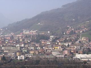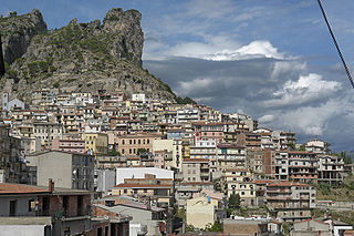
Arguello is a comune (municipality) in the Province of Cuneo in the Italian region Piedmont, located about 60 kilometres (37 mi) southeast of Turin and about 50 kilometres (31 mi) northeast of Cuneo. As of 31 December 2004, it had a population of 184 and an area of 5.0 square kilometres (1.9 sq mi).

Melle is a comune (municipality) in the Province of Cuneo in the Italian region of Piedmont, located about 60 kilometres (37 mi) southwest of Turin and about 30 kilometres (19 mi) northwest of Cuneo. As of 31 December 2004, it had a population of 340 and an area of 28.0 square kilometres (10.8 sq mi).

Robilante is a comune (municipality) in the Province of Cuneo in the Italian region Piedmont, located about 90 kilometres (56 mi) south of Turin and about 10 kilometres (6 mi) southwest of Cuneo. As of 31 December 2004, it had a population of 2,362 and an area of 24.9 square kilometres (9.6 sq mi).

Sambuco is a comune (municipality) in the Province of Cuneo in the Italian region Piedmont, located about 100 kilometres (62 mi) southwest of Turin and about 40 kilometres (25 mi) west of Cuneo. As of 31 December 2004, it had a population of 92 and an area of 46.8 square kilometres (18.1 sq mi).

Sanfrè is a comune (municipality) in the Province of Cuneo in the Italian region Piedmont, located about 35 kilometres (22 mi) south of Turin and about 45 kilometres (28 mi) northeast of Cuneo. As of 31 December 2004, it had a population of 2,602 and an area of 15.4 square kilometres (5.9 sq mi).

Venasca is a comune (municipality) in the Province of Cuneo in the Italian region Piedmont, located about 60 kilometres (37 mi) southwest of Turin and about 25 kilometres (16 mi) northwest of Cuneo. As of 31 December 2004, it had a population of 1,563 and an area of 20.4 square kilometres (7.9 sq mi).

Verduno is a comune (municipality) in the Province of Cuneo in the Italian region Piedmont, located about 50 kilometres (31 mi) southeast of Turin and about 45 kilometres (28 mi) northeast of Cuneo. As of 31 December 2004, it had a population of 523 and an area of 7.3 square kilometres (2.8 sq mi).

Rezzago is a comune (municipality) in the Province of Como in the Italian region Lombardy, located about 45 kilometres (28 mi) north of Milan and about 14 kilometres (9 mi) northeast of Como. As of 30 November 2012, it had a population of 317 and an area of 3.8 square kilometres (1.5 sq mi).

Aviatico is a comune (municipality) in the Province of Bergamo in the Italian region of Lombardy, located about 60 kilometres (37 mi) northeast of Milan and about 12 kilometres (7 mi) northeast of Bergamo. As of 31 December 2007, it had a population of 515 and an area of 8.4 square kilometres (3.2 sq mi).

Colzate is a comune (municipality) in the Province of Bergamo in the Italian region of Lombardy, located about 70 kilometres (43 mi) northeast of Milan and about 20 kilometres (12 mi) northeast of Bergamo. As of 31 December 2004, it had a population of 1,638 and an area of 6.7 square kilometres (2.6 sq mi).

Piario is a comune (municipality) in the Province of Bergamo in the Italian region of Lombardy, located about 80 kilometres (50 mi) northeast of Milan and about 30 kilometres (19 mi) northeast of Bergamo. As of 31 December 2004, it had a population of 990 and an area of 1.5 square kilometres (0.58 sq mi).

Valleve is a comune (municipality) in the Province of Bergamo in the Italian region of Lombardy, located about 80 kilometres (50 mi) northeast of Milan and about 40 kilometres (25 mi) north of Bergamo. As of 31 December 2004, it had a population of 145 and an area of 14.9 square kilometres (5.8 sq mi).

Valnegra is a comune (municipality) in the Province of Bergamo in the Italian region of Lombardy, located about 70 kilometres (43 mi) northeast of Milan and about 30 kilometres (19 mi) north of Bergamo. As of 31 December 2004, it had a population of 233 and an area of 2.1 square kilometres (0.81 sq mi).

Villa di Serio is a comune (municipality) in the Province of Bergamo in the Italian region of Lombardy, located about 50 kilometres (31 mi) northeast of Milan and about 6 kilometres (4 mi) northeast of Bergamo. As of 31 December 2004, it had a population of 6,118 and an area of 4.6 square kilometres (1.8 sq mi).

Loceri is a comune (municipality) in the Province of Nuoro in the Italian region Sardinia, located about 80 kilometres (50 mi) northeast of Cagliari and about 11 kilometres (7 mi) southwest of Tortolì. As of 31 December 2004, it had a population of 1,290 and an area of 19.3 square kilometres (7.5 sq mi).

Tertenia is a comune (municipality) in the Province of Nuoro in the Italian region Sardinia, located about 70 kilometres (43 mi) northeast of Cagliari and about 25 kilometres (16 mi) south of Tortolì.

Ulassai is a comune (municipality) in the Province of Nuoro in the Italian region Sardinia, located about 70 kilometres (43 mi) northeast of Cagliari and about 20 kilometres (12 mi) southwest of Tortolì.

Ussassai is a comune (municipality) in the Province of Nuoro in the Italian region Sardinia, located about 70 kilometres (43 mi) northeast of Cagliari and about 25 kilometres (16 mi) southwest of Tortolì. As of 31 December 2004, it had a population of 706 and an area of 47.4 square kilometres (18.3 sq mi).


