Manciano is a town and comune in the southern part of the province of Grosseto, Tuscany, central Italy. It has a population of about 7,200.

Monte Isola is a town and comune in the province of Brescia, in Lombardy.

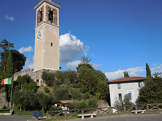
Puegnago del Garda is a comune in the province of Brescia, in Lombardy.

Borgomanero is a comune (municipality) in the Province of Novara in the Italian region Piedmont, located about 110 kilometres (68 mi) northeast of Turin, about 30 kilometres (19 mi) northwest of Novara and about 60 km northwest of Milan.

Massa Martana is an ancient Italian town and comune in the Monti Martani mountain range in the province of Perugia (Umbria). It is 10 km N of Acquasparta, 18 km N of San Gemini and 32 km N of Narni; 14 km S of Bastardo and 27 km S of Bevagna. As of the 2003 census, the town had 3558 inhabitants.

Lovere is a town and comune in the province of Bergamo, in Lombardy, northern Italy, at the northwest end of Lake Iseo.

Altino is a comune and town in the province of Chieti in the Abruzzo region of southern Italy. It is located on a rock spur commanding the valley of the Aventino river. The valley is richly cultivated with orchards, fruit, grapes and olives.

San Salvo is a comune and town in the Province of Chieti in the Abruzzo region of Italy. It is the last Abruzzo town on the Adriatic coast before entering the Molise Region.

Cerchio is a comune and town in the province of L'Aquila in the Abruzzo region of southern Italy.

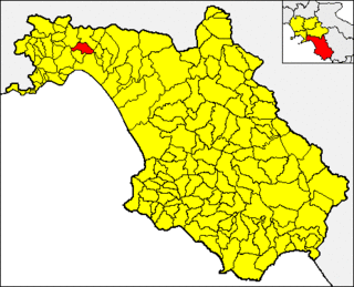
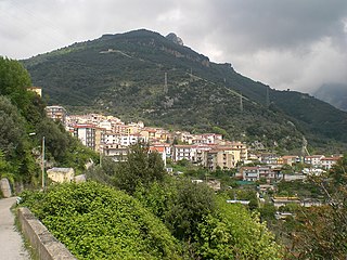
Baronissi is a town and comune in the province of Salerno in the Campania region of south-western Italy. It is home to a campus of the University of Salerno.

Olevano sul Tusciano is a town and comune in the province of Salerno in the Campania region of south-western Italy.

Bodio Lomnago is a town and comune (municipality) located in the province of Varese, in the Lombardy region of northern Italy.

Pineto is a town and comune in the province of Teramo, Abruzzo, in central Italy. It is a 20th-century seaside resort on the Adriatic coast, with sandy beaches shaded by pine trees that give their name to the town.

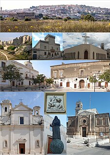
San Giorgio Ionico is a town and comune in the province of Taranto, in the northern Salento, part of the Apulia region of southeast Italy.

San Siro is a comune (municipality) in the Province of Como in the Italian region Lombardy, located on the west shore of Lake Como immediately north of Menaggio and south of Cremia.

Robbio is a city and comune (municipality) in the Province of Pavia in the Italian region Lombardy, located about 50 km southwest of Milan and about 45 km west of Pavia. It is part of Lomellina traditional region. Robbio borders the following municipalities: Borgolavezzaro, Castelnovetto, Confienza, Nicorvo, Palestro, Rosasco, Vespolate.

Legnaro is a comune in the Province of Padua in the Italian region Veneto, located about 30 kilometres (19 mi) southwest of Venice and about 11 kilometres (7 mi) southeast of Padua. As of 31 December, 2010, it had a population of 8,594 and an area of 14.89 square kilometres (5.75 sq mi).

Borgo Velino is a comune (municipality) in the Province of Rieti in the region Latium, Italy. It is located about 70 kilometres (43 mi) northeast of Rome and about 15 kilometres (9 mi) east of the town Rieti. It has an area of 17.3 square kilometres (6.7 sq mi), and as of 31 December 2010 it had a population of 1,004. Until 1927 Borgo Velino was part of the province of L'Aquila in Abruzzo. It is located near the site of a pre- or early-Roman Sabine village named Viario. Rare ruins of this ancient village, now occupied by a cultivated field, were found near a standing medieval tower. Borgo Velino is the birthplace of Giulio Pezzola, a notorious outlaw of the 17th century.

Amaseno is a comune (municipality) in the Province of Frosinone in the Italian region Lazio, located about 100 kilometres (62 mi) southeast of Rome and about 30 kilometres (19 mi) south of Frosinone, located in the Monti Lepini mountain area. Its inhabitants are primarily farmers.

Mamoiada is a comune (municipality) in the Province of Nuoro in the Italian region of Sardinia, located about 110 km (68 mi) north of Cagliari and about 12 km (7 mi) southwest of Nuoro. As of 31 December 2004, it had a population of 2,582 and an area of 49.0 square kilometres (18.9 sq mi).


