Casteldelfino is a comune (municipality) in the Province of Cuneo in the Italian region Piedmont, located about 70 kilometres (43 mi) southwest of Turin and about 45 kilometres (28 mi) northwest of Cuneo.
Priocca is a comune (municipality) in the Province of Cuneo in the Italian region Piedmont, located about 45 kilometres (28 mi) southeast of Turin and about 60 kilometres (37 mi) northeast of Cuneo. As of 31 December 2004, it had a population of 1,979 and an area of 9.1 square kilometres (3.5 sq mi).
Rossana is a comune (municipality) in the Province of Cuneo in the Italian region Piedmont, located about 60 kilometres (37 mi) southwest of Turin and about 20 kilometres (12 mi) northwest of Cuneo. As of 31 December 2004, it had a population of 950 and an area of 19.9 square kilometres (7.7 sq mi).

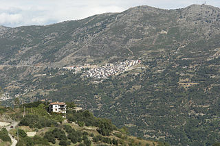
Sambuco is a comune (municipality) in the Province of Cuneo in the Italian region Piedmont, located about 100 kilometres (62 mi) southwest of Turin and about 40 kilometres (25 mi) west of Cuneo. As of 31 December 2004, it had a population of 92 and an area of 46.8 square kilometres (18.1 sq mi).
Serravalle Langhe is a comune (municipality) in the Province of Cuneo in the Italian region Piedmont, located about 60 kilometres (37 mi) southeast of Turin and about 45 kilometres (28 mi) northeast of Cuneo. As of 31 December 2004, it had a population of 340 and an area of 9.1 square kilometres (3.5 sq mi).
Vernante is a comune (municipality) in the Province of Cuneo in the Italian region Piedmont, located about 90 kilometres (56 mi) south of Turin and about 15 kilometres (9 mi) south of Cuneo. As of 31 December 2004, it had a population of 1,307 and an area of 62.0 square kilometres (23.9 sq mi).
Vignolo is a comune (municipality) in the Province of Cuneo in the Italian region Piedmont, located about 80 kilometres (50 mi) south of Turin and about 7 kilometres (4 mi) southwest of Cuneo. As of 31 December 2004, it had a population of 2,112 and an area of 8.1 square kilometres (3.1 sq mi).

Villanova Solaro is a comune (municipality) in the Province of Cuneo in the Italian region Piedmont, located about 40 kilometres (25 mi) south of Turin and about 40 kilometres (25 mi) north of Cuneo. As of 31 December 2004, it had a population of 788 and an area of 14.8 square kilometres (5.7 sq mi).

Aviatico is a comune (municipality) in the Province of Bergamo in the Italian region of Lombardy, located about 60 kilometres (37 mi) northeast of Milan and about 12 kilometres (7 mi) northeast of Bergamo. As of 31 December 2007, it had a population of 515 and an area of 8.4 square kilometres (3.2 sq mi).

Colzate is a comune (municipality) in the Province of Bergamo in the Italian region of Lombardy, located about 70 kilometres (43 mi) northeast of Milan and about 20 kilometres (12 mi) northeast of Bergamo. As of 31 December 2004, it had a population of 1,638 and an area of 6.7 square kilometres (2.6 sq mi).

Piario is a comune (municipality) in the Province of Bergamo in the Italian region of Lombardy, located about 80 kilometres (50 mi) northeast of Milan and about 30 kilometres (19 mi) northeast of Bergamo. As of 31 December 2004, it had a population of 990 and an area of 1.5 square kilometres (0.58 sq mi).

Valleve is a comune (municipality) in the Province of Bergamo in the Italian region of Lombardy, located about 80 kilometres (50 mi) northeast of Milan and about 40 kilometres (25 mi) north of Bergamo. As of 31 December 2004, it had a population of 145 and an area of 14.9 square kilometres (5.8 sq mi).

Verdellino is a comune (municipality) in the Province of Bergamo in the Italian region of Lombardy, located about 40 kilometres (25 mi) northeast of Milan and about 12 kilometres (7 mi) southwest of Bergamo. The town is easily reachable by train, the station of Verdello-Dalmine is in fact located on Verdellino's soil and the stop is one of several on the railroad line that connects the two cities of Bergamo and Milan. As of 31 December 2004, it had a population of 7,186 and an area of 3.8 square kilometres (1.5 sq mi).
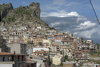
Rodì Milici is an Italian comune in the Metropolitan City of Messina in Sicily. The comune is located about 160 kilometres (99 mi) east of Palermo and about 35 kilometres (22 mi) west of Messina.
Zafferana Etnea is a comune (municipality) in the Metropolitan City of Catania in the Italian region Sicily, located about 160 kilometres (99 mi) southeast of Palermo and about 20 kilometres (12 mi) north of Catania.
Gairo, Gàiru in Sardinian, is a comune (municipality) in the Province of Nuoro in the Italian region Sardinia, located about 80 kilometres (50 mi) northeast of Cagliari and about 30 kilometres (19 mi) southwest of Tortolì. As of 31 December 2004, it had a population of 1,643 and an area of 78.4 square kilometres (30.3 sq mi).

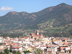
Jerzu, is a comune (municipality) in the Province of Nuoro in the Italian region Sardinia, located about 70 kilometres (43 mi) northeast of Cagliari and about 20 kilometres (12 mi) southwest of Tortolì. As of 31 December 2004, it had a population of 3,287 and an area of 102.5 square kilometres (39.6 sq mi). Jerzu is known for the production of a particular type of wine, called Cannonau di Jerzu.
Loceri is a comune (municipality) in the Province of Nuoro in the Italian region Sardinia, located about 80 kilometres (50 mi) northeast of Cagliari and about 11 kilometres (7 mi) southwest of Tortolì. As of 31 December 2004, it had a population of 1,290 and an area of 19.3 square kilometres (7.5 sq mi).
Ulassai is a comune (municipality) in the Province of Nuoro in the Italian region Sardinia, located about 70 kilometres (43 mi) northeast of Cagliari and about 20 kilometres (12 mi) southwest of Tortolì.
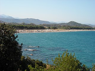
Cardedu is a comune (municipality) in the Province of Nuoro in the Italian region Sardinia, located about 80 kilometres (50 mi) northeast of Cagliari and about 15 kilometres (9 mi) south of Tortolì.