Otego, Kansas | |
|---|---|
 | |
 Otego  Otego | |
| Coordinates: 39°49′38″N98°20′50″W / 39.82722°N 98.34722°W [1] | |
| Country | United States |
| State | Kansas |
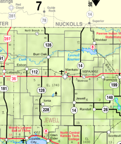
| County | Jewell |
| Elevation | 1,795 ft (547 m) |
| Time zone | UTC-6 (CST) |
| • Summer (DST) | UTC-5 (CDT) |
| Area code | 785 |
| FIPS code | 20-53500 |
| GNIS ID | 484588 [1] |
Otego is an unincorporated community in Jewell County, Kansas, United States. [1]
