Dentonia, Kansas

Last updated

Dentonia, Kansas
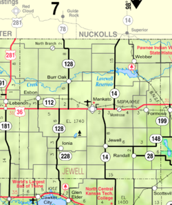
Map of Jewell Co, Ks, USA.png
USA Kansas location map.svg
Red pog.svg
Dentonia
Usa edcp location map.svg
Red pog.svg
Dentonia
Coordinates: 39°41′02″N98°28′03″W / 39.68389°N 98.46750°W / 39.68389; -98.46750 [1]
Country United States
State Kansas
County Jewell
Elevation
[1]
1,736 ft (529 m)
Population
  Total0
Time zone UTC-6 (CST)
  Summer (DST) UTC-5 (CDT)
Area code 785
FIPS code 20-17760 [1]
GNIS ID 484589 [1]

Dentonia is a ghost town in Jewell County, Kansas, United States. [1]

Contents

History

First settled in 1882 with the establishment of a post office, the population of this small farming village peaked in 1910 at 60 residents, at which point it boasted a blacksmith's shop, doctor's office, dance hall, store, church and school. The post office was discontinued in 1903. [2]

Dentonia's population was 34 in 1920, [3] and was just 3 in 1940. [4]

The Dentonia School District was numbered 109. Dentonia's store was the location of the Independent Order of Odd Fellows and Rebekah Lodge. The store closed and was torn down circa 1959. [2]

The town lost its last residents at some point after the closure of the school in 1964, but the church continued to hold services until 1998 and was destroyed by a fire in 2002. [2]

Related Research Articles

<span class="mw-page-title-main">Jewell County, Kansas</span> County in Kansas, United States

Jewell County is a county located in the U.S. state of Kansas. Its county seat and most populous city is Mankato. As of the 2020 census, the county population was 2,932. The county was named for Lewis Jewell, a lieutenant colonel of the 6th Regiment Kansas Volunteer Cavalry.

<span class="mw-page-title-main">Booneville, Iowa</span> Unincorporated community in Iowa, United States

Booneville is an Census Designated Place in Dallas County, Iowa, United States. It is part of the Des Moines–West Des Moines Metropolitan Statistical Area.

<span class="mw-page-title-main">Monti, Iowa</span> Unincorporated community in Iowa, United States

Monti is an unincorporated community located in the southeast corner of Buchanan County, Iowa, in the United States. Founded in the 1880s and platted in 1905, the community lies on the west bank of Buffalo Creek, 6 miles (10 km) east of Quasqueton and 8 miles (13 km) west of Ryan.

Farrar is an unincorporated community in Polk County, Iowa, United States. An unused elementary school building and one church are located in Farrar and 13 houses. As a result of unicorporation all residents of Farrar now have a Maxwell, Iowa address.

Gifford is an unincorporated community in southeastern Hardin County, Iowa, United States.

Charleston is an unincorporated community in Lee County, Iowa, United States, in the state's southeastern corner. Charleston is located at 40°35′27″N91°31′53″W.

Angola is an unincorporated community adjacent to the Angola Neck peninsula in Sussex County, Delaware, United States. Angola is located on an inlet of Rehoboth Bay and is near Delaware Route 24. It is a population center for the Indian River Hundred.

Lycurgus is a rural unincorporated community in Allamakee County, Iowa, United States.

Church is an unincorporated community in Allamakee County, Iowa, United States.

Dunbar is an unincorporated community and former railroad depot village in Green Castle Township, Marshall County, Iowa, United States.

Berea was an unincorporated community in Eureka Township, Adair County, Iowa, United States.

Fisk is an unincorporated community or ghost town in Adair County, Iowa, United States.

Poplar is a rural unincorporated community in Audubon County, Iowa, in the United States. It is part of the Poplar Rural District which is recognized as a rural historic district and was the largest rural settlement of Danish immigrants in the United States.

<span class="mw-page-title-main">Hockerville, Oklahoma</span> Ghost town in Oklahoma, United States

Hockerville is a ghost town in northern Ottawa County, Oklahoma, United States. Hockerville was a mining community near the Kansas-Oklahoma border; it once had more than 500 residents. At least 18 mines operated in the Hockerville area in 1918 alone.

Vandalia is an unincorporated community in Jasper County, in the U.S. state of Iowa.

Ulmer is an unincorporated community in Sac County, in the U.S. state of Iowa.

Bailey was a community in Wayne Township, Mitchell County, Iowa, United States. Founded in 1886 as a whistle stop, it was briefly known as Wapsie. The community lay north of the Wapsipinicon River.

Little Turkey is an unincorporated community in eastern Chickasaw County, in the U.S. state of Iowa.

Saude is an unincorporated community in northern Chickasaw County, in the U.S. state of Iowa.

Astor was an unincorporated community in Crawford County, in the U.S. state of Iowa.

References

  1. 1 2 3 4 5 "Dentonia, Kansas", Geographic Names Information System , United States Geological Survey, United States Department of the Interior
  2. 1 2 3 Krouse, Cerma. "Marihugh remembers hitching Nellie and dashing to Detonia [sic]". The Superior Express. Retrieved August 15, 2023.
  3. Premier Atlas of the World: Containing Maps of All Countries of the World, with the Most Recent Boundary Decisions, and Maps of All the States,territories, and Possessions of the United States with Population Figures from the Latest Official Census Reports, Also Data of Interest Concerning International and Domestic Political Questions. Rand McNally & Company. 1925. p. 191.
  4. The Attorneys List. United States Fidelity and Guaranty Company, Attorney List Department. 1940. p. 320.

Further reading