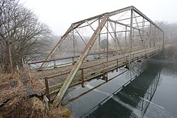
Otranto, Iowa | |
---|---|
Coordinates: 43°27′29″N92°59′08″W / 43.45806°N 92.98556°W | |
Country | United States |
State | Iowa |
County | Mitchell |
Township | Otranto |
Area | |
• Total | 0.41 sq mi (1.06 km2) |
• Land | 0.41 sq mi (1.06 km2) |
• Water | 0.00 sq mi (0.00 km2) |
Elevation | 1,171 ft (357 m) |
Population | |
• Total | 27 |
• Density | 65.85/sq mi (25.42/km2) |
Time zone | Central (CST) |
ZIP code | 50472 (St. Ansgar) |
FIPS code | 19-60285 |
Otranto is an unincorporated community and census-designated place in Otranto Township, Mitchell County, in the U.S. state of Iowa. As of the 2020 census the population was 27, [2] unchanged from 2010.
The community is in northwestern Mitchell County, 7 miles (11 km) northwest of St. Ansgar, the post office serving Otranto, and 18 miles (29 km) northwest of Osage, the county seat. The Minnesota border is 3 miles (5 km) to the north.
Otranto is located along the Cedar River, approximately 4 miles (6 km) southwest of Mona.
Census | Pop. | Note | %± |
---|---|---|---|
2010 | 27 | — | |
2020 | 27 | 0.0% | |
U.S. Decennial Census [3] |
As of the census of 2020, [4] there were 27 people, 14 households, and 13 families residing in the community. The population density was 65.9 inhabitants per square mile (25.4/km2). There were 14 housing units at an average density of 34.1 per square mile (13.2/km2). The racial makeup of the community was 81.5% White, 0.0% Black or African American, 3.7% Native American, 0.0% Asian, 0.0% Pacific Islander, 7.4% from other races and 7.4% from two or more races. Hispanic or Latino persons of any race comprised 11.1% of the population.
Of the 14 households, 21.4% of which had children under the age of 18 living with them, 92.9% were married couples living together, 0.0% were cohabitating couples, 0.0% had a female householder with no spouse or partner present and 7.1% had a male householder with no spouse or partner present. 7.1% of all households were non-families. 7.1% of all households were made up of individuals, 7.1% had someone living alone who was 65 years old or older.
The median age in the community was 54.8 years. 22.2% of the residents were under the age of 20; 0.0% were between the ages of 20 and 24; 7.4% were from 25 and 44; 48.1% were from 45 and 64; and 22.2% were 65 years of age or older. The gender makeup of the community was 51.9% male and 48.1% female.
Fairbank is a city in Buchanan and Fayette counties in the U.S. state of Iowa. The population was 1,111 at the time of the 2020 census.
Baxter is a city in Jasper County, Iowa, United States. Baxter is located 33 miles (53 km) northeast of Des Moines. The population was 962 at the 2020 census.
Beacon is a city in Mahaska County, Iowa, United States. The population was 445 at the 2020 census.
Mitchell is a city in Mitchell County, Iowa, United States. The population was 124 at the time of the 2020 census.
Stacyville is a city in Mitchell County, Iowa, United States. The population was 458 at the time of the 2020 census.
Hancock is a city in Pottawattamie County, Iowa, United States, along the West Nishnabotna River. The population was 200 at the time of the 2020 census.
Northwood is a city and the county seat of Worth County, Iowa, United States, along the Shell Rock River. The population was 2,072 at the time of the 2020 census.
Mitchellville is a city located in Polk and Jasper counties in the U.S. state of Iowa. The population was 2,485 at the time of the 2020 census.
Mineola is an unincorporated village and census-designated place in Mills County, Iowa, United States.
Little Cedar is an unincorporated community and census-designated place in central Mitchell County, Iowa, United States. As of the 2020 census it had a population of 64. Little Cedar has a post office with the ZIP code of 50454.
Toeterville is an unincorporated community and census-designated place in northwestern Mitchell County, Iowa, United States. As of the 2020 census it had a population of 53.
St. Benedict is an unincorporated community and census-designated place (CDP) in Prairie Township, Kossuth County, Iowa, United States. As of the 2020 census it had a population of 31.
New Haven is an unincorporated community and census-designated place in Mitchell County, Iowa, United States. As of the 2020 census the population of New Haven was 77.
Mona is an unincorporated community and census-designated place in Mitchell County, Iowa, United States. As of the 2020 census the population of Mona was 35.
Beaverdale is an unincorporated community and census-designated place (CDP) in Flint River Township, Des Moines County, Iowa, United States. As of the 2020 census it had a population of 880. It is part of the Burlington, Iowa micropolitan area.
Roseville is a census-designated place mainly located in Ulster Township and a small portion in the northern part of Union Township in Floyd County in the state of Iowa. As of the 2020 census the population was 39
Diamondhead Lake is an unincorporated community and census-designated place in Penn Township, Guthrie County, Iowa, United States. As of the 2020 census the population was 371.
Meyer is an unincorporated community and census-designated place in Stacyville Township, Mitchell County, in the state of Iowa, United States. As of the 2020 census the population was 14, down from 31 in 2010.
Bentley is a census-designated place located in the eastern portion of Norwalk Township in Pottawattamie County in the state of Iowa, United States. As of the 2020 census the population was 93. Its location is approximately 4 miles (6 km) east of the city of Underwood.
Kent Estates is an unincorporated area and census-designated place (CDP) in Muscatine County, Iowa, United States. As of the 2020 census, the population was 2,074.