Algeria comprises 2,381,740 square kilometres (919,590 sq mi) of land, more than 80% of which is desert, in North Africa, between Morocco and Tunisia. It is the largest country in Africa. Its Arabic name, Al Jazair, is believed to derive from the rocky islands along the coastline of the Mediterranean Sea. The northern portion, an area of mountains, valleys, and plateaus between the Mediterranean and the Sahara Desert, forms an integral part of the section of North Africa known as the Maghreb. This area includes Morocco, Tunisia, and the northwestern portion of Libya known historically as Tripolitania.

The Atlas Mountains are a mountain range in the Maghreb in North Africa. It separates the Sahara Desert from the Mediterranean Sea and the Atlantic Ocean; the name "Atlantic" is derived from the mountain range, which stretches around 2,500 km (1,600 mi) through Morocco, Algeria and Tunisia. The range's highest peak is Toubkal, which is in central Morocco, with an elevation of 4,167 metres (13,671 ft). The Atlas Mountains are primarily inhabited by Berber populations.

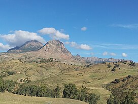
The Aures Mountains are a subrange of the Saharan Atlas in northeastern Algeria. The mountain range gives its name to the mountainous natural and historical region of the Aures.

Laghouat is one of the fifty-eight provinces (wilaya) of Algeria. It is located in the north central part of Algeria. The province borders Tiaret Province to the north, El Bayadh Province to the west, Ghardaia Province to the south and Djelfa Province to the east. The capital of the province is Laghouat City. The province is famous for palm trees and livestock.

The Chenouis or Chenoua are a Berber ethnic group native to the Chenoua Mountains in northern Algeria. They traditionally inhabit areas between the east of Ténès to the west of Cherchell. The Chenoui people number about 106,000. They speak the Shenwa language, a Northern Berber language that is closely related to the Shawiya language and Zenata varieties spoken by Berbers of the Aures mountains in Eastern Algeria and the Rif region. The Shenwa language has about 76,000 speakers.

The Anti-Atlas, also known as Lesser Atlas or Little Atlas, is a mountain range in Morocco, a part of the Atlas Mountains in the northwest of Africa. The Anti-Atlas extends from the Atlantic Ocean in the southwest toward the northeast, to the heights of Ouarzazate and further east to the city of Tafilalt, altogether a distance of approximately 500 km. The range borders on the Sahara to the south.

The Middle Atlas is a mountain range in Morocco. It is part of the Atlas mountain range, a mountainous region with more than 100,000 km2, 15 percent of its landmass, rising above 2,000 metres. The Middle Atlas is the northernmost and second highest of three main Atlas Mountains chains of Morocco. To south, separated by the Moulouya and Um Er-Rbiâ rivers, lies the High Atlas. The Middle Atlas form the westernmost end of a large plateaued basin extending eastward into Algeria, also bounded by the Tell Atlas to the north and the Saharan Atlas to the south, both lying largely in Algeria. North of the Middle Atlas and separated by the Sebou River, lie the Rif mountains which are an extension of the Baetic System, which includes the Sierra Nevada in the south of Spain. The basin of the Sebou is not only the primary transportation route between Atlantic Morocco and Mediterranean Morocco but is an area, watered by the Middle Atlas range, that constitutes the principal agricultural region of the country.

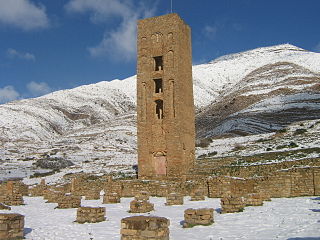
Souk Ahras is a municipality in Algeria. It is the capital of Souk Ahras Province. The Numidian city of Thagaste, on whose ruins Souk Ahras was built, was the birthplace of Augustine of Hippo and a center of Berber culture.

The Edough Massif, Edough Mountains or Djebel Edough is a mountain range of the Maghreb area in Northern Africa.
The Babor Range is a mountain range of the Tell Atlas in Algeria. The highest point of the range is 2,004 m high Mount Babor.

Derrag is a town and commune in Médéa Province, Algeria.

The Jbel Saghro or Djebel Sahrho is a mountain range in south- east Morocco. It is located south of the High Atlas and east of the Anti-Atlas in the northwest of Africa, northeast of Taliouine and southwest of Ouarzazate.

The Amour Range is a mountain range in Algeria, which comprises part of the Saharan Atlas of the Atlas Mountain System.

The Ksour Range or Kçour Range is a mountain range in Algeria. Stretching across the provinces of Béchar and El Bayadh, it is the westernmost range of the Saharan Atlas, with the Amour Range further east.

The Dahra Range is a mountain range located in northern Algeria. 'Dahra' is an Arabic word meaning 'back'; in toponymy this term indicates a long plateau of lesser altitude.

The Belezma Range, also transliterated as Belzma, is a prolongation of the Aurès Mountains, at the confluence of the Tell Atlas and the Saharan Atlas in northeastern Algeria. It is separated from the main Aurès Range by the Batna-El Kantara basin.
The Hodna Mountains are a mountain massif in northeastern Algeria. It rises on the northern side of the Hodna natural region in the M'Sila Province, near the town of Maadid around 200 km southeast of Algiers. These mountains are one of the ranges of the Saharan Atlas, part of the Atlas Mountain System.

The Titteri is a historical region in Algeria. It is located in the mountainous area of the southern Tell Atlas in the Atlas Mountains.
Mount Bou Nasser or Jbel Bou Naceur is a mountain in Sefrou Province, Fès-Meknès, Morocco. Its altitude is 3,340 meters.