
A Michigan left or P-turn is an at-grade intersection design that replaces each left (farside) turn at an intersection between a (major) divided roadway and a secondary (minor) roadway with the combination of a right (nearside) turn followed by a U-turn, or a U-turn followed by a right (nearside) turn, depending on the situation. It is in use in numerous countries.
M-1, also known as Woodward Avenue, is a north–south state trunkline highway in the Metro Detroit area of the US state of Michigan. The highway, called "Detroit's Main Street", runs from Detroit north-northwesterly to Pontiac. It is one of the five principal avenues of Detroit, along with Michigan, Grand River, Gratiot, and Jefferson avenues. These streets were platted in 1805 by Judge Augustus B. Woodward, namesake to Woodward Avenue. The Federal Highway Administration (FHWA) has listed the highway as the Automotive Heritage Trail, an All-American Road in the National Scenic Byways Program. It has also been designated a Pure Michigan Byway by the Michigan Department of Transportation (MDOT), and was also included in the MotorCities National Heritage Area designated by the US Congress in 1998.
M-3, known for most of its length as Gratiot Avenue, is a north–south state trunkline highway in the Detroit metropolitan area of the US state of Michigan. The trunkline starts in Downtown Detroit and runs through the city in a northeasterly direction along one of Detroit's five major avenues. The highway passes several historic landmarks and through a historic district. It also connects residential neighborhoods on the city's east side with suburbs in Macomb County and downtown.

M-5, commonly referred to as Grand River Avenue and the northern section as the Haggerty Connector, is a 27.9-mile-long (44.9 km) state trunkline highway in the Metro Detroit area of the US state of Michigan. The highway runs through suburbs in Oakland and Wayne counties in addition to part of Detroit itself. It starts in Commerce Township as a north–south divided highway and freeway called the Haggerty Connector and connects with Interstate 96 (I-96) in Novi. The freeway then turns southeasterly to bypass the suburb of Farmington as an east–west highway. The freeway ends on the southeast side of Farmington, and M-5 follows Grand River Avenue as boulevard into Detroit. The eastern terminus is at the five-way intersection between Grand River Avenue, Cass Avenue, and Middle Street in Downtown Detroit, where it had been extended to in May 2016 from an interchange with I-96 on the northwest side of the city. The trunkline passes between suburban residential subdivisions and along urban commercial areas while serving 17,200–68,800 vehicles on average each day.
M-8 is a 5.5-mile (8.9 km) state trunkline highway in the U.S. state of Michigan lying within the cities of Detroit and Highland Park. Much of it is the Davison Freeway, the nation's first urban depressed freeway, which became a connector between the Lodge (M-10) and the Chrysler freeways.

M-10 is a state trunkline highway in the Metro Detroit area of Michigan in the United States. Nominally labeled north-south, the route follows a northwest-southeast alignment. The southernmost portion follows Jefferson Avenue in downtown Detroit, and the southern terminus is at the intersection of Jefferson and M-3 next to the entrance to the Detroit–Windsor Tunnel. The northern terminus is in West Bloomfield Township at the intersection with Orchard Lake Road. The highway has several names as it runs through residential and commercial areas of the west side of Detroit and into the suburb of Southfield. It is called the John C. Lodge Freeway, James Couzens Highway, and Northwestern Highway. One segment has also been named the Aretha Franklin Memorial Highway.

M-102 is an east–west state trunkline highway in the US state of Michigan that runs along the northern boundary of Detroit following 8 Mile Road. The highway follows the Michigan Baseline, a part of the land survey of the state, and the roadway is also called Base Line Road in places. As a county road or city street, 8 Mile Road extends both east and west of the M-102 designation, which leaves 8 Mile on the eastern end to follow Vernier Road. The western terminus of M-102 is at the junction of 8 Mile Road and M-5 and the opposite end is at Vernier Road and Interstate 94 (I-94). The 8 Mile Road name extends west to Pontiac Trail near South Lyon with a discontinuous segment located west of US Highway 23 (US 23). The eastern end of 8 Mile Road is in Grosse Pointe Woods, near I-94, with a short, discontinuous segment east of Mack Avenue.
M-17 is a 6.390-mile-long (10.284 km) state trunkline highway in the U.S. state of Michigan, connecting the cities of Ypsilanti and Ann Arbor in Washtenaw County. It was once part of a highway that spanned the southern Lower Peninsula of Michigan before the creation of the U.S. Highway System in 1926. The designation once extended into downtown Detroit, but the eastern terminus was progressively scaled back in the late 1960s to the current location in Ypsilanti. The changes made to the highways in Washtenaw County spawned Business M-17, a business loop for 11 years between 1945 and 1956.

M-153 is an east–west state trunkline highway in the Metro Detroit area of the US state of Michigan. It is also known as Ford Road for nearly its entire length, except for its westernmost portion where the highway follows a short expressway to M-14. Named for William Ford, father of Henry Ford, Ford Road runs from near Dixboro to the Dearborn–Detroit border. The M-153 designation continues along Wyoming Avenue where it terminates at a junction with Interstate 94 (I-94) and US Highway 12 (US 12) on the city line.
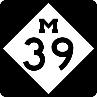
M-39 is a 16-mile-long (26 km) north–south state trunkline highway in Metro Detroit area of the US state of Michigan that runs from Lincoln Park, on the south end, to Southfield on the north. The official southern terminus of M-39 is at the corner of Southfield Road and Lafayette Boulevard in Lincoln Park, one block southeast of the junction of Interstate 75 and two blocks northwest of M-85. From there the highway heads northward. The first 2.3 miles (3.7 km) of the highway follows Southfield Road, a divided highway in the Downriver area. It then transitions into the Southfield Freeway, which is a 13.7-mile-long (22.0 km) freeway that runs from I-94 in Allen Park north through Dearborn, and then the west side of Detroit, to Southfield. The northern terminus is at M-10 in Southfield.

US Highway 24 is a United States Numbered Highway that runs from Minturn, Colorado, to Independence Township, Michigan. In Michigan, it is also known as Telegraph Road and runs for 79.828 miles (128.471 km) as a major north–south state trunkline highway from Bedford Township at the Ohio state line through Metro Detroit. The highway runs through three counties in southeastern Michigan, Monroe, Wayne and Oakland, as it parallels the Lake Erie shoreline and bypasses Metro Detroit on the west. Telegraph Road connects several suburbs together and passes through the western edge of Detroit before it terminates northwest of Clarkston at an interchange with Interstate 75 (I-75).
Michigan's 13th congressional district is a United States congressional district in Wayne County, Michigan. It is currently represented by Democrat Shri Thanedar.
The Imperial Highway is a west-east thoroughfare in the counties of Los Angeles, Orange, Riverside, San Diego, and Imperial in the U.S. state of California. The main portion of the existing route begins at Vista Del Mar in Los Angeles near the Los Angeles International Airport and ends at the Anaheim–Orange city line at Via Escola where it becomes Cannon Street. Historically, the Imperial Highway extended from Vista Del Mar to Calexico, where a portion of the highway still exists. The original route was replaced with other highways, leading the older portions of the Imperial Highway to fall out of use.

Centinela Avenue is a 10.2 mile major street in the Westside region of Los Angeles County, California.

Louisiana Highway 49 (LA 49) is a state highway located in Jefferson Parish, Louisiana. It runs 3.93 miles (6.32 km) in a north–south direction along Williams Boulevard from U.S. Highway 61 (US 61) to an intersection with Joe Yenni Boulevard and 44th Street in Kenner.
Springwells Township is a defunct civil township in Wayne County, in the U.S. state of Michigan. All of the land is now incorporated as part of the cities of Detroit and Dearborn. Springwells is also famously known as the birthplace of Henry Ford.

The Detroit metropolitan area in southeast Michigan is served by a comprehensive network of roads and highways. Three primary Interstate Highways pass through the region, along with three auxiliary Interstates, and multiple state and U.S. Highways. These are supplemented by the Mile Road System, a series of local roads spaced one mile apart on a perpendicular grid.

This is a list of trails and greenways in Detroit.
Livernois Avenue is a major thoroughfare and section line road on the west side of Metro Detroit in the US state of Michigan.
