The E-M-F Company was an early American automobile manufacturer that produced automobiles from 1909 to 1912. The name E-M-F was gleaned from the initials of the three company founders: Barney Everitt, William Metzger, and Walter Flanders.

Albert Kahn was an American industrial architect who designed industrial plant complexes such as the Ford River Rouge automobile complex. He designed the construction of Detroit skyscrapers and office buildings as well as mansions in the city suburbs. He led an organization of hundreds of architect associates and in 1937, designed 19% of all architect-designed industrial factories in the United States. Under a unique contract in 1929, Kahn established a design and training office in Moscow, sending twenty-five staff there to train Soviet architects and engineers, and to design hundreds of industrial buildings under their first five-year plan. They trained more than 4,000 architects and engineers using Kahn's concepts. In 1943, the Franklin Institute posthumously awarded Kahn the Frank P. Brown Medal.

The Ford Piquette Avenue Plant is a former factory located within the Milwaukee Junction area of Detroit, Michigan, in the United States. Built in 1904, it was the second center of automobile production for the Ford Motor Company, after the Ford Mack Avenue Plant. At the Piquette Avenue Plant, the company created and first produced the Ford Model T, the car credited with initiating the mass use of automobiles in the United States. Prior to the Model T, several other car models were assembled at the factory. Early experiments using a moving assembly line to make cars were also conducted there. It was also the first factory where more than 100 cars were assembled in one day. While it was headquartered at the Piquette Avenue Plant, Ford Motor Company became the biggest U.S.-based automaker, and it would remain so until the mid-1920s. The factory was used by the company until 1910, when its car production activity was relocated to the new, bigger Highland Park Ford Plant.

Fisher Body was an automobile coachbuilder founded by the Fisher brothers in 1908 in Detroit, Michigan.

New Center is a commercial and residential district located in Detroit, Michigan, adjacent to Midtown, one mile (1.6 km) north of the Cultural Center, and approximately three miles (5 km) north of Downtown. The area is centered just west of the intersection of Woodward Avenue and Grand Boulevard, and is bounded by, and includes the Virginia Park Historic District on the north, the Edsel Ford Freeway (I-94) on the south, John R Street on the east and the Lodge Freeway on the west. New Center, and the surrounding areas north of I-94, are sometimes seen as coterminous with the North End, while in fact separate districts.

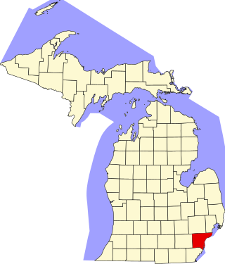
This is a list of the National Register of Historic Places listings in Wayne County, Michigan.

The Brush Park Historic District is a neighborhood located in Detroit, Michigan. It is bounded by Mack Avenue on the north, Woodward Avenue on the west, Beaubien Street on the east, and the Fisher Freeway on the south. The Woodward East Historic District, a smaller historic district completely encompassed by the larger Brush Park neighborhood, is located on Alfred, Edmund, and Watson Streets, from Brush Street to John R. Street, and is recognized by the National Register of Historic Places.

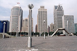
The architecture of metropolitan Detroit continues to attract the attention of architects and preservationists alike. With one of the world's recognizable skylines, Detroit's waterfront panorama shows a variety of architectural styles. The post-modern neogothic spires of One Detroit Center refer to designs of the city's historic Art Deco skyscrapers. Together with the Renaissance Center, they form the city's distinctive skyline.

Washington Boulevard Historic District is a multi-block area of downtown Detroit, Michigan. It consists of structures facing Washington Boulevard between State and Clifford Streets. In 1982, it was added to the National Register of Historic Places. It includes the Book-Cadillac Hotel, the Book Tower, the Industrial Building, and Detroit City Apartments among other architecturally significant buildings. Washington Boulevard is one of the city's main boulevards and part of Augustus Woodward's 1807-design for the city. Because Woodward's plan was never completed, the boulevard contains a sharp curve south of Michigan Avenue where it was connected to an existing street.

The Boston–Edison Historic District is a neighborhood located in Detroit, Michigan. It consists of over 900 homes built on four east-west streets: West Boston Boulevard, Chicago Boulevard, Longfellow Avenue and Edison Avenue, stretching from Woodward Avenue in the east to Linwood Avenue in the west. It is one of the largest residential historic districts in the nation. It is surrounded by Sacred Heart Major Seminary to the west, the Arden Park-East Boston Historic District and the Cathedral of the Most Blessed Sacrament to the east, and the Atkinson Avenue Historic District to the south. The district was designated a Michigan State Historic Site in 1973 and listed on the National Register of Historic Places in 1975.

The East Ferry Avenue Historic District is a historic residential district in Midtown Detroit, Michigan. The nationally designated historic district stretches two blocks from Woodward Avenue east to Brush Street; the locally designated historic district includes a third block between Brush and Beaubien. The district includes the separately designated Col. Frank J. Hecker House and the Charles Lang Freer House. It was designated a Michigan State Historic Site in 1976 and listed on the National Register of Historic Places in 1980.

The Cass Motor Sales is a commercial building located at 5800 Cass Avenue in Detroit, Michigan, USA. It was listed on the National Register of Historic Places in 1986.

The New Amsterdam Historic District is a historic district located in Detroit, Michigan. Buildings in this district are on or near three sequential east-west streets on the two blocks between Woodward Avenue and Second Avenue. It was listed on the National Register of Historic Places in 2001.

This is a list of the National Register of Historic Places listings in Detroit, Michigan.

The Harmonie Club is a club located at 267 East Grand River Avenue in Downtown Detroit, Michigan. It was designated a Michigan State Historic Site in 1975 and listed on the National Register of Historic Places in 1980.
Milwaukee Junction is an area in Detroit, Michigan, east of New Center. Located near the railroad junction of the Grand Trunk Western Railroad's predecessors Detroit, Grand Haven and Milwaukee Railway and the Chicago, Detroit and Canada Grand Trunk Junction, the area encompasses the streets of East Grand Boulevard to the north, St. Aubin St./Hamtramck Drive to the east, John R Street to the west, and the border following I-94 to the south. Due to the presence of numerous car companies within it at the turn of the 20th century, Milwaukee Junction is considered the "cradle of the Detroit auto industry".

The University–Cultural Center MRA is a pair of multiple property submissions to the National Register of Historic Places which were approved on April 29 and May 1, 1986. The structures included are all located in Midtown, near Woodward Avenue and Wayne State University in Detroit, Michigan. The two submissions are designated the University–Cultural Center MRA Phase I, containing five properties, and the University–Cultural Center MRA Phase II, containing three properties.

Philip A. Hart Plaza, in downtown Detroit, is a city plaza along the Detroit River. It is located more or less on the site at which Antoine Laumet de La Mothe, sieur de Cadillac landed in 1701 when he founded Fort Pontchartrain du Détroit, the settlement that became Detroit. In 2011, the Detroit-Wayne County Port Authority opened its new cruise ship passenger terminal and dock at Hart Plaza, adjacent to the Renaissance Center, which receives major cruise ships such as the MS Hamburg and the Yorktown.

This is a list of the National Register of Historic Places listings in Downtown and Midtown Detroit, Michigan. It is intended to be a complete list of the properties and districts on the National Register of Historic Places in Downtown and Midtown neighborhoods in Detroit, Michigan, United States. Latitude and longitude coordinates are provided for many National Register properties and districts; these locations may be seen together in online maps.


