National Register of Historic Places listings in Kalamazoo County, Michigan

Last updated

Map of Michigan with Kalamazoo County highlighted Map of Michigan highlighting Kalamazoo County.svg
Map of Michigan with Kalamazoo County highlighted

The following is a list of Registered Historic Places in Kalamazoo County, Michigan.
    This National Park Service list is complete through NPS recent listings posted April 5, 2024. [1]

Contents

[2] Name on the Register [3] ImageDate listed [4] Location City or townDescription
1 The Acres
The Acres The Acres sign.jpg
The Acres
May 19, 2004
(#04000458)
10036, 10069, 11090, 11108 and 11185 Hawthorne Dr.
42°15′42″N85°24′32″W / 42.261667°N 85.408889°W / 42.261667; -85.408889 (The Acres)
Charleston Township
2 Peter B. Appeldorn House
Peter B. Appeldorn House PeterBAppledornHouseKalamazooMI.JPG
Peter B. Appeldorn House
May 27, 1983
(#83000854)
532 Village St.
42°16′59″N85°35′30″W / 42.283056°N 85.591667°W / 42.283056; -85.591667 (Peter B. Appeldorn House)
Kalamazoo
3 Booth-Dunham Estate
Booth-Dunham Estate Booth-Dunham Estate.jpg
Booth-Dunham Estate
April 1, 1998
(#98000271)
6059 S. Ninth St.
42°13′45″N85°40′37″W / 42.229167°N 85.67695°W / 42.229167; -85.67695 (Booth-Dunham Estate)
Texas Charter Township
4 Bronson Park Historic District
Bronson Park Historic District BronsonParkKalamazooMI.JPG
Bronson Park Historic District
May 27, 1983
(#83000855)
Roughly bounded by S. Rose, S. Park, W. Lovell, and W. Michigan Aves.
42°17′24″N85°35′10″W / 42.29°N 85.5861°W / 42.29; -85.5861 (Bronson Park Historic District)
Kalamazoo
5 Eric and Margaret Ann (Davis) Brown House
Eric and Margaret Ann (Davis) Brown House The Eric and Margaret Brown House.jpg
Eric and Margaret Ann (Davis) Brown House
April 26, 2016
(#16000200)
2806 Taliesin Dr.
42°15′48″N85°37′58″W / 42.263337°N 85.632707°W / 42.263337; -85.632707 (Eric and Margaret Ann (Davis) Brown House)
Kalamazoo
6 Isaac Brown House
Isaac Brown House IsaacBrownHouseKalamazooMI.JPG
Isaac Brown House
May 27, 1983
(#83000856)
427 S. Burdick St.
42°17′17″N85°34′58″W / 42.288056°N 85.582778°W / 42.288056; -85.582778 (Isaac Brown House)
Kalamazoo
7 Climax Post Office Building
Climax Post Office Building Old Climax Post Office.jpg
Climax Post Office Building
January 27, 1999
(#99000053)
107 N. Main St.
42°14′19″N85°20′10″W / 42.238611°N 85.336111°W / 42.238611; -85.336111 (Climax Post Office Building)
Climax
8 William S. Delano House
William S. Delano House Delano Homestead.jpg
William S. Delano House
August 9, 1979
(#79001157)
N of Kalamazoo at 555 W. E Ave.
42°21′42″N85°35′51″W / 42.36166°N 85.5975°W / 42.36166; -85.5975 (William S. Delano House)
Kalamazoo
9 Desenberg Building
Desenberg Building The Desenberg Building.jpg
Desenberg Building
August 13, 1979
(#79001158)
251 E. Michigan Ave.
42°17′33″N85°34′51″W / 42.2925°N 85.580833°W / 42.2925; -85.580833 (Desenberg Building)
Kalamazoo
10 Benjamin and Maria (Ogden) Drake Farm
Benjamin and Maria (Ogden) Drake Farm Drake house photo.jpg
Benjamin and Maria (Ogden) Drake Farm
December 12, 2012
(#12001031)
927 N. Drake Rd.
42°18′03″N85°39′12″W / 42.30095°N 85.65323°W / 42.30095; -85.65323 (Benjamin and Maria (Ogden) Drake Farm)
Kalamazoo
11 Engine House No. 3
Engine House No. 3 Engine House No.3.jpg
Engine House No. 3
May 27, 1983
(#83000857)
607 Charlotte Ave.
42°17′51″N85°33′52″W / 42.2975°N 85.564444°W / 42.2975; -85.564444 (Engine House No. 3)
Kalamazoo Note NRIS erroneously tags this as a delisted property, confusing it with The Harriett (refnum 83000057).
12 Fanckboner-Nichols Farmstead
Fanckboner-Nichols Farmstead Fanckboner-Nichols Farmstead.jpg
Fanckboner-Nichols Farmstead
May 2, 2007
(#07000387)
5992 West VW Ave.
42°07′18″N85°39′55″W / 42.121667°N 85.665278°W / 42.121667; -85.665278 (Fanckboner-Nichols Farmstead)
Prairie Ronde Township
13 John Gibbs House
John Gibbs House John Gibbs House.jpg
John Gibbs House
May 27, 1983
(#83000858)
3403 Parkview Ave.
42°15′35″N85°38′25″W / 42.259722°N 85.640278°W / 42.259722; -85.640278 (John Gibbs House)
Kalamazoo
14 Gibson, Inc. Factory and Office Building
Gibson, Inc. Factory and Office Building Gibson office.jpg
Gibson, Inc. Factory and Office Building
April 29, 2022
(#100007673)
225 Parsons St.
42°18′04″N85°34′51″W / 42.301111°N 85.580833°W / 42.301111; -85.580833 (Gibson, Inc. Factory and Office Building)
Kalamazoo
15 Henry Gilbert House
Henry Gilbert House HenryGilbertHouseKalamazooMI.JPG
Henry Gilbert House
May 27, 1983
(#83000859)
415 W. Lovell
42°17′19″N85°35′16″W / 42.288611°N 85.587778°W / 42.288611; -85.587778 (Henry Gilbert House)
Kalamazoo
16 Richard and Mary Woodward Gregory House
Richard and Mary Woodward Gregory House Richard and Mary Woodward Gregory House-.jpg
Richard and Mary Woodward Gregory House
June 20, 2002
(#02000666)
913 E. Augusta Rd.
42°20′35″N85°20′38″W / 42.343056°N 85.343889°W / 42.343056; -85.343889 (Richard and Mary Woodward Gregory House)
Augusta
17 Haymarket Historic District
Haymarket Historic District Haymarket Historic District.jpg
Haymarket Historic District
May 27, 1983
(#83000860)
Michigan Ave. between Portage St. and the Grand Rapids and Indiana railroad line; also 105-141 E. Michigan Ave.
42°17′33″N85°34′49″W / 42.2925°N 85.580278°W / 42.2925; -85.580278 (Haymarket Historic District)
Kalamazoo Second set of addresses represents a boundary increase of May 4, 2011
18 Henderson Park-West Main Hill Historic District
Henderson Park-West Main Hill Historic District The Henderson Castle at 100 Monroe St.jpg
Henderson Park-West Main Hill Historic District
July 21, 1995
(#95000871)
Roughly bounded by W. Main, Thompson, Academy, Monroe, W. Lovell and Valley Sts. and Prairie Ave.
42°17′29″N85°36′21″W / 42.291389°N 85.605833°W / 42.291389; -85.605833 (Henderson Park-West Main Hill Historic District)
Kalamazoo
19 Illinois Envelope Co. Building
Illinois Envelope Co. Building Illinois Envelope Building.jpg
Illinois Envelope Co. Building
May 27, 1983
(#83000861)
400 Bryant St.
42°16′19″N85°34′40″W / 42.271944°N 85.577778°W / 42.271944; -85.577778 (Illinois Envelope Co. Building)
Kalamazoo
20 Kalamazoo State Hospital Water Tower
Kalamazoo State Hospital Water Tower Kalamazoo State Hospital Water Tower.jpg
Kalamazoo State Hospital Water Tower
March 16, 1972
(#72000624)
Oakland Dr.
42°16′37″N85°36′28″W / 42.276944°N 85.607778°W / 42.276944; -85.607778 (Kalamazoo State Hospital Water Tower)
Kalamazoo
21 Silas W. Kendall House
Silas W. Kendall House The Silas W. Kendall House.jpg
Silas W. Kendall House
December 28, 1990
(#90001958)
7540 Stadium Dr., Oshtemo Township
42°15′19″N85°41′52″W / 42.255278°N 85.697778°W / 42.255278; -85.697778 (Silas W. Kendall House)
Kalamazoo
22 Ladies Library Association Building
Ladies Library Association Building LadiesLibraryAssociationBuildingKalamazooMI.JPG
Ladies Library Association Building
July 8, 1970
(#70000274)
333 S. Park St.
42°17′20″N85°35′13″W / 42.288889°N 85.586944°W / 42.288889; -85.586944 (Ladies Library Association Building)
Kalamazoo
23 Lawrence and Chapin Building
Lawrence and Chapin Building Lawrence and Chapin Buildiing.jpg
Lawrence and Chapin Building
May 27, 1983
(#83000862)
201 N. Rose St.
42°17′34″N85°35′07″W / 42.292778°N 85.585278°W / 42.292778; -85.585278 (Lawrence and Chapin Building)
Kalamazoo
24 Lee Paper Company Mill Complex
Lee Paper Company Mill Complex Lee Paper Mill.jpg
Lee Paper Company Mill Complex
August 11, 2016
(#16000524)
300 W. Highway St.
42°06′51″N85°32′16″W / 42.114245°N 85.537814°W / 42.114245; -85.537814 (Lee Paper Company Mill Complex)
Vicksburg
25 David Lilienfeld House
David Lilienfeld House DavidLilienfeldHouseKalamazooMI.JPG
David Lilienfeld House
January 23, 1986
(#86000119)
447 W. South St.
42°17′22″N85°35′18″W / 42.289444°N 85.588333°W / 42.289444; -85.588333 (David Lilienfeld House)
Kalamazoo
26 The Marlborough
The Marlborough TheMarlboroughKalamazooMI.JPG
The Marlborough
May 27, 1983
(#83000863)
471 W. South St.
42°17′22″N85°35′21″W / 42.289444°N 85.589167°W / 42.289444; -85.589167 (The Marlborough)
Kalamazoo
27 Masonic Temple Building
Masonic Temple Building Masonic Temple-Kalamazoo.jpg
Masonic Temple Building
May 12, 1980
(#80001876)
309 N. Rose St.
42°17′38″N85°35′06″W / 42.293889°N 85.585°W / 42.293889; -85.585 (Masonic Temple Building)
Kalamazoo
28 Michigan Central Depot
Michigan Central Depot Michigan Central Depot-Kalamazoo.jpg
Michigan Central Depot
June 11, 1975
(#75000949)
459 N. Burdick St.
42°17′44″N85°35′03″W / 42.295556°N 85.584167°W / 42.295556; -85.584167 (Michigan Central Depot)
Kalamazoo
29 Henry Montague House
Henry Montague House Henry Montague House.jpg
Henry Montague House
May 27, 1983
(#83000864)
814 Oakland Dr.
42°17′01″N85°35′55″W / 42.283611°N 85.598611°W / 42.283611; -85.598611 (Henry Montague House)
Kalamazoo
30 The Oaklands
The Oaklands The Oaklands.jpg
The Oaklands
May 27, 1983
(#83000865)
1815 W. Michigan Ave.
42°17′01″N85°36′41″W / 42.283611°N 85.611389°W / 42.283611; -85.611389 (The Oaklands)
Kalamazoo
31 Old Central High School
Old Central High School OldCentralHighSchoolKalamazooMI.JPG
Old Central High School
August 16, 1983
(#83000866)
714 S. Westnedge Ave.
42°17′05″N85°35′26″W / 42.284722°N 85.590556°W / 42.284722; -85.590556 (Old Central High School)
Kalamazoo
32 Old Fire House No. 4
Old Fire House No. 4 Old Fire House No.4.jpg
Old Fire House No. 4
May 27, 1983
(#83000867)
526 N. Burdick St.
42°17′50″N85°34′59″W / 42.297222°N 85.583056°W / 42.297222; -85.583056 (Old Fire House No. 4)
Kalamazoo
33 Oshtemo Town Hall
Oshtemo Town Hall The Oshtemo Town Hall.jpg
Oshtemo Town Hall
May 19, 2004
(#04000459)
10 S. Eighth St.
42°17′19″N85°41′15″W / 42.288611°N 85.6875°W / 42.288611; -85.6875 (Oshtemo Town Hall)
Oshtemo Charter Township
34 Parkwyn Village
Parkwyn Village Levin house exterior 3.jpg
Parkwyn Village
April 29, 2022
(#100007690)
Winchell and Lorraine Aves.; Parkwyn and Taliesin Drs.
42°15′51″N85°37′51″W / 42.264167°N 85.630833°W / 42.264167; -85.630833 (Parkwyn Village)
Kalamazoo
35 Portage Street Fire Station
Portage Street Fire Station The Portage Street Fire Station.jpg
Portage Street Fire Station
September 12, 1985
(#85002150)
1249 Portage St.
42°16′46″N85°34′12″W / 42.279444°N 85.57°W / 42.279444; -85.57 (Portage Street Fire Station)
Kalamazoo
36 Alonzo T. Prentice House
Alonzo T. Prentice House The Alonzo T. prentice House.jpg
Alonzo T. Prentice House
May 27, 1983
(#83000868)
839 W. Lovell St.
42°17′19″N85°35′42″W / 42.288611°N 85.595°W / 42.288611; -85.595 (Alonzo T. Prentice House)
Kalamazoo
37 Richland Historic District
Richland Historic District Kedzie House Richland MI.jpg
Richland Historic District
April 11, 1997
(#97000278)
7567-8020 N. 32nd, 8023-8047 Church, 8951-8965 Park Sts., 8650-8118 E. D Ave., 8760-8905 Gull Rd., 9057-9063 RR
42°22′27″N85°27′26″W / 42.374167°N 85.457222°W / 42.374167; -85.457222 (Richland Historic District)
Richland
38 Rickman Hotel
Rickman Hotel Rickman Hotel.jpg
Rickman Hotel
December 9, 1994
(#94001425)
345 N. Burdick
42°17′39″N85°35′01″W / 42.294167°N 85.583611°W / 42.294167; -85.583611 (Rickman Hotel)
Kalamazoo
39 Martin W. Roberts House
Martin W. Roberts House MartinWRobertsHouseKalamazooMI.JPG
Martin W. Roberts House
May 27, 1983
(#83000869)
703 Wheaton Ave.
42°16′54″N85°35′33″W / 42.281667°N 85.5925°W / 42.281667; -85.5925 (Martin W. Roberts House)
Kalamazoo
40 Rose Place Historic District
Rose Place Historic District RosePlaceHistoricDistrictKalamazooMI.JPG
Rose Place Historic District
May 27, 1983
(#83000870)
Rose Pl.
42°16′58″N85°35′08″W / 42.282778°N 85.585556°W / 42.282778; -85.585556 (Rose Place Historic District)
Kalamazoo
41 Enoch Shaffer House
Enoch Shaffer House Enoch Shaffer House.jpg
Enoch Shaffer House
May 27, 1983
(#83000871)
1437 Douglas Ave.
42°18′22″N85°36′12″W / 42.306111°N 85.603333°W / 42.306111; -85.603333 (Enoch Shaffer House)
Kalamazoo
42 Patrick and Sarah Dobbins Shields House
Patrick and Sarah Dobbins Shields House Patrick and Sarah Dobbins Shields House.jpg
Patrick and Sarah Dobbins Shields House
July 24, 2007
(#07000745)
6681 N. 2nd St.
42°21′19″N85°44′46″W / 42.355278°N 85.746111°W / 42.355278; -85.746111 (Patrick and Sarah Dobbins Shields House)
Alamo
43 South Street Historic District
South Street Historic District SouthStreetHistoricDistrictBKalamazooMI.JPG
South Street Historic District
August 28, 1979
(#79001159)
South St. between Oakland Dr. and Westnedge Ave.; also roughly W. Lovell St. from Oakland Dr. to Pearl St. and Academy St. east of Oakland
42°17′22″N85°35′32″W / 42.289444°N 85.592222°W / 42.289444; -85.592222 (South Street Historic District)
Kalamazoo Second set of boundaries represents a boundary increase of April 14, 1995
44 Sparks-Anderson House
Sparks-Anderson House The Sparks-Anderson House.jpg
Sparks-Anderson House
April 7, 2014
(#14000125)
7653 W. Main St.
42°17′43″N85°41′58″W / 42.295278°N 85.699444°W / 42.295278; -85.699444 (Sparks-Anderson House)
Oshtemo Township
45 State Hospital Gatehouse
State Hospital Gatehouse State Hospital Gatehouse.jpg
State Hospital Gatehouse
May 27, 1983
(#83000872)
1006 Oakland Dr.
42°16′53″N85°36′00″W / 42.281389°N 85.6°W / 42.281389; -85.6 (State Hospital Gatehouse)
Kalamazoo
46 State Theatre
State Theatre 2014TeenFilmmaker-018 (12797065884).jpg
State Theatre
November 17, 2021
(#83004623)
404 S Burdick St,
42°17′18″N85°35′00″W / 42.28835°N 85.58326°W / 42.28835; -85.58326 (State Theatre)
Kalamazoo
47 Andrew J. Stevens House
Andrew J. Stevens House Andre J. Stevens House.jpg
Andrew J. Stevens House
May 27, 1983
(#83000873)
4024 Oakland Dr.
42°15′04″N85°36′52″W / 42.25111°N 85.614444°W / 42.25111; -85.614444 (Andrew J. Stevens House)
Kalamazoo
48 Stuart Area Historic District
Stuart Area Historic District 229 Stuart Avenue.jpg
Stuart Area Historic District
May 27, 1983
(#83000874)
Roughly bounded by the Michigan Central railroad line, Douglas, Forbes, W. Main, North, and Elm Sts., and Kalamazoo and Grand Aves.; also roughly along Ransom and Willard Sts., Allen Boulevard and Eleanor St., and 425-433 Douglas St. and 818 North St.
42°17′40″N85°35′54″W / 42.294444°N 85.598333°W / 42.294444; -85.598333 (Stuart Area Historic District)
Kalamazoo Second set of boundaries represents a boundary increase of July 20, 1995
49 Charles E. Stuart House
Charles E. Stuart House Stuart House.jpg
Charles E. Stuart House
March 16, 1972
(#72000625)
427 Stuart Ave.
42°17′43″N85°35′53″W / 42.295278°N 85.598056°W / 42.295278; -85.598056 (Charles E. Stuart House)
Kalamazoo
50 Dr. Nathan M. Thomas House
Dr. Nathan M. Thomas House The Dr. Nathan M. Thomas House.jpg
Dr. Nathan M. Thomas House
April 22, 1982
(#82002843)
613 E. Cass St.
42°06′59″N85°37′47″W / 42.116389°N 85.629722°W / 42.116389; -85.629722 (Dr. Nathan M. Thomas House)
Schoolcraft
51 United States Post Office
United States Post Office US Post Office-Kalamazoo.jpg
United States Post Office
December 26, 2017
(#100001930)
410 W. Michigan Ave.
42°17′30″N85°35′16″W / 42.291602°N 85.587838°W / 42.291602; -85.587838 (United States Post Office)
Kalamazoo
52 Upjohn Company Office Building
Upjohn Company Office Building Upjohn Company Office Building.jpg
Upjohn Company Office Building
November 28, 2022
(#100008450)
301 John St
42°17′22″N85°34′52″W / 42.2894°N 85.5812°W / 42.2894; -85.5812 (Upjohn Company Office Building)
Kalamazoo
53 Vicksburg Historic District
Vicksburg Historic District Main Street, Vicksburg, Michigan.jpg
Vicksburg Historic District
April 28, 2022
(#100007671)
East Highway, North and South Main, East and West Maple, East and West Park, East and West Prairie, East and West South, and West Washington Sts.; North and South Kalamazoo and South Michigan Aves; East and West Liberty Lns.
42°07′12″N85°31′56″W / 42.12°N 85.532222°W / 42.12; -85.532222 (Vicksburg Historic District)
Vicksburg
54 Vicksburg Union Depot
Vicksburg Union Depot Vicksburg Union Depot postcard.jpg
Vicksburg Union Depot
April 4, 2024
(#100010197)
300 N. Richardson St.
42°07′26″N85°31′47″W / 42.123889°N 85.529722°W / 42.123889; -85.529722 (Vicksburg Union Depot)
Vicksburg
55 Vine Area Historic District
Vine Area Historic District VineAreaHistoricDistrictBKalamazooMI.JPG
Vine Area Historic District
August 16, 1983
(#83000875)
Roughly bounded by S. Rose, S. Westnedge, W. Walnut, and Ranney Sts.
42°17′05″N85°35′12″W / 42.284722°N 85.586667°W / 42.284722; -85.586667 (Vine Area Historic District)
Kalamazoo
56 William L. Welsh Terrace
William L. Welsh Terrace WIlliamLWelshTerraceKalamazooMI.JPG
William L. Welsh Terrace
May 27, 1983
(#83000876)
101-105 W. Dutton St.
42°17′05″N85°35′00″W / 42.284722°N 85.583333°W / 42.284722; -85.583333 (William L. Welsh Terrace)
Kalamazoo

Former listings

[2] Name on the RegisterImageDate listedDate removedLocationCity or townDescription
1 East Hall
East Hall Western Michigan University East Hall.JPG
East Hall
February 23, 1978
(#78001501)
March 7, 2017Oakland Dr.
42°17′10″N85°35′47″W / 42.286111°N 85.596389°W / 42.286111; -85.596389 (East Hall)
Kalamazoo
2 Fountain of the Pioneers
Fountain of the Pioneers The Fountain of the Pioneers.jpg
Fountain of the Pioneers
June 28, 2016
(#16000417)
August 19, 2019Bronson Park, bounded by Academy, Rose, South & Park Sts.
42°17′25″N85°35′08″W / 42.290191°N 85.585511°W / 42.290191; -85.585511 (Fountain of the Pioneers)
Kalamazoo Removed from the park in 2018 [5] and delisted in 2019. [6]
3 Western State Normal School Historic District
Western State Normal School Historic District Western Michigan University East Hall.JPG
Western State Normal School Historic District
August 10, 1990
(#90001230)
March 7, 2017Roughly bounded by Stadium Dr., Oliver St., and Davis St.
42°17′08″N85°35′58″W / 42.285556°N 85.599444°W / 42.285556; -85.599444 (Western State Normal School Historic District)
Kalamazoo

See also

Related Research Articles

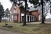
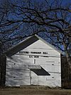
The following is a list of Registered Historic Places in Allegan County, Michigan.
     This National Park Service list is complete through NPS recent listings posted April 5, 2024.

The following is a list of Registered Historic Places in Branch County, Michigan.

<span class="mw-page-title-main">National Register of Historic Places listings in Cheboygan County, Michigan</span>

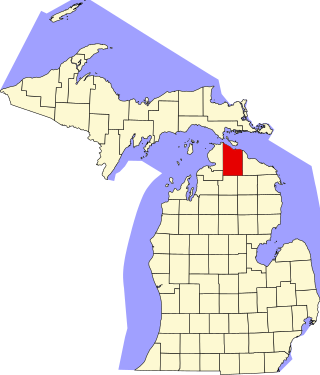
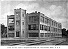
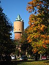
This is a list of the National Register of Historic Places listings in Cheboygan County, Michigan.

<span class="mw-page-title-main">National Register of Historic Places listings in Calhoun County, Michigan</span>

The following is a list of Registered Historic Places in Calhoun County, Michigan.
     This National Park Service list is complete through NPS recent listings posted April 5, 2024.

The following is a list of Registered Historic Places in Eaton County, Michigan.
     This National Park Service list is complete through NPS recent listings posted April 5, 2024.

<span class="mw-page-title-main">National Register of Historic Places listings in Ingham County, Michigan</span>

This is a list of the National Register of Historic Places listings in Ingham County, Michigan.

The following is a list of Registered Historic Places in Ionia County, Michigan.
     This National Park Service list is complete through NPS recent listings posted April 5, 2024.

The following is a list of Registered Historic Places in Huron County, Michigan.
     This National Park Service list is complete through NPS recent listings posted April 5, 2024.

The following is a list of Registered Historic Places in Livingston County, Michigan.
     This National Park Service list is complete through NPS recent listings posted April 5, 2024.

<span class="mw-page-title-main">National Register of Historic Places listings in Leelanau County, Michigan</span>

This is a list of the National Register of Historic Places listings in Leelanau County, Michigan.

<span class="mw-page-title-main">National Register of Historic Places listings in Kent County, Michigan</span>

The following is a list of Registered Historic Places in Kent County, Michigan.
     This National Park Service list is complete through NPS recent listings posted April 5, 2024.

The following is a list of Registered Historic Places in Midland County, Michigan.
     This National Park Service list is complete through NPS recent listings posted April 5, 2024.

<span class="mw-page-title-main">National Register of Historic Places listings in Manistee County, Michigan</span>

This is a list of the National Register of Historic Places listings in Manistee County, Michigan.

<span class="mw-page-title-main">National Register of Historic Places listings in Macomb County, Michigan</span>

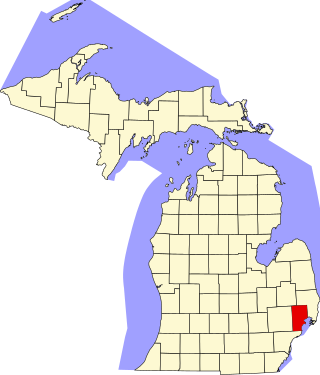
The following is a list of Registered Historic Places in Macomb County, Michigan.
     This National Park Service list is complete through NPS recent listings posted April 5, 2024.

The following is a list of Registered Historic Places in Muskegon County, Michigan.
     This National Park Service list is complete through NPS recent listings posted April 5, 2024.

The following is a list of Registered Historic Places in Ottawa County, Michigan.
     This National Park Service list is complete through NPS recent listings posted April 5, 2024.

The following is a list of Registered Historic Places in Shiawassee County, Michigan.

<span class="mw-page-title-main">National Register of Historic Places listings in St. Joseph County, Michigan</span>

This is a list of the National Register of Historic Places listings in St. Joseph County, Michigan.

<span class="mw-page-title-main">National Register of Historic Places listings in Washtenaw County, Michigan</span>

List of Registered Historic Places in Washtenaw County, Michigan.
     This National Park Service list is complete through NPS recent listings posted April 5, 2024.

The following is a list of Registered Historic Places in Tuscola County, Michigan.
     This National Park Service list is complete through NPS recent listings posted April 5, 2024.

References

  1. National Park Service, United States Department of the Interior, "National Register of Historic Places: Weekly List Actions", retrieved April 5, 2024.
  2. 1 2 Numbers represent an alphabetical ordering by significant words. Various colorings, defined here, differentiate National Historic Landmarks and historic districts from other NRHP buildings, structures, sites or objects.
  3. "National Register Information System". National Register of Historic Places . National Park Service. April 24, 2008.
  4. The eight-digit number below each date is the number assigned to each location in the National Register Information System database, which can be viewed by clicking the number.
  5. "Kalamazoo Removes Sculpture Depicting Armed White Settler Towering over a Native American".
  6. "National Register of Historic Places: Weekly List 20190823". National Park Service. Retrieved August 30, 2019.