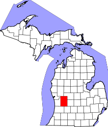
[2] Name on the Register [3] Image Date listed [4] Location City or town Description 1 Ada Covered Bridge Ada Covered Bridge February 16, 1970 (# 70000275 Across the Thornapple River 42°57′08″N 85°29′10″W / 42.952222°N 85.486111°W / 42.952222; -85.486111 (Ada Covered Bridge ) Ada 2 Aldrich Building Aldrich Building November 12, 1982 (# 82000536 98 Monroe Center, NW. 42°57′55″N 85°40′12″W / 42.965278°N 85.67°W / 42.965278; -85.67 (Aldrich Building ) Grand Rapids 3 Aldrich Godfrey and White Block Aldrich Godfrey and White Block January 27, 1999 (# 99000052 89-99 Monroe Center 42°57′53″N 85°40′13″W / 42.964722°N 85.670278°W / 42.964722; -85.670278 (Aldrich Godfrey and White Block ) Grand Rapids 4 Mathias J. Alten House and Studio Mathias J. Alten House and Studio June 23, 2009 (# 08001102 1593 East Fulton Street 42°57′47″N 85°37′50″W / 42.963056°N 85.630417°W / 42.963056; -85.630417 (Mathias J. Alten House and Studio ) Grand Rapids 5 American Box Board Company Headquarters and Factory American Box Board Company Headquarters and Factory November 24, 2020 (# 100005823 470 Market Ave. SW 42°57′17″N 85°40′56″W / 42.95473°N 85.68221°W / 42.95473; -85.68221 (American Box Board Company Headquarters and Factory ) Grand Rapids 6 American Seating Company Factory Complex American Seating Company Factory Complex July 25, 2003 (# 03000687 801 Broadway Ave., NW. 42°58′40″N 85°40′46″W / 42.977814°N 85.679506°W / 42.977814; -85.679506 (American Seating Company Factory Complex ) Grand Rapids 7 Berkey and Gay Furniture Company Factory Berkey and Gay Furniture Company Factory December 20, 2000 (# 00001486 940 Monroe Ave., NW. 42°58′44″N 85°40′18″W / 42.978889°N 85.671667°W / 42.978889; -85.671667 (Berkey and Gay Furniture Company Factory ) Grand Rapids 8 John W. Blodgett Estate John W. Blodgett Estate July 28, 1983 (# 83000877 250 Plymouth Rd., SE. 42°57′26″N 85°37′25″W / 42.957222°N 85.623611°W / 42.957222; -85.623611 (John W. Blodgett Estate ) East Grand Rapids 9 Business Route M-21 – Plaster Creek Bridge Business Route M-21 – Plaster Creek Bridge December 17, 1999 (# 99001522 Business Loop Interstate 196/Chicago Drive over Plaster Creek 42°56′09″N 85°41′14″W / 42.935833°N 85.687222°W / 42.935833; -85.687222 (Business Route M-21 – Plaster Creek Bridge ) Wyoming 10 Central Furniture Company – H. E. Shaw Furniture Company Factory Central Furniture Company – H. E. Shaw Furniture Company Factory December 24, 2013 (# 13000969 400 Ionia Avenue, SW 42°57′20″N 85°40′11″W / 42.955579°N 85.669647°W / 42.955579; -85.669647 (Central Furniture Company – H. E. Shaw Furniture Company Factory ) Grand Rapids 11 Clipper Belt Lacer Company Complex Clipper Belt Lacer Company Complex December 26, 2023 (# 100009650 974-1010 Front Avenue NW 42°58′54″N 85°40′31″W / 42.981667°N 85.675278°W / 42.981667; -85.675278 (Clipper Belt Lacer Company Complex ) Grand Rapids 12 Irving Andrew and Olive Crane Kendall Dean House Irving Andrew and Olive Crane Kendall Dean House July 20, 2023 (# 100009174 2350 Leonard St, NW 42°59′08″N 85°43′35″W / 42.985556°N 85.726389°W / 42.985556; -85.726389 (Irving Andrew and Olive Crane Kendall Dean House ) Grand Rapids 13 Division Avenue – Plaster Creek Bridge Division Avenue – Plaster Creek Bridge December 17, 1999 (# 99001523 Division Ave. over Plaster Creek 42°55′05″N 85°39′58″W / 42.918056°N 85.666111°W / 42.918056; -85.666111 (Division Avenue – Plaster Creek Bridge ) Grand Rapids Bridge was replaced in 2007 14 Downtown Lowell Historic District Downtown Lowell Historic District December 9, 1999 (# 99001539 Roughly along Main St. between Hudson and Washington 42°56′04″N 85°20′16″W / 42.934444°N 85.337778°W / 42.934444; -85.337778 (Downtown Lowell Historic District ) Lowell 15 Eastern Avenue School Eastern Avenue School September 4, 2013 (# 13000666 758 Eastern Avenue, NE 42°58′36″N 85°38′56″W / 42.976748°N 85.648759°W / 42.976748; -85.648759 (Eastern Avenue School ) Grand Rapids 16 Fallasburg Covered Bridge Fallasburg Covered Bridge March 16, 1972 (# 72000627 Covered Bridge Rd. 42°58′51″N 85°19′38″W / 42.980833°N 85.327222°W / 42.980833; -85.327222 (Fallasburg Covered Bridge ) Lowell 17 Fallasburg Historic District Fallasburg Historic District March 31, 1999 (# 98001217 Covered Bridge Rd. 42°58′56″N 85°19′24″W / 42.982222°N 85.323333°W / 42.982222; -85.323333 (Fallasburg Historic District ) Vergennes Township 18 Fine Arts Building Fine Arts Building November 12, 1982 (# 82000537 220 Lyon St., NW. 42°58′01″N 85°40′26″W / 42.966944°N 85.673889°W / 42.966944; -85.673889 (Fine Arts Building ) Grand Rapids 19 First (Park) Congregational Church First (Park) Congregational Church November 12, 1982 (# 82000538 10 E. Park Pl., NE. 42°57′51″N 85°39′56″W / 42.964167°N 85.665556°W / 42.964167; -85.665556 (First (Park) Congregational Church ) Grand Rapids 20 President Gerald R. Ford, Jr. Boyhood Home President Gerald R. Ford, Jr. Boyhood Home February 27, 1995 (# 95000073 649 Union Ave., SE. 42°57′02″N 85°39′15″W / 42.950556°N 85.654167°W / 42.950556; -85.654167 (President Gerald R. Ford, Jr. Boyhood Home ) Grand Rapids 21 Fulton Manor Fulton Manor December 2, 2021 (# 100007211 1450 Fulton St. East 42°57′45″N 85°38′05″W / 42.962500°N 85.634722°W / 42.962500; -85.634722 (Fulton Manor ) Grand Rapids 22 Goodspeed Brothers Building Goodspeed Brothers Building April 17, 1980 (# 80001877 188 Monroe St., NW. 42°58′00″N 85°40′19″W / 42.966667°N 85.671944°W / 42.966667; -85.671944 (Goodspeed Brothers Building ) Grand Rapids 23 Graham House Graham House January 13, 1972 (# 72000626 323-325 Main St. 42°56′02″N 85°20′30″W / 42.9339°N 85.34167°W / 42.9339; -85.34167 (Graham House ) Lowell 24 Grand Rapids Christian High School Grand Rapids Christian High School July 25, 2018 (# 100002712 415 Franklin St., SE. 42°56′55″N 85°39′31″W / 42.9486°N 85.6586°W / 42.9486; -85.6586 (Grand Rapids Christian High School ) Grand Rapids The school's old campus. 25 Grand Rapids Savings Bank Building Grand Rapids Savings Bank Building December 28, 1990 (# 90001956 60 Monroe Center, NW. 42°57′52″N 85°40′07″W / 42.964444°N 85.668611°W / 42.964444; -85.668611 (Grand Rapids Savings Bank Building ) Grand Rapids 26 Grand Rapids Storage and Van Company Building Grand Rapids Storage and Van Company Building December 12, 2012 (# 12001032 1415 Lake Dr. SE 42°57′27″N 85°38′04″W / 42.95742°N 85.63435°W / 42.95742; -85.63435 (Grand Rapids Storage and Van Company Building ) Grand Rapids Built in 1926, renovated into a mixed-use apartment structure and called the Kingsley Building. 27 Heartside Historic District Heartside Historic District March 2, 1982 (# 82002844 Division, Commerce, and Ionia Aves., Fulton, Weston, Oakes, and Cherry Sts.; also roughly Sheldon Blvd. SE, South Division Ave., Commerce Ave. SW, Ionia Ave. SW, Weston St. SE, Cherry St. SW, Williams St. SW, Bartlett St. SW, and Goodrich Street SW, all south of Fulton St. and north of Wealthy St. 42°57′42″N 85°40′09″W / 42.961667°N 85.669167°W / 42.961667; -85.669167 (Heartside Historic District ) Grand Rapids Second set of addresses represent a boundary increase approved July 11, 2022. 28 Heritage Hill Historic District Heritage Hill Historic District March 11, 1971 (# 71000399 Bounded by Michigan Ave. on the north, Pleasant St. on the south, Union Ave. on the east, and Clarendon Pl. and Jefferson Ave. on the west 42°57′35″N 85°39′25″W / 42.959722°N 85.656944°W / 42.959722; -85.656944 (Heritage Hill Historic District ) Grand Rapids 29 Keeler Building Keeler Building November 27, 2017 (# 80004806 56 N Division Ave. 42°57′54″N 85°40′04″W / 42.965131°N 85.667664°W / 42.965131; -85.667664 (Keeler Building ) Grand Rapids 30 Kent County Civil War Monument Kent County Civil War Monument July 14, 2004 (# 04000690 Division Ave. at Monroe Ave. 42°57′49″N 85°40′04″W / 42.963611°N 85.667778°W / 42.963611; -85.667778 (Kent County Civil War Monument ) Grand Rapids 31 Ladies' Literary Club Ladies' Literary Club October 26, 1971 (# 71000400 61 Sheldon St., SE. 42°57′45″N 85°40′01″W / 42.9625°N 85.666944°W / 42.9625; -85.666944 (Ladies' Literary Club ) Grand Rapids 32 Ledyard Block Historic District Ledyard Block Historic District September 8, 1983 (# 83000878 123-145 Ottawa Ave., and 104-124 Monroe Center, NW. 42°57′57″N 85°40′14″W / 42.965833°N 85.670556°W / 42.965833; -85.670556 (Ledyard Block Historic District ) Grand Rapids 33 Lexington School Lexington School September 4, 2013 (# 13000667 45 Lexington Avenue, NW 42°57′53″N 85°41′04″W / 42.964640°N 85.684467°W / 42.964640; -85.684467 (Lexington School ) Grand Rapids 34 Loraine Building Loraine Building November 24, 1982 (# 82000539 124 E. Fulton St. 42°57′47″N 85°39′56″W / 42.963056°N 85.665556°W / 42.963056; -85.665556 (Loraine Building ) Grand Rapids 35 Medical Arts Building Medical Arts Building May 18, 2000 (# 00000506 26 Sheldon Blvd. SE. 42°57′44″N 85°39′58″W / 42.962222°N 85.666111°W / 42.962222; -85.666111 (Medical Arts Building ) Grand Rapids 36 Metal Office Furniture Company (Steelcase) Plants No. 2 and 3 Metal Office Furniture Company (Steelcase) Plants No. 2 and 3 July 17, 2004 (# 04000691 401 Hall St. SW. 42°56′34″N 85°40′41″W / 42.942778°N 85.678056°W / 42.942778; -85.678056 (Metal Office Furniture Company (Steelcase) Plants No. 2 and 3 ) Grand Rapids 37 Michigan Trust Company Building Michigan Trust Company Building February 24, 1983 (# 83000879 40 Pearl St., NW. 42°57′58″N 85°40′12″W / 42.966111°N 85.67°W / 42.966111; -85.67 (Michigan Trust Company Building ) Grand Rapids 38 Monroe Avenue Water Filtration Plant Monroe Avenue Water Filtration Plant July 31, 2002 (# 02000815 1430 Monroe Ave. NW. 42°59′14″N 85°40′12″W / 42.987222°N 85.67°W / 42.987222; -85.67 (Monroe Avenue Water Filtration Plant ) Grand Rapids 39 Mt. Mercy Academy and Convent Mt. Mercy Academy and Convent August 5, 1993 (# 93000769 1425 Bridge St., NW. 42°58′22″N 85°42′11″W / 42.972778°N 85.703056°W / 42.972778; -85.703056 (Mt. Mercy Academy and Convent ) Grand Rapids 40 Norton Mound Group Norton Mound Group October 15, 1966 (# 66000396 Between I-196 and Indian Mound Road [5] 42°56′12″N 85°43′19″W / 42.936667°N 85.721944°W / 42.936667; -85.721944 (Norton Mound Group ) Grand Rapids 41 Augustus Paddock House Augustus Paddock House September 12, 1985 (# 85002154 1033 Lake Dr., SE. 42°57′36″N 85°38′34″W / 42.96°N 85.642778°W / 42.96; -85.642778 (Augustus Paddock House ) Grand Rapids 42 Peck Block Peck Block December 7, 2000 (# 00001483 34-50 Monroe Center NW. 42°57′51″N 85°40′07″W / 42.964167°N 85.668611°W / 42.964167; -85.668611 (Peck Block ) Grand Rapids 43 Abram W. Pike House Abram W. Pike House July 8, 1970 (# 70000276 230 Fulton St., E. 42°57′42″N 85°39′47″W / 42.961667°N 85.663056°W / 42.961667; -85.663056 (Abram W. Pike House ) Grand Rapids 44 Porter Hollow Embankment and Culvert Porter Hollow Embankment and Culvert September 24, 2001 (# 01001018 White Pine Trail at Stegman Creek, west of Summit Ave. 43°09′57″N 85°34′01″W / 43.165833°N 85.566944°W / 43.165833; -85.566944 (Porter Hollow Embankment and Culvert ) Algoma Township 45 Rood Building Rood Building March 4, 1988 (# 88000142 139 Pearl Street [6] 42°57′59″N 85°40′20″W / 42.966389°N 85.672194°W / 42.966389; -85.672194 (Rood Building ) Grand Rapids 46 Saint Joseph Seminary Saint Joseph Seminary September 16, 2019 (# 100004384 600 Burton St. SE 42°55′39″N 85°39′05″W / 42.9274°N 85.6514°W / 42.9274; -85.6514 (Saint Joseph Seminary ) Grand Rapids 47 Sisters of the Order of Saint Dominic Motherhouse Complex Sisters of the Order of Saint Dominic Motherhouse Complex April 7, 2022 (# 100007588 2025 Fulton St. E 42°57′55″N 85°37′10″W / 42.965278°N 85.619444°W / 42.965278; -85.619444 (Sisters of the Order of Saint Dominic Motherhouse Complex ) Grand Rapids Also known as Marywood Academy 48 Sixth Street Bridge Sixth Street Bridge August 13, 1976 (# 76001030 Spans Grand River between Newberry and 6th St. 42°58′36″N 85°40′27″W / 42.976667°N 85.674167°W / 42.976667; -85.674167 (Sixth Street Bridge ) Grand Rapids 49 Sligh Furniture Company Building Sligh Furniture Company Building July 21, 2023 (# 100009175 211 Logan St, SW 42°57′16″N 85°40′24″W / 42.954444°N 85.673333°W / 42.954444; -85.673333 (Sligh Furniture Company Building ) Grand Rapids 50 St. Cecilia Society Building St. Cecilia Society Building December 9, 1971 (# 71000401 24-30 Ransom Ave., NE. 42°57′49″N 85°39′53″W / 42.963611°N 85.664722°W / 42.963611; -85.664722 (St. Cecilia Society Building ) Grand Rapids 51 Third Reformed Church Third Reformed Church April 22, 1982 (# 82002845 1009 Hermitage St., SE. 42°57′40″N 85°38′39″W / 42.961111°N 85.644167°W / 42.961111; -85.644167 (Third Reformed Church ) Grand Rapids 52 Thornapple River Drive Bridge Thornapple River Drive Bridge April 18, 1990 (# 90000570 Thornapple River Dr. over Thornapple River 42°56′23″N 85°29′29″W / 42.939722°N 85.491389°W / 42.939722; -85.491389 (Thornapple River Drive Bridge ) Cascade Township 53 Turner House Turner House July 8, 1970 (# 70000277 731 Front St., NW. 42°58′35″N 85°40′35″W / 42.976389°N 85.676389°W / 42.976389; -85.676389 (Turner House ) Grand Rapids 54 U.S. Post Office U.S. Post Office July 10, 1974 (# 74000990 17 Pearl St. NW 42°58′00″N 85°40′06″W / 42.966666°N 85.668333°W / 42.966666; -85.668333 (U.S. Post Office ) Grand Rapids 55 Villa Maria Villa Maria March 27, 1987 (# 86003373 1315 Walker NW. 42°59′01″N 85°42′02″W / 42.983611°N 85.700556°W / 42.983611; -85.700556 (Villa Maria ) Grand Rapids 56 Whitney Tavern Stand Whitney Tavern Stand February 1, 2007 (# 06001326 5283 Whitneyville Ave. 42°52′08″N 85°27′34″W / 42.868889°N 85.459444°W / 42.868889; -85.459444 (Whitney Tavern Stand ) Cascade Township 57 Willard Building Willard Building January 14, 2013 (# 12001172 150 E. Fulton St. 42°57′47″N 85°39′52″W / 42.963049°N 85.664468°W / 42.963049; -85.664468 (Willard Building ) Grand Rapids Built in 1930. Home of E. A. Rood & Company, a china and glassware specialty store for many years.