
Hambledon is a rural scattered village in the Waverley borough of Surrey, situated south of Guildford. It is dominated by a buffer zone of fields and woodland, mostly south of the Greensand Ridge escarpment between Witley and Chiddingfold, having no dual carriageways or railways; however, it is bordered to the west by the Portsmouth Direct Line, and many of its small population are London commuters or retirees. Its main amenities are a church, a village pub, and the village shop and post office.

Elstead is a civil parish in Surrey, England with shops, houses and cottages spanning the north and south sides of the River Wey; development is concentrated on two roads that meet at a central green. It includes Pot Common its southern neighbourhood. Hamlets in the parish, marginally separated from the village centre, are Charleshill and Elstead Common, both rich in woodland. Elstead lies between Farnham and Godalming on the B3001 road about 2.2 miles (3.6 km) west of the A3 Milford interchange.
Bisley is a village and civil parish in the Borough of Surrey Heath in Surrey, England, approximately 25 miles (40 km) southwest of central London. It is midway between Woking and Camberley. The village had a population of 3,965 in the 2011 Census.

Thursley is a village and civil parish in southwest Surrey, west of the A3 between Milford and Hindhead. An associated hamlet is Bowlhead Green. To the east is Brook. In the south of the parish rises the Greensand Ridge, in this section reaching its escarpment near Punch Bowl Farm and the Devil's Punch Bowl, Hindhead.

Charlwood is a village and civil parish in the Mole Valley district of Surrey, England. It is immediately north-west of London Gatwick Airport in West Sussex, close west of Horley and north of Crawley. The historic county boundary between Surrey and Sussex ran to the south of Gatwick Airport. Boundaries were reformed in 1974 so that the county boundary between Surrey and West Sussex, delineated by the Sussex Border Path, now runs along the northern perimeter of the airport, and the southern extent of Charlwood.

Abinger is a large, well-wooded and mostly rural civil parish that lies between the settlements of Dorking, Shere and Ewhurst in the district of Mole Valley, Surrey, England.

Headley is a village and civil parish in the North Downs in Surrey, England. The nearest settlements are, to the west, Mickleham and Leatherhead; to the north, Ashtead and Langley Vale; to the east, Walton-on-the-Hill; and to the south, Box Hill. It is just outside the M25 motorway encircling London.
Worplesdon is a village 3.1 miles (5.0 km) NNW of Guildford in Surrey, England and a large dispersed civil parish that includes the settlements of: Worplesdon itself, Fairlands, Jacobs Well, Rydeshill and Wood Street Village, all various-sized smaller settlements, well-connected by footpaths and local roads. Its area includes Whitmoor Common, which can be a collective term for all of its commons.

Peaslake, Hoe, and Colman's Hill are in the centre of the Surrey Hills National Landscape and mid-west of the Greensand Ridge about 5 miles (8.0 km) ESE of Guildford. Surrounded by denser pine and other coniferous forest-clad hills, the three conjoined settlements have a small core in Peaslake itself with the amenities of a village, but are otherwise lightly scattered settlements at a higher elevation than the centre of Shere, the civil parish.
Dormansland is a large village and civil parish with a low population approximately one mile south of Lingfield in Surrey, England. It was founded in the 19th century and is bordered on the east by the county of Kent and on the south by West Sussex and East Sussex, the only area of the county which borders East Sussex. The nearest town is the small town of East Grinstead, immediately across the West Sussex border.

Burstow is a village and civil parish in the Tandridge district of Surrey, England. Its largest settlement is Smallfield. Smallfield is 2.5 miles (4.0 km) ENE of Gatwick Airport and the M23 motorway, 7.5 miles (12.1 km) southwest of Oxted and 1.8 miles (2.9 km) east of Horley. Crawley is a nearby large commercial town, 3.7 miles (6.0 km) southwest of Burstow and 5 miles (8.0 km) southwest of Smallfield. Towards the outside of the London commuter belt, some residents commute to the capital by road or rail from here as London is 24.5 miles (39.4 km) to the north or Horley railway station is accessible.
Leigh is a village and civil parish in Surrey, between Reigate, Dorking and Charlwood in the east of Mole Valley district. The village centre is suburban and its remainder is agricultural, interspersed by four satellite clustered localities: Dawesgreen, Bunce Common, Shellwood Cross and Nalderswood which benefit from the amenities of the village and a minority of the remainder is woodland.
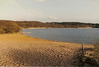
Frensham is a village in Surrey, England, next to the A287 road, 13 miles (20.9 km) WSW of Guildford, the county town. Frensham lies on the right bank of the River Wey, only navigable to canoes, shortly before its convergence with the north branch. Farnham is the nearest town, 3.5 miles (5.6 km) to the north.

Puttenham is a village in Surrey, England, located just south of the Hog's Back which is the narrowest stretch of the North Downs. Puttenham is about midway between the towns of Guildford and Farnham, and can be accessed from the A31 trunk road which runs along the spine of the Hog's Back. Villages nearby include Wanborough, Shackleford and Compton.
Stanwell Moor is a village and moor in the Borough of Spelthorne, approximately 17 miles (27 km) west of central London. Historically part of the county of Middlesex, it was transferred to Surrey in 1965. West of its generally narrow moor is the M25 London Orbital Motorway and the village is 1 mile (1.6 km) southwest of Heathrow Airport Terminal 5.

Wotton is a well-wooded parish with one main settlement, a small village mostly south of the A25 between Guildford in the west and Dorking in the east. The nearest village with a small number of shops is Westcott. Wotton lies in a narrow valley, collecting the headwaters of the Tilling Bourne which then has its first combined flow in the Vale of Holmesdale. The parish is long north to south, reaching to the North Downs escarpment in the north to the escarpment of the Greensand Ridge at Leith Hill in the south.

Felbridge is a village and civil parish in the Tandridge district of Surrey with a playing field within its focal area, narrowly in West Sussex. Felbridge village forms a contiguous settlement with East Grinstead and had 829 homes and households at the time of the 2011 census. Domewood is part of Felbridge civil parish, which was created in 1953.
Horne is a rural village and civil parish in the District of Tandridge in Surrey, England. The parish includes the hamlet of Newchapel, where the British Wildlife Centre is situated. Eastern fields forming a narrow part of the parish are split by the A22 road, a main road to East Grinstead.

Titsey is a rural village and a civil parish on the North Downs almost wholly within the M25 London Orbital Motorway in the Tandridge District of Surrey, England.

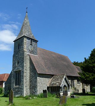
The Church of St John the Baptist, Outwood, is the parish church of Outwood, Surrey, England.

