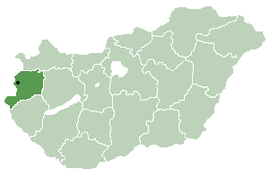
Vas is an administrative county of Hungary. It was also one of the counties of the former Kingdom of Hungary. It is part of the Centrope Project.

Hegyhátszentjakab is a village in Vas County, in the west region of Hungary.
Gencsapáti is a village in Vas county, Hungary.
Gérce is a village in Vas county, Hungary.
Kisrákos is a village in Vas county, Hungary.
Megyehíd is a village in Vas county, Hungary.
Mesterháza is a village in Vas county, Hungary.
Nárai is a village in Vas county, Hungary.
Nemesládony is a village in Vas county, Hungary.
Ölbő is a village in Vas county, Hungary.

Rábapaty is a village in Vas county, Hungary.
Sajtoskál is a village in Vas county, Hungary.
Simaság is a village in Vas county, Hungary.
Sorkikápolna is a village in Vas county, Hungary.
Sorokpolány is a village in Vas county, Hungary.
Szaknyér is a village in Vas county, Hungary.

Szalafő is a village in Vas county, Hungary.

Vasszécseny is a village in Vas county, Hungary.

Márianosztra is a village in Pest county, Hungary.
Szokolya is a village in Pest county, Hungary.


