
Bethlehem Township is a township in Northampton County, Pennsylvania, United States. The population of Bethlehem Township was 23,730 at the 2010 census. It is a suburb of Bethlehem and is part of the Lehigh Valley metropolitan statistical area, which had a population of 861,899 and was the 68th-most populous metropolitan area in the U.S. as of the 2020 census.
Bushkill Township is a township in Northampton County, Pennsylvania. Its population was 8,178 at the 2010 census. It is part of the Lehigh Valley metropolitan area, which had a population of 861,899 and was the 68th-most populous metropolitan area in the U.S. as of the 2020 census.
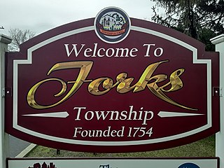
Forks Township is a township in Northampton County, Pennsylvania. The population of Forks Township was 14,721 as of the 2010 census. It is part of the Lehigh Valley metropolitan area, which had a population of 861,899 and was the 68th-most populous metropolitan area in the U.S. as of the 2020 census. The township is home to the global headquarters of Crayola, founded in 1885, a global arts supply company and the world's leading manufacturer of crayons.

Palmer Township is a township in Northampton County, Pennsylvania. The population of Palmer Township was 20,691 at the 2010 census.

Stockertown is a borough in Northampton County, Pennsylvania. The borough's population was 927 as of the 2010 census. It is part of the Lehigh Valley metropolitan area, which had a population of 861,899 and was the 68th most populous metropolitan area in the U.S. as of the 2010 census.

Upper Nazareth Township is a township in Northampton County, Pennsylvania. It is part of the Lehigh Valley metropolitan area, which had a population of 861,899 and was the 68th-most populous metropolitan area in the U.S. as of the 2020 census. At the 2010 census, the Upper Nazareth Township population was 6,231.

Pennsylvania Route 191 is a 111.54 mi (179.51 km)-long state highway in the U.S. state of Pennsylvania. The route, a major non-freeway corridor connecting the Lehigh Valley to the Pocono Mountains in eastern Pennsylvania, is designated from U.S. Route 22 in Brodhead near the city of Bethlehem to the New York state line over the Delaware River at Hancock, New York.
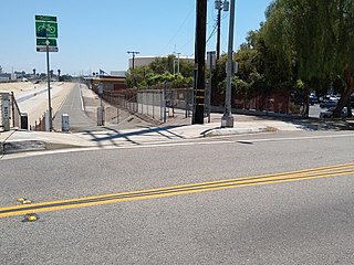
The Coyote Creek bikeway is a Class 1 bike path in Los Angeles County that runs adjacent to the Coyote Creek flood control channel for approximately 9.5 miles. The bike path is controlled by Caltrans. The path begins in Santa Fe Springs on the North fork of the Coyote Creek and extends south into Long Beach where it joins the San Gabriel River bicycle path at the trail bridge just South of Willow Street/Katella Avenue.

The San Gabriel River Trail is a 28-mile (45 km) bike path along the San Gabriel River through El Dorado Regional Park and onto street bike trails near the Alamitos Bay Marina in Los Angeles County, California. The South end is Seal Beach. The northern segment begins near Whittier Narrows Recreation Area.

The Arroyo Seco Bicycle Path is an approximately 2-mile (3.2 km) long Class I bicycle path along the Arroyo Seco river channel and canyon in the Northeast Los Angeles region of Los Angeles County, California. It parallels the Arroyo Seco Parkway, which is also a part of the canyon.

The Hockhocking Adena Bikeway, known colloquially as The Bike Path or more formally as The Athens County Bike Path, is a 21-mile (34 km) long bicycle path in Athens County, Ohio, in the United States. The original section of the path was built on a levee along the Hocking River at Ohio University in Athens, on university land. It was gradually expanded and now crosses university land, city land, and county land. The greater part of the path is a rail trail,. The eastern terminus of the path is near the intersection of East State Street with US-50 on the east side of Athens and its western terminus is in Nelsonville, at the Rocky Brands Factory Outlet at the intersection of Canal Street and Myers Street, one block from the Historic Square Arts District.
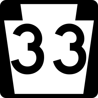
Pennsylvania Route 33 is a 27.7-mile-long (44.6 km) freeway in eastern Pennsylvania. The highway runs from its interchange with Interstate 78 (I-78) south of Easton in the Lehigh Valley to I-80 and PA 611 west of Stroudsburg.

Pennsylvania Route 512 is a 26.1-mile-long (42.0 km) state route in Northampton County in the Lehigh Valley region in eastern Pennsylvania. The southern terminus is at U.S. Route 22 north of Bethlehem in Hanover Township. The northern terminus is at PA 611 in Upper Mount Bethel Township. The route heads north from US 22 to Bath, where it intersects PA 248. From here, PA 512 continues northeast and intersects PA 946 in Moorestown before it reaches an interchange with the PA 33 freeway in Wind Gap. The route heads east through the northern Northampton County boroughs of Wind Gap, Pen Argyl, Bangor, and East Bangor, intersecting PA 191 in Bangor. Past here, PA 512 continues east to PA 611.

The Cape Cod Rail Trail (CCRT) is a 25.5-mile (41.0 km) paved rail trail located on Cape Cod in Massachusetts. The trail route passes through the towns of Yarmouth, Dennis, Harwich, Brewster, Orleans, Eastham, and Wellfleet. It connects to the 6-plus mile (10 km) Old Colony Rail Trail leading to Chatham, the 2 mile Yarmouth multi-use trail, and 8 miles (13 km) of trails within Nickerson State Park. Short side trips on roads lead to national seashore beaches including Coast Guard Beach at the end of the Nauset Bike Trail in Cape Cod National Seashore. The trail is part of the Claire Saltonstall Bikeway.
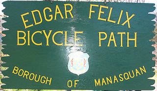
The Edgar Felix Bikeway is a 5.4 miles (8.7 km) rail trail in New Jersey between Manasquan and Allaire State Park. The trail was constructed on a former roadbed of the Farmingdale and Squan Village Railroad and the Freehold and Jamesburg Agricultural Railroad.
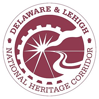
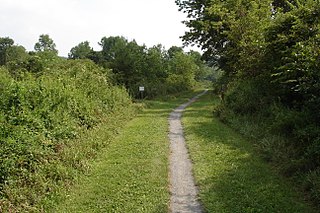
The Delaware & Lehigh Canal National and State Heritage Corridor (D&L) is a 165-mile (266 km) National Heritage Area in eastern Pennsylvania in the United States. It stretches from north to south, across five counties and over one hundred municipalities. It follows the historic routes of the Lehigh and Susquehanna Railroad, Lehigh Valley Railroad, the Lehigh Navigation, Lehigh Canal, and the Delaware Canal, from Bristol northeast of Philadelphia to Wilkes-Barre in the northeastern part of the state.
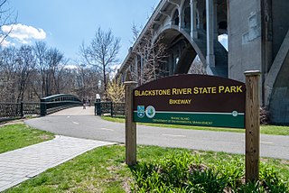
The Blackstone River Greenway is a partially completed 48-mile (77 km) paved rail trail defining the course of the East Coast Greenway through the Blackstone Valley from Worcester, Massachusetts to Providence, Rhode Island in the United States.

