Related Research Articles

The Erie Canal is a historic canal in upstate New York that runs east-west between the Hudson River and Lake Erie. Completed in 1825, the canal was the first navigable waterway connecting the Atlantic Ocean to the Great Lakes, vastly reducing the costs of transporting people and goods across the Appalachians. In effect, the canal accelerated the settlement of the Great Lakes region, the westward expansion of the United States, and the economic ascendancy of New York State. It has been called "The Nation's First Superhighway."
The Lake Shore and Michigan Southern Railway, established in 1833 and sometimes referred to as the Lake Shore, was a major part of the New York Central Railroad's Water Level Route from Buffalo, New York, to Chicago, Illinois, primarily along the south shore of Lake Erie and across northern Indiana. The line's trackage remains a major rail transportation corridor used by Amtrak passenger trains and several freight lines; in 1998, its ownership was split at Cleveland between CSX Transportation to the east and Norfolk Southern Railway in the west.

The Great Allegheny Passage (GAP) is a 150-mile (240 km) rail trail between Pittsburgh, Pennsylvania and Cumberland, Maryland. Together with the C&O Canal towpath, the GAP is part of a 335 mi (539 km) route between Pittsburgh and Washington, D.C., that is popular with through hikers and cyclists.

The Rochester Industrial and Rapid Transit Railway, more commonly known as the Rochester subway, was a light rail rapid transit line in the city of Rochester, New York, from 1927 to 1956. The subway was constructed in the bed of the old Erie Canal, which allowed the route to be grade-separated for its entire length. Two miles (3.2 km) of the route through downtown were constructed in a cut-and-cover tunnel that became Broad Street, and the only underground portion of the subway. The Rochester Subway was designed to reduce interurban traffic on city streets, and to facilitate freight interchange between the railroads. The line was operated on a contract basis by New York State Railways until Rochester Transit Corporation (RTC) took over in 1938. The last day of passenger service was June 30, 1956. Portions of the right-of-way were used for expressway construction, while the rest was abandoned and filled in over the years. The largest remaining section is a stretch of tunnel under Broad Street from Exchange Street to the intersection of Court Street and South Avenue.

The Pittsburgh, Cincinnati, Chicago and St. Louis Railroad, commonly called the Pan Handle Route, was a railroad that was part of the Pennsylvania Railroad system. Its common name came from its main line, which began at Pittsburgh, Pennsylvania, crossed the Northern Panhandle of West Virginia, and continued west to Bradford, Ohio, where it split into a northern line to Chicago and a southern one through Indianapolis, Indiana, to East St. Louis, Illinois.

The Lackawanna Cut-Off was a rail line built by the Delaware, Lackawanna & Western Railroad (DL&W). Constructed from 1908 to 1911, the line was part of a 396-mile (637 km) main line between Hoboken, New Jersey, and Buffalo, New York. It ran west for 28.6 miles (46.0 km) from Port Morris Junction in Port Morris, New Jersey, near the south end of Lake Hopatcong about 45 miles (72 km) west-northwest of New York City, to Slateford Junction in Slateford, Pennsylvania near the Delaware Water Gap.
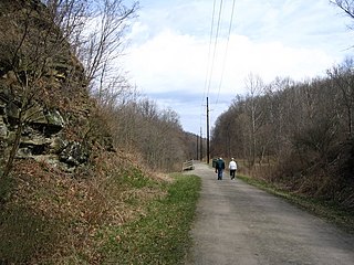
The Montour Trail is a multi-use recreational rail trail near Pittsburgh, Pennsylvania. It was formerly the Montour Railroad.

The Western Maryland Rail Trail (WMRT) is a 28-mile (45 km) shared-use rail trail in the U.S. state of Maryland that follows the former right-of-way of the Western Maryland Railway (WM) between Fort Frederick State Park and Little Orleans via Hancock, paralleling the C&O Canal and Potomac River. The asphalt-paved trail is suitable for walking, jogging, biking, rollerblading, country skiing, and snowshoeing.

Pittsburgh, surrounded by rivers and hills, has a unique transportation infrastructure that includes roads, tunnels, bridges, railroads, inclines, bike paths, and stairways.

The Old Erie Canal State Historic Park encompasses a 36-mile (58 km) linear segment of the original Erie Canal's Long Level section. It extends westward from Butternut Creek in the town of DeWitt, just east of Syracuse, to the outskirts of Rome, New York. The park includes restored segments of the canal's waterway and towpath which were in active use between 1825 and 1917. It is part of the New York State Park system.
Transportation in New York is made up of some of the most extensive and one of the oldest transportation infrastructures in the country. Engineering difficulties because of the terrain of the State of New York and the unique issues of New York City brought on by urban crowding have had to be overcome since the state was young. Population expansion of the state generally followed the path of the early waterways, first the Hudson River and then the Erie Canal. Today, railroad lines and the New York State Thruway follow the same general route.

The Pennsylvania Canal was a complex system of transportation infrastructure improvements including canals, dams, locks, tow paths, aqueducts, and viaducts. The Canal and Works were constructed and assembled over several decades beginning in 1824, the year of the first enabling act and budget items. It should be understood the first use of any railway in North America was the year 1826, so the newspapers and the Pennsylvania Assembly of 1824 applied the term then to the proposed rights of way mainly for the canals of the Main Line of Public Works to be built across the southern part of Pennsylvania.
Transportation in North America is performed through a varied transportation system, whose quality ranges from being on par with a high-quality European motorway to an unpaved gravelled back road that can extend hundreds of miles. There is also an extensive transcontinental freight rail network, but passenger railway ridership is lower than in Europe and Asia.
A fixed link or fixed crossing is a persistent, unbroken road or rail connection across water that uses some combination of bridges, tunnels, and causeways and does not involve intermittent connections such as drawbridges or ferries. A bridge–tunnel combination is commonly used for major fixed links.
The Auburn Trail is a multi-use rail trail located principally in the towns of Victor and Farmington, Ontario County, New York (USA). It is approximately 11 miles (18 km) long and maintained by the Towns of Victor and Farmington and Victor Hiking Trails. The trail mostly follows the alignment of the Auburn and Rochester Railroad. Additional disconnected portions of the Auburn trail are found in the Towns of Pittsford and Brighton, Monroe County, NY. A detailed description and map of the Auburn Trail are available from Victor Hiking Trails.

The Cleveland, Painesville and Ashtabula Railroad (CP&A), also known informally as the Cleveland and Erie Railroad, the Cleveland and Buffalo Railroad, and the Lake Shore Railroad, was a railway which ran from Cleveland, Ohio, to the Ohio-Pennsylvania border. Founded in 1848, the line opened in 1852. The railroad completed the rail link between Buffalo, New York, and Chicago, Illinois.
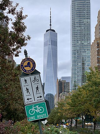
The Empire State Trail is a multi-use trail in New York State that was proposed by Governor Andrew Cuomo in January 2017 and completed in December 2020. The trail runs from Manhattan north to the Canadian border in Rouses Point near the northern tip of Lake Champlain, and also from Buffalo to Albany. At 750 miles (1,210 km), it is the longest multi-use trail in the United States. The trail includes pre-existing trail segments, which retain their existing identity but are now co-signed as a segment of the Empire State Trail. The trail also links to other regional bicycling and hiking trails such as the Appalachian Trail, the Adirondack and Catskill Parks, the Great Lakes Seaway Trail, the Genesee Valley Greenway, and others. A segment near its southernmost part, on the Hudson River Greenway in Manhattan, is concurrent with the East Coast Greenway. The trail is used for hiking, biking, snowshoeing, cross-country skiing and in some areas snowmobiling.

The Cleveland and Mahoning Valley Railroad (C&MV) was a shortline railroad operating in the state of Ohio in the United States. Originally known as the Cleveland and Mahoning Railroad (C&M), it was chartered in 1848. Construction of the line began in 1853 and was completed in 1857. After an 1872 merger with two small railroads, the corporate name was changed to "Cleveland and Mahoning Valley Railroad". The railroad leased itself to the Atlantic and Great Western Railway in 1863. The C&MV suffered financial instability, and in 1880 its stock was sold to a company based in London in the United Kingdom. A series of leases and ownership changes left the C&MV in the hands of the Erie Railroad in 1896. The CM&V's corporate identity ended in 1942 after the Erie Railroad completed purchasing the railroad's outstanding stock from the British investors.
References
- 1 2 "Erie to Pittsburgh Trail". Erie to Pittsburgh Trail Alliance. Retrieved 2015-10-03.
- ↑ Walsh, Lawrence (2015-04-04). "Cyclists look north to progress on the Erie to Pittsburgh Trail". Pittsburgh Post-Gazette . Retrieved 2015-10-03.