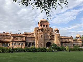
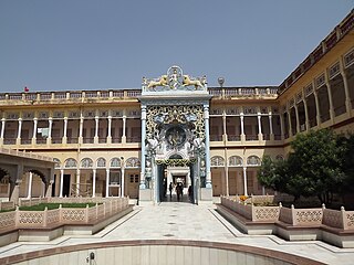
Bikaner is a city in the northwest of the state of Rajasthan, India. It is located 330 kilometres (205 mi) northwest of the state capital, Jaipur. Bikaner city is the administrative headquarters of Bikaner District and Bikaner division.
Sikar is a city and municipal council in the Sikar district of the state of Rajasthan in India. It is the administrative headquarters of the Sikar district. It is largest city of the Shekhawati region, which consists of Sikar, Churu and Jhunjhunu. After Kota, Sikar is one of the major coaching hubs in the country for competitive examination preparations and has a number of engineering and medical coaching institutes.
Jhunjhunu is a city in the state of Rajasthan in northern India and the administrative headquarters of Jhunjhunu District. Rajasthani and Hindi are widely spoken in Jhunjhunu. Jhunjhunu has given the highest number of soldiers to the Indian army and the paramilitary.

Nagaur is a city and municipal council in Nagaur district of the state of Rajasthan in India. It is the administrative headquarters of Nagaur District. The Nagaur city lies about midway between Jodhpur and Bikaner.
Nawalgarh is a heritage city in Jhunjhunu district of Indian state of Rajasthan. It is part of the Shekhawati region and is midway between Jhunjhunu and Sikar. It is 31.5 km from Sikar and 39.2 km from Jhunjhunu. Nawalgarh is famous for its fresco and havelis and considered as Golden City of Rajasthan. It is also the motherland of some great business families of India.
Dausa is a city and administrative headquarters of Dausa district in the state of Rajasthan, India. It is 55 km from Jaipur, 240 km from Delhi and located on Jaipur-Agra National Highway (NH-21).

Sri Ganganagar is the northernmost city of the Indian state of Rajasthan, near the international border of India and Pakistan. It is the administrative headquarters of Sri Ganganagar district. It is named after Maharaja Shri Ganga Singh Bahadur, Maharaja of Bikaner. The city is also known as the "Food Basket of Rajasthan".
Biaora is a city and municipality in Rajgarh district in the state of Madhya Pradesh, India. biaora is one of the six tehsils of rajgarh district. The primary languages spoken in biaora are Malvi, English and Hindi. It is situated on National Highway NH-3 and Jaipur National Highway.

Gangapur City is a city and a municipal council located in Gangapur City District in the Indian state of Rajasthan. It is the administrative headquarters of Gangapur City District. It is famous for its Sweet Cuisine Kheermohan and newly built Kushalgarh Baba Shyam Temple.
Lakheri is a town and municipality in Bundi district in the Indian state of Rajasthan. It is located in the southeast of Rajasthan, around 180 kilometres (112 mi) south of the state capital, Jaipur. Lakheri has been a subdivision headquarters since 2002. Yugantar Sharma (RAS) is the Sub-division Officer and magistrate of Lakheri subdivision. It is the second largest city in the district, after Bundi and 104th largest city in rajasthan.

Narwana is a town and a municipal council, just 36 km from Jind city in Jind district in the Indian state of Haryana.
Phalodi is a city in Phalodi district in the Indian state of Rajasthan. It is the headquarters for Phalodi District. Phalodi is also called the "salt city" due to the salt industry in Rin. Phalodi is in the buffer zone of Thar Desert and often subject to extreme temperature conditions due to its arid climate. It holds the record for the highest verified temperature recorded in Rajasthan at 51.0 °C (123.8 °F) on 19 May 2016. It is also the highest temperature ever recorded in India.
Degana is a town municipality and headquarter to Sub-Division and Tehsil located in Nagaur district of Rajasthan, India.
National Highway 11 or NH 11 is a National Highway in India that links Jaisalmer (Rajasthan) and Rewari (Haryana). This 848 km-long highway passes through Myajlar, Pithala, Jaisalmer, Pokaran, Ramdevara, Phalodi, Bap, Diyatra Gajner, Bikaner, Sri Dungargarh, Rajaldesar, Ratangarh, Rolsabsar, Fatehpur, Tajsar, Mandawa, Jhunjhunu, Bagar, Chirawa, Singhana, Pacheri, Narnaul, Ateli and Rewari.
Shihori is a village in Banaskantha district of the Indian state of Gujarat. It is the administrative headquarters of the Kankrej Taluka and has a population of more than 10,000.
Jamwa Ramgarh also popularly known as the Ramgarh, is a subdivision of the Jaipur district in Rajasthan, India. It is located on State Highway 55, about 28 kilometres (17 mi) East-North of Jaipur city. It was best known for Ramgarh Lake which is now dry.
Rajnota is a village in Kotputli tehsil in Jaipur district in the Indian state of Rajasthan.

Malwas is a village and post in the Churu district of northern Rajasthan state, India.

Atru is a town in the Baran district in Rajasthan, India. It is located in the southeast of northern Indian state of Rajasthan. It is tehsil of Baran. It is located around 30 kilometres south of the Baran district. Atru tehsil is the biggest tehsil of the Baran district and has 141 villages under its administration. There are many facilities like a railway station, a hospital, schools, markets, well equipped roads for traffic. The most famous festival is Dhanush lila on the occasion there is a fair is organized for 3 days.

Jaitpura is a village situated in North-East of Phulera Tehsil of Jaipur district in Rajasthan, India. It is 10 km from Phulera, 8 km from Sambhar, 60 km from Jaipur. The village is spread in approx. 18000 Bighas area. Its altitude is 390 metres above MSL. Its Pin-Code is 303604, India.


