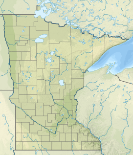
Eagle Mountain is the highest natural point in Minnesota, United States, at 2,301 feet (701 m). It is in northern Cook County in the Boundary Waters Canoe Area Wilderness and Superior National Forest in the Misquah Hills, northwest of Grand Marais. It is a Minnesota State Historic Site.

The Misquah Hills are a range of mountains in northeastern Minnesota, in the United States. They are located in or near the Boundary Waters Canoe Area Wilderness within Superior National Forest. Eagle Mountain, the highest point in Minnesota at 2,301 feet, is considered to be part of the Misquah Hills.

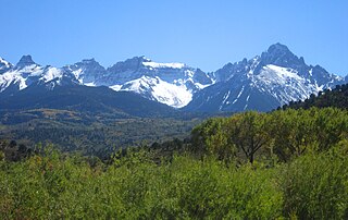
Eagle Peak is a mountain in the Absaroka Range in the U.S. state of Wyoming and at 11,372 feet (3,466 m) is the highest point in Yellowstone National Park. It is located about 6 miles (9.7 km) east of the southeast arm of Yellowstone Lake.
The Southern Rocky Mountains are a major subregion of the Rocky Mountains of North America located in the southeastern portion of the U.S. state of Wyoming, the central and western portions of Colorado, the northern portion of New Mexico, and extreme eastern portions of Utah. The Southern Rocky Mountains are also commonly known as the Southern Rockies, and since the highest peaks are located in the State of Colorado, they are sometimes known as the Colorado Rockies, although many important ranges and peaks rise in the other three states. The Southern Rockies include the highest mountain ranges of the Rocky Mountains and include all 30 of the highest major peaks of the Rockies.

Eagle Peak is located in the Warner Mountains in Modoc County, California, United States. The area is protected in the South Warner Wilderness on the Modoc National Forest. The summit is the highest point in the Warner Mountains and Modoc County. Much of the precipitation that falls on Eagle Peak is snow due to the high elevation of the mountain.
Eagle Peak is a mountain in Catron County, New Mexico, near the town of Reserve. The summit is the highest point in the Tularosa Mountains.
Lone Eagle Peak is a mountain summit in the Indian Peaks of the Front Range of the Rocky Mountains of North America. The 11,946-foot (3,641 m) peak is located in the Indian Peaks Wilderness of Arapaho National Forest, 12.4 miles (19.9 km) northeast by north of the Town of Fraser in Grand County, Colorado, United States. Lone Eagle Peak was named in honor of Charles Lindbergh.
Lima Mountain is a 2238-foot summit in Cook County, Minnesota. It is located in the Lima Mountain Unit, a 2540-acre inventoried roadless area adjacent to the Boundary Waters Canoe Area. There is a 1-mile trail to the summit, where a fire tower once stood. Lima Mountain has a 328-foot rise over the saddle connecting it with the Misquah Hills High Point and Peak 2266. A trail to the summit begins along the Lima Grade just north of its junction with Lima Mountain Road
The Misquah Hills High Point, or Point 2260 is the unnamed high point of the Misquah Hills and the third highest point in the state of Minnesota. It has 420 feet of clean prominence from its parent, Eagle Mountain, from which it is 5.68 miles isolated.