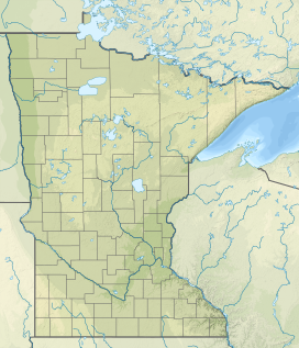
The Misquah Hills are oriented east-to-west, north of the Brule River valley,[2] and south of Cross Lake and Winchell Lake. Their peaks are all within four miles east and seven miles west of Misquah Lake,[3] and include several of the highest points in Minnesota. More broadly, the term has been used to include the ridges and monadnocks to the south of the Brule as well. Point 2260, Gaskin Mountain (2245ft), and Point 2230 (misidentified by Grant and Winchell as the highest point in the state) are all within the Misquah Hills by the strict definition, and Eagle Mountain (2301ft), Peak 2266, Lima Mountain (2238ft), Brule Mountain (2226ft), and Pine Mountain (2194ft) are commonly included. Adding to this confusion, the preliminary report of the original leveling party included three unnamed knobs three miles east of the Brule Mountain in the Misquah Hills as well, roughly in the area of Peak 2266.[2]
Their elevation above the surrounding plateau does not exceed 600 feet. Eagle Mountain, the highest point in Minnesota at 2,301 feet (701 meters) above sea level, is about 1700 feet above nearby Lake Superior.[4] At this modest elevation the Misquah Hills nevertheless are the highest points for over five hundred miles (~800km) in any direction, as well as the second-highest range of the Canadian Shield in the US, after the Adirondack Mountains.[5]
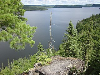
Hiking in the Misquah Hills has long been overshadowed by the vast amount of excellent canoeing in the lakes of the Boundary Waters Canoe Area Wilderness. Many of the peaks remain unnamed, most are only accessible by water, and only Eagle Mountain, Lima Mountain, and Pine Mountain have summit trails.[12]
Notes
↑ "miskwaa (vii)". The Ojibwe People's Dictionary. Department of American Indian Studies, University of Minnesota. Retrieved 22 September 2015.
1 2 Berkey, Chas P. "Preliminary Report of the Levelling Party." Annual Report, for the Year 1881. Ed. Winchell, N. H. Geological and Natural History Survey of Minnesota. p. 135. St. Paul, 1882.
↑ Upham, Warren (2001) Minnesota Place Names, A Geographical Encyclopedia, Third Edition, p. 629; MHS Press; ISBN0-87351-396-7
↑ Ojakangas, Richard W.; Matsch, Charles L. (1982). Minnesota's Geology. University of Minnesota Press, 15. ISBN0-8166-0953-5.
↑ U.S. Geological Survey. (various quadrangles) [maps]. 1:50,000. Washington D.C.: USGS, 1971; Canada Dept. of Energy, Mines and Resources, Canada Centre for Mapping. [maps]. 1:50,000. Ottawa: Canada Centre for Mapping, 1973.
↑ Ojakangas, Richard W.; Matsch, Charles L. (1982). Minnesota's Geology. University of Minnesota Press, pp. 49–57. ISBN0-8166-0953-5.
↑ Erwin Raisz, Physiographical Map of North America, in Espenshade, Edward B., Jr., and Joel L. Morrison, editors. Goode's World Atlas, 17th ed. Chicago: Rand McNally & Co. 1986.
The Boundary Waters Canoe Area Wilderness is a 1,090,000-acre (4,400 km2) wilderness area within the Superior National Forest in the northeastern part of the US state of Minnesota under the administration of the U.S. Forest Service. A mixture of forests, glacial lakes, and streams, the BWCAW's preservation as a primitive wilderness began in the 1900s and culminated in the Boundary Waters Canoe Area Wilderness Act of 1978. It is a popular destination for canoeing, hiking, and fishing, and is one of the most visited wildernesses in the United States.
The Laurentian Mountains, also known as the Laurentians or Laurentides, are a mountain range in Canada. The range is 1,448 km long and ranges in height from 500 m with peaks over 1,000 m. The Laurentian Mountains extend across Labrador and Quebec within the Laurentian Upland, which contains foothills in northeastern Ontario. The range is located near the rivers of Ottawa, St. Lawrence, and Saguenay. The Laurentian Mountains primarily stretch across multiple regions in Quebec, with geologic formations such as the Jacques-Cartier Massif located within the range.
Eagle Mountain is the highest natural point in Minnesota, United States, at 2,301 feet (701 m). It is in northern Cook County in the Boundary Waters Canoe Area Wilderness and Superior National Forest in the Misquah Hills, northwest of Grand Marais. It is a Minnesota State Historic Site.
Savanna Portage State Park is a state park of Minnesota, USA, established in 1961 to preserve the historic Savanna Portage, a difficult 6-mile (9.7 km) trail connecting the watersheds of the Mississippi River and Lake Superior. The portage trail crosses a drainage divide separating the West Savanna River, which drains to the Mississippi River and the Gulf of Mexico, from the East Savanna River, which flows in an opposite direction to the Saint Louis River, Lake Superior and the Great Lakes, and the Saint Lawrence River to the Atlantic Ocean.
Superior National Forest, part of the United States National Forest system, is located in the Arrowhead Region of the state of Minnesota between the Canada–United States border and the north shore of Lake Superior. The area is part of the greater Boundary Waters region along the border of Minnesota and the Canadian province of Ontario, a historic and important thoroughfare in the fur trading and exploring days of New France and British North America.
The geology of Minnesota comprises the rock, minerals, and soils of the U.S. state of Minnesota, including their formation, development, distribution, and condition.
The U.S. State of Minnesota is the northernmost state outside Alaska; its isolated Northwest Angle in Lake of the Woods is the only part of the 48 contiguous states lying north of the 49th parallel north. Minnesota is in the U.S. region known as the Upper Midwest in interior North America. The state shares a Lake Superior water border with Michigan and Wisconsin on the northeast; the remainder of the eastern border is with Wisconsin. Iowa is to the south, South Dakota and North Dakota are to the west, and the Canadian provinces of Manitoba and Ontario are to the north. With 87,014 square miles (225,370 km2), or approximately 2.26% of the United States, Minnesota is the 12th largest state.
The Midcontinent Rift System (MRS) or Keweenawan Rift is a 2,000 km (1,200 mi) long geological rift in the center of the North American continent and south-central part of the North American plate. It formed when the continent's core, the North American craton, began to split apart during the Mesoproterozoic era of the Precambrian, about 1.1 billion years ago. The rift failed, leaving behind thick layers of igneous rock that are exposed in its northern reaches, but buried beneath later sedimentary formations along most of its western and eastern arms. Those arms meet at Lake Superior, which is contained within the rift valley. The lake's north shore in Ontario and Minnesota defines the northern arc of the rift. From the lake, the rift's eastern arm trends south to central lower Michigan, and possibly into Indiana, Ohio, Kentucky, Tennessee, and Alabama. The western arm runs from Lake Superior southwest through portions of Wisconsin, Minnesota, Iowa, and Nebraska to northeastern Kansas, and possibly into Oklahoma.
The Sawtooth Mountains are a range of hills or small mountains on the North Shore of Lake Superior in the U.S. state of Minnesota, extending about 30 miles (48 km) from Carlton Peak near Tofte on the west, to Grand Marais on the east.
The Duluth Complex, the related Beaver Bay Complex, and the associated North Shore Volcanic Group are rock formations which comprise much of the basement bedrock of the northeastern part of the U.S. state of Minnesota in central North America. The Duluth and Beaver Bay complexes are intrusive rocks formed about 1.1 billion years ago during the Midcontinent Rift; these adjoin and are interspersed with the extrusive rocks of the North Shore Volcanic Group produced during that same geologic event. These formations are part of the Superior Upland physiographic region of the United States, which is associated with the Laurentian Upland of the Canadian Shield, the core of the North American Craton.
The proglacial lakes of Minnesota were lakes created in what is now the U.S. state of Minnesota in central North America in the waning years of the last glacial period. As the Laurentide Ice Sheet decayed at the end of the Wisconsin glaciation, lakes were created in depressions or behind moraines left by the glaciers. Evidence for these lakes is provided by low relief topography and glaciolacustrine sedimentary deposits. Not all contemporaneous, these glacial lakes drained after the retreat of the lobes of the ice sheets that blocked their outlets, or whose meltwaters fed them. There were a number of large lakes, one of which, Glacial Lake Agassiz, was the largest body of freshwater known to have existed on the North American continent; there were also dozens of smaller and more transitory lakes filled from glacial meltwater, which shrank or dried as the ice sheet retreated north.
The Laurentian Upland is a physiographic region which, when referred to as the "Laurentian Region" or the Grenville geological province, is recognized by Natural Resources Canada as one of five provinces of the larger Canadian Shield physiographic division. The United States Geological Survey recognizes the Laurentian Upland as the larger general upland area of the Canadian Shield.
The Mokelumne Wilderness is a 105,165-acre federally designated wilderness area located 70 miles (110 km) east of Sacramento, California. It is within the boundaries of three national forests: Stanislaus, Eldorado and Toiyabe. First protected under the Wilderness Act of 1964, the Mokelumne's borders were expanded under the California Wilderness Act of 1984 with the addition of 55,000 acres. The wilderness takes its name from the Mokelumne River, which was named after a Mi-wok Indian village located on the riverbank in California's Central Valley.
The North Shore Highlands are a physiographic and ecological region of the U.S. state of Minnesota in central North America. They were formed by a variety of geologic processes, but are principally composed of rock created by magma and lava from a rift about 1.1 billion years ago, which rock formations are interspersed with and overlain by glacial deposits. Their ecology derives from these origins, with thin, rocky soils supporting flora and fauna typical of their northern, inland location.
Abita Lake is a lake in West Cook, Minnesota, which, at an elevation of 2,040.19 feet (621.85 m) above sea level, is Minnesota's ninth highest named lake. Prior to modern surveys, the lake was once believed to be Minnesota's highest elevation lake.
Brule Lake is a lake in Cook County, Minnesota. It is situated between two long sills in the Superior Upland, causing the lake to be eight times longer east and west than it is north and south. Out of the opposite ends flow the Temperance River and the South Brule, a tributary of the Brule River. Brule Lake was logged heavily in the early 1900s, and the region around it was consumed in 1929 by a logging-related forest fire which bears Brule Lake's name. Now the lake is part of the protected Boundary Waters Canoe Area, a federal wilderness area for which Brule Lake serves as an entrance point.
Peak 2266 is the second highest point in Minnesota, after Eagle Mountain. It is rarely climbed and has no summit trail. Peak 2266 was surveyed in 1961, in the same survey which established Eagle Mountain as the state's high point. The survey found that 2266 was also higher than the previous record holder, point 2230 in the Misquah Hills.
Lima Mountain is a 2238-foot summit in Cook County, Minnesota. It is located in the Lima Mountain Unit, a 2540-acre inventoried roadless area adjacent to the Boundary Waters Canoe Area. There is a 1-mile trail to the summit, where a fire tower once stood. Lima Mountain has a 328-foot rise over the saddle connecting it with the Misquah Hills High Point and Peak 2266. A trail to the summit begins along the Lima Grade just north of its junction with Lima Mountain Road
The Misquah Hills High Point, or Point 2260 is the unnamed high point of the Misquah Hills and the third highest point in the state of Minnesota. It has 420 feet of clean prominence from its parent, Eagle Mountain, from which it is 5.68 miles isolated.
Rose Lake is a lake on the border between Cook County, Minnesota and Ontario.
This page is based on this Wikipedia article Text is available under the CC BY-SA 4.0 license; additional terms may apply. Images, videos and audio are available under their respective licenses.