This article needs additional citations for verification .(June 2020) |
Pedro Meoqui Meoqui | |
---|---|
City | |
Coordinates: 28°16′20″N105°28′55″W / 28.27222°N 105.48194°W | |
Country | ![]() |
State | Chihuahua |
Municipality | Meoqui |
Population (2010) | |
• Total | 22,574 |
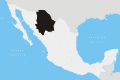
Pedro Meoqui is a city named after General Pedro Meoqui and is the seat of the municipality of Meoqui, in the northern Mexican state of Chihuahua. As of 2010, the municipality had a total population of 22,574, [1] up from 21,306 as of 2005. [2]
The community of Meoqui was founded as a Franciscan mission town in the mid-seventeenth century. Was Fray Andrés Ramírez, a franciscan missionary, the recognized founder of Meoqui, arrived from San Antonio de Julimes as part of a larger effort to Christianize the Indians along the San Pedro River and began the development of the area along the San Pedro River, then inhabited by indigenous Conchos, Julimes, Navichames and Mezquites. The region was subject to the rule of the regional military presidios from the end of the 17th Century until 1773, when the Military Presidio of San Pablo was established.
In 1771, Irish soldier and commander Hugo O'Conor, who had served in the Spanish Royal Army since 1750 and had distinguished himself as a military strategist in several of the Spanish colonies, was appointed Captain and assigned to the northern frontier of New Spain. On January 20, 1773, he was promoted to Colonel and appointed Commandant Inspector of Presidios for all of Nueva Viscaya. In 1773, Colonel O'Conor established the home base of his garrison, the 4th Flying Company, in the area, establishing the Presidio of San Pablo. From there, he led multiple campaigns further north in 1775 and 1776 to establish Spanish control over the area and pushing the Apaches further west. O’Conor and the Presidio commanders who followed him ruled the area politically until 1826, when the Presidio came under the political jurisdiction of San Jerónimo and began to function as an Ayuntamiento (town). In 1837 the town became part of the Rosales Subprefecture, ten years after the Rosales Canton was established. In 1886, the town was integrated into the Canton of Meoqui, and from 1887 to 1911 was part of the Camargo District.
The name of the community and the surrounding municipality, adopted in 1866, is in honor of General Pedro Meoqui Mañon, a military leader from the city of Mexico. He participated in the Puebla campaign in Nueva México with Ignacio Comonfort; during the War of Reform he was active in the conservative ranks and participated in their Intervention. In 1864, when Meoqui Mañon was a colonel, he escorted Benito Juárez from Monterrey to Chihuahua, passing through the community en route. In 1866, Juárez returned to the community and decided to consecrate the community - a town located about an hour from the state capital of Chihuahua - as the Villa of General Pedro Meoqui Mañón (colloquially referred to as "Meoqui") on December 11 as a tribute to his faithful friend who was cruelly murdered on August 8, 1865, in Hidalgo del Parral in the Battle of Parral against the French invasors.
In 1966, the town of Meoqui acquired the designation of City. [3]
The dominant soils in the municipality are Haplic Yermosols in its central portion, with medium texture and level or broken slopes, and with associations of lithosols and / or eutrophic regosols, luvic[ check spelling ], with inclusions of rendzinas and / or solonetzs orticos[ check spelling ]. Land use is mainly agricultural and livestock. In terms of land tenure, private property is first with 29,362 hectares, equivalent to 58.72% of the total land area; Secondly, community-use (ejidal) agricultural property consists of 10,903 hectares, representing 21.78% of the land area and distributed across three ejidos. Urban development consists of 846 hectares or 1.69% of the total land area.
On October 27, 1987, several children claimed to see small humanoid beings leave the earth. This news made the City of Meoqui the focus of international attention. Thus emerged the urban legend of the Monitos of Meoqui. [4]
An important part of the local identity of Meoqui is represented by the bottling of soft drinks at the former Coca-Cola complex of Meoqui, which still produces flavored drinks unique in the country, including the famous Apple Soda of Chihuahua (Manzanita Soto de Chihuahua).[ citation needed ]
The local gastronomy is similar to that of other places in the center of the state of Chihuahua but is characterized especially by the so-called Morelian tacos that are found in the center of the city. The abigeo stew is another distinguished dish, made with dried meat and red chili sauce originated by Col. Lázaro Cárdenas.[ citation needed ]
Eduardo Najera - Basketball Player
Alex Saucedo - Boxer
Ciudad Juárez, commonly referred to as just Juárez, is the most populous city in the Mexican state of Chihuahua. It was known until 1888 as El Paso del Norte. It is the seat of the Juárez Municipality with an estimated population of 2.5 million people. Juárez lies on the Rio Grande river, south of El Paso, Texas, United States. Together with the surrounding areas, the cities form El Paso–Juárez, the second largest binational metropolitan area on the Mexico–U.S. border, with a combined population of over 3.4 million people.
The city of Chihuahua or Chihuahua City is the state capital of the Mexican state of Chihuahua. As of 2020, the city of Chihuahua had a population of 925,762 inhabitants. while the metropolitan area had a population of 988,065 inhabitants.
Durango, officially the Free and Sovereign State of Durango, is one of the 31 states which make up the 32 Federal Entities of Mexico, situated in the northwest portion of the country. With a population of 1,832,650, the 8th lowest of Mexico's states, Durango has Mexico's second-lowest population density, after Baja California Sur. The capital city, Victoria de Durango, is named after the first President of Mexico, Guadalupe Victoria.
A presidio was a fortified base established by the Spanish Empire mainly between the 16th and 18th centuries in areas under their control or influence. The term is derived from the Latin word praesidium meaning protection or defense.
Chihuahua is a state in Northwest Mexico that is divided into 67 municipalities. According to the 2020 Mexican census, Chihuahua is the 12th most populous state with 3,741,869 inhabitants and the largest by land area spanning 247,798.08 square kilometres (95,675.37 sq mi).
The Presidio of Monterey (POM), located in Monterey, California, is an active US Army installation with historic ties to the Spanish colonial era. Currently, it is the home of the Defense Language Institute Foreign Language Center (DLI-FLC). It is the last and only presidio in California to have an active military installation.
Ojinaga Municipality is one of the 67 municipalities of Chihuahua, in northern Mexico. The municipal seat lies at Ojinaga, a rural bordertown on the U.S.-Mexico border. The municipality has an area of 9,500.50 km2 (3,668.16 sq mi).
Santa Rosalía de Camargo, originally called Santa Rosalía, and now known as "Ciudad Camargo", is a city in the eastern part of the Mexican state of Chihuahua, located at the confluence of the Rio Parral and the Rio Conchos in the Allende Valley. It serves as the municipal seat of Camargo municipality and also serves as an important agricultural and livestock center for the area. Ciudad Camargo was originally founded in 1740 and refounded in 1792.
Delicias is a city in the Mexican state of Chihuahua and serves as the seat of the municipality of the same name. The current president of this town is Jesus Valenciano. It is located southeast of the state capital, Chihuahua. Delicias was declared an official municipality of the state of Chihuahua on January 7, 1935. Delicias is a small industrial city and a major agricultural center located in the Conchos River Valley. As of 2015, the city of Delicias had a population of 148,045 inhabitants, while the metropolitan area had a population of 223,993 inhabitants. It was founded on 30 April 1933, making it one of Mexico's youngest cities. The municipality of Delicias is one of the smallest in the state in terms of size area.
El Camino Real de Tierra Adentro, also known as the Silver Route, was a Spanish 2,560-kilometre-long (1,590 mi) road between Mexico City and San Juan Pueblo, New Mexico, that was used from 1598 to 1882. It was the northernmost of the four major "royal roads" that linked Mexico City to its major tributaries during and after the Spanish colonial era.
Imuris is the municipal seat of Imuris Municipality in the north of the Mexican state of Sonora.
The Free Company of Volunteers of Catalonia was a military company of the Spanish Army serving in the Spanish colonial empire.
Hugh O'Conor, better known by his Spanish name Hugo Oconór, was a military governor of northern Mexico. He was appointed governor of Texas by the Spanish viceroy of New Spain in 1767. It is recorded that O'Conor rode well over 10,000 miles (16,000 km) on horseback in the course of conducting his duties. O'Conor was called "The Red Captain" by the Apache, both for the color of his hair and his formidable military leadership.
The Presidio Santa Cruz de Terrenate is a former Spanish military presidio, or fortress, located roughly west of the town of Tombstone, Arizona, in the United States of America.
Meoqui is one of the 67 municipalities of Chihuahua, in northern Mexico. The municipal seat lies at Pedro Meoqui. The municipality covers an area of 370 km2, making it one of the smallest in the state but one of the most densely populated.
Ixtlán de Juárez is a town and municipality in the Mexican state of Oaxaca about 65 km north of the city of Oaxaca on Federal Highway 175 towards Veracruz. It is part of the Ixtlán District in the Sierra Norte de Oaxaca region.
Santa Cruz de Rosales is a town and seat of the municipality of Rosales, in the northern Mexican state of Chihuahua. As of 2010, the town had a population of 5,570, up from 5,377 as of 2005
The 5th federal electoral district of Chihuahua is one of the 300 electoral districts into which Mexico is divided for elections to the federal Chamber of Deputies and one of nine such districts currently operating in the state of Chihuahua.
Chihuahua, officially the Free and Sovereign State of Chihuahua, is one of the 31 states which, along with Mexico City, comprise the 32 federal entities of Mexico. It is located in the northwestern part of Mexico and is bordered by the states of Sonora to the west, Sinaloa to the southwest, Durango to the south, and Coahuila to the east. To the north and northeast, it shares an extensive border with the U.S. adjacent to the U.S. states of New Mexico and Texas. The state was named after its capital city, Chihuahua City; the largest city is Ciudad Juárez. In 1864 the city of Chihuahua was declared capital of Mexico by Benito Juarez during the Reform War and French intervention. The city of Parral was the largest producer of silver in the world in 1640. During the Mexican War of Independence, Miguel Hidalgo was executed on July 30, 1811, in Chihuahua city.