Peepal Khoont

Last updated

Peepal Khoont
Pipalkhunt
Tehsil Headquarter & District Subdivision
Coordinates: 23°48′N74°34′E / 23.80°N 74.56°E / 23.80; 74.56 Coordinates: 23°48′N74°34′E / 23.80°N 74.56°E / 23.80; 74.56
CountryFlag of India.svg  India
State Rajasthan
District Pratapgarh
Population
 (2011)
  Total118,439
Languages
  Official Hindi Vagdi
Time zone UTC+5:30 (IST)
PIN
312624 (New), 327023 (Old)
Telephone code02961
Vehicle registration RJ-03/RJ-35
Sex ratio 957 /

Peepal Khoont mainly known as Pipalkhunt is a Tehsil headquarter and Panchayat Samiti of the Pratapgarh district of Rajasthan state. It is a sub-division among the 5 sub-divisions of the Pratapgarh district. The main market is called Sadar Bajar. It is situated on National Highway 113. Pipalkhunt [1] is a town located on the Banswara - Jaipur Expressway surrounded by the hills, plants and trees. The town is situated on the bank of the Mahi River.

Contents

History

Pipalkhunt had been a sub tehsil of Ghatol tehsil of Banswara district before it was declared as a sub division of Pratapgarh, when the district came into existence. Pratapgarh district is the 33rd district of Rajasthan, created on 26 January 2008. It is a part of Udaipur Division. The distance from Pipalkhunt to Pratapgarh is 38 km (24 mi), and from Banswara is 46 km (29 mi).At first Kesrimal Dhirawat named person come &setup in village.

Population

Inhabited by about 80% of tribal population of Meena community, Pipalkhunt has 31 Gram Panchayats, 3 Inspector revenue circles, 20 patwar circles and 207 inhabited villages.

As per 2011 census, the population of this sub division was around 5890 out of which the male population was around 2980 and females were around 2914. Scheduled caste population was around 3,424 and scheduled tribe population was around 66,355.

Literacy and education

It has 52.44% male literacy, and 22.74% female literacy as per 2001 census.

Educational Institutions in Peepal Khoont include:

  1. Government Sr. Sec. School
  2. Government Primary School
  3. Government Secondary Girls School
  4. Mewar College of Graduation (Affiliated to Mohanlal Sukhadia University, Udaipur)
  5. Vaagad Shikshan Sansthan
  6. Saraswati Educational Society
  7. Bhardwaj Public School

Geography

Peepal Khoont Forest Forest in Peepal Khoont.jpg
Peepal Khoont Forest

Part of this tehsil has dense forest wealth. Bori, Chhari, Dungawali, Jetaliya, Kelamata, Nayan, Kesharpura, Ghantali and Tamatiya are relatively bigger villages.

The town has a Govt. Hospital, Homeopathy Hospital, Panchayat Samiti, Police station, Tehsil Headquarter, Magistrate Office, Lower Justice Court and Many Administrative hubs for nearby villages.

Pipalkhunt is the center of many political affairs as the previous and current MLAs (Member of Vidhan Sabha) are from the nearby locations of Pipalkhunt.

Main attractions

  1. Amba Mata Mandir,
  2. Pawti Hanuman Mandir
  3. Mahi Mata Mandir
  4. Sheetla Mata Mandir
  5. Digamber Jain Mandir (Aranath Bhagwan)
  6. Mahi River
  7. Shiv Mandir
  8. Digamber Jain Mandir (Aadinath Bhagwan)
  9. Shri 1008 Godi Parasnath Shwetamber Jain Mandir
  10. Kali Kalyan Dham Kallaji Rathore
  11. Gautameshwar Mahadev
  12. Mahi Bajaj Sagar Dam
  13. Rama Peer Ki Dargah
  14. Jakham Dam
  15. Mail Talab
  16. Kela Mela
  17. Digamber Jain Mandir (Shantinath Bhagwan)
  18. Sita Mata Wildlife Sanctuary - It houses ancient Valmiki Ashram (the birthplace of Luv and Kush, the twins born to Sita and Lord Rama), the Hanuman and Sitamata temples, and other places of historical and mythological importance. Another place of interest in the sanctuary, 5 km (3.1 mi) from Tikhi Magri, is Lakhiya Bhata, where drawings of prehistoric animals are engraved on rocks. There is a fair held in the sanctuary at the Sita Mata temple every July.

Jainism

The Jain community in Pipalkhunt is one of the main religions of the main town. The Jain people celebrate many festivals like Mahavir Jayanti, Paryushana, Samvatsari, etc. One Jain Temple of Shri Aranatha Bhagwan is also there which was built a few years ago . Many Digambar and Shwetambar Jain Monks (Saadhu Shri and Saadhvi Shri) keep visiting here and shadow this place with their blessings. Most of the Jain persons are Shopkeepers and having their shops in the main market. Out of the two sub-sects of Jains, mostly Digambars resides here. There are only a few families of Shwetambar sect.

Transport Connectivity

By Air

Nearest Airport is Maharana Pratap Airport or Udaipur Airport which is the domestic airport at Udaipur, Rajasthan, India. It is situated 22 km (14 mi) east of Udaipur city which is about 165 km (103 mi). far from Pipalkhunt. It has a temporary helipad in operation.

By Train

The nearest Railway stations to the Peepal Khoont are Mandsaur (69 km), Nimbahera (115 km), Dungarpur (119 km), Ratlam (100 km) and Udaipur (165 km).

Pratapgarh is the only district without rail-connectivity in Rajasthan state. However, as a result of untiring efforts by ex-district collector Hemant Shesh, the Government of Rajasthan agreed to pursue vigorously with Ministry of Railways, Government of India to connect Pratapgarh with broad-gauge from Mandsaur (32 km), for which appropriate financial contribution to GOI may also be made by the state, if required. It is therefore, presumed that a new railway track ultimately shall be laid from Mandsaur to Pratapgarh, as publicly assured and announced by Shri Ashok Gahlot, the chief minister of Rajasthan on 18 May 2011 at Pratapgarh. Shri Dinesh Trivedi, Minister of Railways, introducing the Railway Budget 2012–2013 on 14 March 2012 has declared to undertake a survey of laying railway track between Mandsaur and Pratapgarh. This new line includes in the GOI list of 111 New Line Surveys to be taken up during 2012–13.

The Railway Ministry has approved railway line to be established to connect the Dungarpur and Ratlam station. The total distance between Ratlam to Dungarpur is around 187.6 km (116.6 mi), Banswara is situated in the center of these two stations. Recently railway line work in progress and final location for rail track marked by agency.

By Road

Peepal Khoont is well connected with major cities in Rajasthan, Gujarat & Madhya Pradesh by road. Daily bus services connects Pipalkhunt with Delhi (714 km), Jaipur (458 km), Bhilwara (207 km), Mumbai (683 km), Chittorgarh (148 km), Ajmer (345 km), Alwar (604 km), Jodhpur (422 km), Bikaner (596 km), Pilani (661 km), Hanumangarh (774 km), Shriganganagar (840 km), Pali, Jalore (360 km), Jhalawar (291 km), Kota, Ahmedabad (295 km), Vadodara (274 km), Surat (420 km), Bhavnagar (467 km), Vapi (524 km), Ratlam (127 km), Neemuch (108 km), Dungarpur (119 km), Rajsamand (275 km), Bhopal (445 km), Indore (271 km), Mandsaur (69 km), Dahod (149 km), Godhra (197 km) and many other cities in Rajasthan. Private bus operators are also providing regular connectivity to Peepal Khoont from nearby places.

Public Representatives

Lok Sabha

Chittorgarh-Pratapgarh Lok Sabha constituency is one of the 25 Lok Sabha (parliamentary) constituencies in Rajasthan state in India.

Sh. Chandra Prakash Joshi is the newly elected member of Lok Sabha from Chittorgarh (Lok Sabha constituency) in the 2014 elections.

Vidha Sabha

In 2013 assembly elections in Rajasthan, Sh. Navneetlal Ninama of BJP won the Ghatol (St) assembly constituency.

Related Research Articles

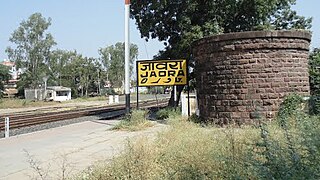
Ratlam is a city in the northwestern part of the Malwa region in Madhya Pradesh state of India. The city of Ratlam lies 480 metres (1,570 ft)above sea level. It is the administrative headquarters of Ratlam district, which was created in 1947 after the independence of India. It is located 294 kilometres west of the state capital Bhopal.

<span class="mw-page-title-main">Jaora</span> City in Madhya Pradesh, India

Jaora is a city and a municipality in Ratlam district in the Indian state of Madhya Pradesh. Jaora is located in the Malwa region, between Ratlam and Mandsaur. It was the capital of the Jaora princely state of Jaora before Independence. During the Mourning of Muharram, thousands of people from all over the world visit the shrine of Hussain Tekri. Jains visit Jaora as a place that the Jain ascetic Rajendrasuri practiced tapasya.

Banswara is a city in the Banswara district in southern Rajasthan, India. The name, Banswara, came from king ‘Bansiya Bhil’

<span class="mw-page-title-main">Mewar</span> Region in the Indian state of Rajasthan

Mewar or Mewad is a region in the south-central part of Rajasthan state of India. It includes the present-day districts of Bhilwara, Chittorgarh, Pratapgarh, Rajsamand, Udaipur, Pirawa Tehsil of Jhalawar District of Rajasthan, Neemuch and Mandsaur of Madhya Pradesh and some parts of Gujarat.

<span class="mw-page-title-main">Banswara district</span> District of Rajasthan in India

Banswara District has an area of 5,037 km2 (1,945 sq mi), which is 1.47% of Rajasthan state, India. The city of Banswara is the district headquarters. It is bounded on the north by Udaipur District, on the northeast by Pratapgarh District, on the east and southeast by Madhya Pradesh state, on the southwest by Gujarat state, and on the west by Dungarpur District.

Dhariawad is a census town in Pratapgarh district in the state of Rajasthan, India. It is the administrative headquarters for Dhariawad Tehsil.

Kekri is a town in kekri district of the Indian state of Rajasthan. It is situated at a distance of about 90 km from the city of Ajmer. Kekri was made a district on March 17 2023, this city used to come in Ajmer district earlier.

Kherwara Chhaoni is a census town in the Udaipur district in the Indian state of Rajasthan. It is part of the Vagad region, which includes the districts of Dungarpur, Banswara and parts of Udaipur district. It is in close proximity to two major highways, National Highway 8 and Rajasthan State Highway 76 and National Highway 927A passes through it. Its name derives from the large number of Kher (Khair) trees in the region in the past.

<span class="mw-page-title-main">Maharana Pratap University of Agriculture and Technology</span>

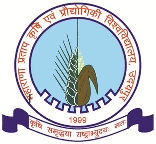
Maharana Pratap University of Agriculture and Technology is situated in Udaipur city of Rajasthan state in India. The government of Rajasthan founded this university by the bifurcation of Rajasthan Agriculture University, Bikaner on 1 November 1999. Since then it has been the principal academic institution supporting mainly south and south-eastern parts of Rajasthan, taking the national responsibility of identifying, designing, preparing and adapting new techniques in the field of production technology for agricultural development. Its jurisdiction is spread over 7 districts of Rajasthan: Banswara, Bhilwara, Chittorgarh, Dungarpur, Pratapgarh, Rajsamand, and Udaipur.

Palsana is a Town located in the Sikar District region of Rajasthan state in India. It is 84 km away from Jaipur, 350 km from Jodhpur 245 km from Bikaner and 250 km from Delhi.

<span class="mw-page-title-main">Culture of Rajasthan</span> Overview of Rajasthans culture

The culture of Rajasthan includes many artistic traditions that reflect the ancient Indian way of life. Rajasthan is also called "Land of Kings". It has many tourist attractions and facilities for tourists. This historical state of India attracts tourists and vacationers with its rich culture, tradition, heritage, and monuments. It also has some wildlife sanctuaries and national parks.

<span class="mw-page-title-main">Pratapgarh district, Rajasthan</span> District of Rajasthan in India

Pratapgarh district is the 33rd district of Rajasthan, created on 26 January 2008. It is a part of Udaipur Division and has been carved out from the erstwhile tehsils of Chittorgarh, Udaipur and Banswara districts. Pratapgarh town is the administrative headquarters of the district.

Jaipur-Hyderabad Express is a train started by Indian Railways in September 2010. It connects Ajmer/Jaipur in Rajasthan with Hyderabad the capital of Telangana. It replaced a train called Meenakshi Express that used to run from Jaipur to Kacheguda near Secunderabad on metre gauge but was cancelled when the track was being converted to 5 ft 6 in broad gauge.

The 19329/19330 Veer Bhumi Chittaurgarh Express is a daily train service which runs between Indore Junction railway station of Indore, the largest city and commercial hub of Central Indian state, Madhya Pradesh and Ahmedabad, India via Chittorgarh and Udaipur, major cites in Rajasthan.

<span class="mw-page-title-main">Sita Mata Wildlife Sanctuary</span> Wildlife sanctuary in India

The Sita Mata Wildlife Sanctuary is a wildlife sanctuary situated in Pratapgarh and Chittaurgarh districts of Rajasthan Rajasthan, India, declared as a protected forest area by the Government of Rajasthan Notification No. F 11 (9) Revenue/8/79, dated 2/11/1979. It is a dense forest, with an area of 422.95 square kilometers, which is about 40% of the total land area of the district. The land is undulating because of the confluence of three different formations — Malwa Plateau, the Vindhyachal Hills and Aravali mountain ranges.

Sarvan is a village in Sailana Tehsil in Ratlam district of Madhya Pradesh, India. It belongs to Ujjain division. It is located 32 km north of District headquarters Ratlam and 298 km from State capital Bhopal. Sarvan Pin code is 457550 and postal head office is Sailana.

<span class="mw-page-title-main">Motagaon</span> Town in Rajasthan, India

Motagaon is a town in Banswara district of Rajasthan, India. It is located in the Wagad region, The town is about 35 km from Banswara and 5 KM from State Highway RJ SH-32 Banswara-Udaipur. The town is known for its famous temple called Ranchhod Ji Mandir dedicated to Lord Krishna near the banks of Mahi River. The 2011 Census of India estimated the population of Motagaon at 4,548.

References

  1. 1. 'Zila Nirdeshika', 2008, Published by Collector, Pratapgarh