Peleliu Airfield

Last updated
Peleliu Airfield
Peleliu 16 March 1945.jpg
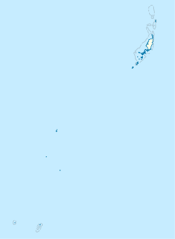
Aerial photo of Peleliu airfield, 16 March 1945
Summary
Airport typePublic
Owner Republic of Palau
Location Peleliu, Palau
Built1944
Occupants U.S. Army Air Forces Seventh Air Force (until 1945)
Elevation  AMSL 9 ft / 3 m
Coordinates 06°59′54″N134°13′58″E / 6.99833°N 134.23278°E / 6.99833; 134.23278 Coordinates: 06°59′54″N134°13′58″E / 6.99833°N 134.23278°E / 6.99833; 134.23278
Map
Palau location map.svg
Airplane silhouette.svg
Peleliu Airfield
Location of the Airport in Palau
Runways
Direction LengthSurface
ftm
04/226,0001,828Gravel

Peleliu Airfield( FAA LID : C23 [1] ) is a small airfield on Peleliu, one of the islands of Palau. It also served as an airfield during World War II.

Contents

History

Peleliu Airfield was built by the Japanese in 1944 with a pair of intersecting runways. During the Battle of Peleliu on 15 September 1944, 11,000 Japanese defended the island when the 1st Marine Division assaulted landing on the southwest corner of the island, just to the west of the airfield. On D+1, the 5th Marines moved to capture the airfield and push toward the eastern shore. They quickly raced across the airfield under heavy artillery fire from the highlands to the north, suffering heavy casualties in the process. After capturing the airfield, they rapidly advanced to the eastern end of Peleliu, leaving the island's southern defenders to be wiped out by the 7th Marines. This area was hotly contested by the Japanese, who still occupied numerous pillboxes. Temperatures remained around 115 °F (46 °C), and the Marines soon suffered high casualties from heat exhaustion. Further complicating their situation, the Marines' only available water supply was contaminated with oil. Still, by D+8 the 5th and 7th Marines accomplished their objectives, holding the airfield and the southern portion of the island.

Having quickly captured the airfield, Seabees from the 33rd and 73rd Naval Construction Battalions had it operational by D+3. The "Grasshoppers" (VMO-1) soon began aerial spotting missions for Marine artillery and Naval gunfire. On 26 September 1944 (D+11), the Corsairs of the VMF-114 landed on the airstrip. The Corsairs began dive-bombing missions across Peleliu, and also brought two more useful weapons to the fight against Japanese fortifications. Corsairs fired rockets, to blow open cave entrances for the infantrymen, and also delivered napalm attacksonly the second time the weapon had been used in the Pacific. The napalm proved useful, burning away vegetation hiding spider holes, and killing their occupants.

After liberation, the Seabees further repaired, expanded and upgraded the airfield. The airbase was under the command of Colonel Karl S. Day. In December 1944, the two runways measured 6,000 by 300 feet (1,829 m × 91 m) and 3,900 by 260 feet (1,189 m × 79 m). A PBY that took off from Peleliu on 3 August 1945 was the first to locate survivors of the USS Indianapolis 4 days after it was sunk.

The USAAF Seventh Air Force moved the F-5-equipped 28th Photographic Reconnaissance Squadron to Peleliu from Kwajalein on 5 October 1944 to carry out long-range photographic missions over the Philippines. The recon squadron remained until April, 1945 when it was moved northwest to Okinawa. [2]

After the end of the war, Peleliu and its airfield were abandoned by the Americans. Today the vegetation on the island, which was largely burnt out by the battle, has regrown and has replaced the scars of war. As it had been heavily defended by the Japanese, there are still tanks, Amtracs, an A6M Zero, canteens, helmets, etc., scattered in the jungle from the war. The airfield still exists, and has limited use with the SW-NE runway still usable, but for light aircraft only.

Map of the battle of Peleliu Battle of Peleliu map.jpg
Map of the battle of Peleliu

Facilities and aircraft

The airport resides at an estimated elevation of 9 feet (3 m) above mean sea level. It has one runway designated 4/22 with a gravel surface measuring 6,000 by 40 feet (1,828 x 12 m). For the 12-month period ending on 23 May 1987, the airport had 1,500 air taxi aircraft operations, an average of 125 per month. [1]

Airlines and destinations

Passenger

AirlinesDestinations
Belau Air Angaur
Pacific Mission Aviation Koror

See also

Related Research Articles

Battle of Peleliu World War II battle in the Pacific theater

The Battle of Peleliu, codenamed Operation Stalemate II by the US military, was fought between the United States and Japan during the Mariana and Palau Campaign of World War II, from September 15 to November 27, 1944, on the island of Peleliu.

Bauerfield International Airport

Bauerfield International Airport is an airport located in Port Vila, Vanuatu. The airport is relatively small in size, but its runway has the capability and length to accept jets up to the Airbus A330. It serves as the hub for Vanuatu's flag carrier airline, Air Vanuatu.

Dobbins Air Reserve Base Military base in Georgia, USA

Dobbins Air Reserve Base or Dobbins ARB is a United States Air Force reserve air base located in Marietta, Georgia, a suburb about 20 miles (32 km) northwest of Atlanta. Originally known as Dobbins Air Force Base, it was named in honor of Captain Charles M. Dobbins, a World War II C-47 pilot who died near Sicily.

Bonriki International Airport

Bonriki International Airport is an international airport in Kiribati, serving as the main gateway to the country. It is located in its capital, South Tarawa, which is a group of islets in the atoll of Tarawa in the Gilbert Islands, precisely on Bonriki.

Saipan International Airport

Saipan International Airport, also known as Francisco C. Ada/Saipan International Airport, is a public airport located on Saipan Island in the United States Commonwealth of the Northern Mariana Islands. The airport is owned by Commonwealth Ports Authority. Its airfield was previously known as Aslito and Isely Field.

Bucholz Army Airfield

Bucholz Army Airfield is a United States Army airfield located on Kwajalein Atoll, Marshall Islands. Its position is ideal for refueling during trans-Pacific flights, and the airport is available to civilians through Air Marshall Islands and United Airlines.

Guiuan Airport is an airport located in the municipality of Guiuan, in the province of Eastern Samar in the Philippines. It is classified as a feeder airport by the Civil Aviation Authority of the Philippines, an attached agency of the Department of Transportation and Communications that is responsible for the operations all airports in the Philippines, except the major international airports.

Momote Airport

Momote Airport is an airport on Los Negros Island in the Admiralty Islands, Papua New Guinea. It also serves Manus Island, which is connected to Los Negros by a bridge.

Munda Airport is an international airport adjacent to the town of Munda, Western Province in Solomon Islands.

Naval Air Station Barbers Point

Naval Air Station Barbers Point, on O'ahu, also called John Rodgers Field, is a former United States Navy airfield closed in 1999, and renamed Kalaeloa Airport. Parts of the former air station serve as a film and television studio for the Hawaii State Film Office.

Abemama Airport is the airport serving Abemama, Kiribati. It is located on the north of the atoll, 200 meters northeast of the village of Tabiang.

Leo Wattimena Airport

Leo Wattimena Airport, formerly known as Pitu Airport is a private airport located on the southern coast of Morotai Island, North Maluku, Indonesia.

Central Field (Iwo Jima)

Central Field or Iwo Jima Air Base is a former World War II airfield on Iwo Jima in the Bonin Islands, located in the Central Pacific. The Bonin Islands are part of Japan. Today, the base is the only airfield on the island, operated by the Japan Self-Defense Forces.

South Field (Iwo Jima)

South Field was a World War II airfield on Iwo Jima in the Volcano Islands, located in the Central Pacific. The Volcano Islands are part of Japan. The airfield was located on the southern corner of Iwo Jima located on the Motoyama plateau, to the north of Mount Suribachi. South Field was significant to the overall Battle of Iwo Jima.

East Field (Saipan)

East Field is a former World War II airfield on Saipan in the Mariana Islands, part of Naval Advance Base Saipan.

North Field (Tinian) Former World War II airfield on Tinian in the Mariana Islands

North Field is a former World War II airfield on Tinian in the Mariana Islands. Abandoned after the war, today North Field is a tourist attraction. Along with several adjacent beaches on which Allied forces landed during the Battle of Tinian, the airfield is the major component of the National Historic Landmark District Tinian Landing Beaches, Ushi Point Field, Tinian Island.

Nukufetau Airfield is a former World War II airfield on the south-eastern side of Nukufetau on Motulalo Island during the Pacific War.

Alexai Point Army Airfield

Alexai Point Army Airfield is an abandoned World War II airfield with two runways laid across Alexai Point on Attu Island, Alaska. The remains of the Seabee built airbase are located about 4 miles east of the closed Casco Cove Coast Guard Station, directly across Massacre Bay.

West Field (Tinian)

West Field is a former World War II airfield on Tinian in the Mariana Islands. Today, West Field is used as the civilian Tinian International Airport.

Nanumea Airfield

Nanumea Airfield is a former World War II airfield on the island of Nanumea in the Ellice Islands.

References

  1. 1 2 3 FAA Airport Form 5010 for C23 – Peleliu PDF , effective 2 July 2009.
  2. PD-icon.svg This article incorporates  public domain material from the Air Force Historical Research Agency website http://www.afhra.af.mil/ .
    • Maurer, Maurer (1983). Air Force Combat Units Of World War II. Maxwell AFB, Alabama: Office of Air Force History. ISBN   0-89201-092-4.