
The Preseli Hills or, as they are known locally and historically, Preseli Mountains is a range of hills in north Pembrokeshire, west Wales, mostly within the Pembrokeshire Coast National Park.

Mynachlog-ddu is a village, parish and community in the Preseli Hills, Pembrokeshire, Wales. The community includes the parish of Llangolman.
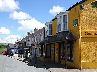
Crymych is a village of around 800 inhabitants and a community in the northeast of Pembrokeshire, Wales. It is situated approximately 800 feet (240 m) above sea level at the eastern end of the Preseli Mountains, on the old Tenby to Cardigan turnpike road, now the A478.

Dinas Cross is both a village, a community and a former parish in Pembrokeshire, Wales. Located between Fishguard and Newport in the Pembrokeshire Coast National Park, it is a popular holiday destination on the A487 road. The two hamlets, Cwm-yr-Eglwys and Pwllgwaelod, are in the community. The community has an elected community council and gives its name to an electoral ward of Pembrokeshire County Council which covers the communities of Dinas Cross, Cwm Gwaun and Puncheston.

Camrose is a village, parish and community in the historic cantref of Roose in Pembrokeshire, Wales. The community includes the villages of Keeston and Wolfsdale. Since 1987 the parish has been expanded to include the whole historic parish of Lambston and parts of Haverfordwest St Martins.

Llawhaden is a village, parish and community in the Hundred of Dungleddy, Pembrokeshire, West Wales. The community of Llawhaden includes the parish of Robeston Wathen, part of Narberth and the hamlet of Gelli, and had a population of 634 in 2001, increasing to 688 at the 2011 Census.

Eglwyswrw[ɛɡlʊɨˈsuːrʊ](listen) is a village, community and parish in the former Cantref of Cemais, Pembrokeshire, Wales. The village lies between Newport and Cardigan at the junction of the A487 road and the B4332 at an altitude of 130 metres (430 ft).
Cilymaenllwyd is a community on the extreme northwest of Carmarthenshire in Wales. The community population at the 2011 census was 742. It lies about 25 miles (40 km) west of Carmarthen, 12 miles (19 km) southeast of Fishguard and 19 miles (31 km) northwest of Haverfordwest. The A478 road runs through the community.
Llanwnda is a rural village and parish to the north of the Welsh county of Pembrokeshire and part of the community of Pencaer. It lies some two miles northwest of the port of Fishguard and is inside the boundaries of the Pembrokeshire Coast National Park.

Eglwyswen is a scattered rural settlement and parish in Pembrokeshire, Wales. It is on the north slopes of the Preseli Hills, 2.5 miles (4.0 km) northwest of Crymych. The south-western part of the parish is in the Pembrokeshire Coast National Park and includes the settlements of Pontyglasier and Penygroes. The parish is part of the community of Crymych.
Puncheston is a village, parish and community in Pembrokeshire, southwest Wales.
Llandeilo Llwydarth or Llandilo is an ancient area and parish in the Preseli Hills between Llangolman and Maenclochog in the community of Maenclochog, Pembrokeshire, Wales.

The B4329 is a scenic route and a former turnpike in Pembrokeshire, West Wales. It links Eglwyswrw in the north of the county to Haverfordwest, the county town in the south, in an approximately southwesterly direction, crossing the Preseli Mountains.

Llys y Fran is a small village and parish in the community of New Moat on the southern slopes of the Preseli Mountains in Pembrokeshire, Wales. The parish includes the small settlement of Gwastad. A notable feature is Llys y Fran Reservoir and Country Park, a popular tourist attraction.
Crosswell is a hamlet on the B4329 road in the community of Eglwyswrw, Pembrokeshire, Wales, in the parish of Meline. It is 7 miles (11 km) southwest of Cardigan, 17 miles (27 km) northeast of Haverfordwest and 11 miles (18 km) east of Fishguard.
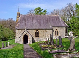
Meline is a parish in the Diocese of St David's in north Pembrokeshire, Wales. There is no settlement of this name.

Monington is a small settlement and parish in the community of Nevern, north Pembrokeshire, Wales. It is on the Nant Ceibwr that flows through Moylegrove and into Ceibwr Bay. Part of the parish lies within the Pembrokeshire Coast National Park.

Tegryn is a hilltop linear village in north Pembrokeshire, Wales, in the community and parish of Clydau and is the largest settlement in the community.

Llanfair-Nant-Gwyn is a hamlet and small parish in the community of Eglwyswrw, north Pembrokeshire, Wales. It is a rural parish with few dwellings and was in the ancient Hundred of Cemais.
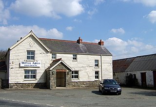
Tufton is a crossroads hamlet in the parish of Henry's Moat in Pembrokeshire, Wales, on the B4329, a road between Eglwyswrw and Haverfordwest across the Preseli Hills. It is in the community of Puncheston.

