Percival, Iowa

Last updated
Percival, Iowa
USA Iowa location map.svg
Red pog.svg
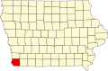
Percival
Location in the state of Iowa
Coordinates: 40°44′56″N95°48′48″W / 40.74889°N 95.81333°W / 40.74889; -95.81333 [1]
Country Flag of the United States.svg  United States
State Flag of Iowa.svg  Iowa
County Fremont County
Area
[2]
  Total0.44 sq mi (1.14 km2)
  Land0.44 sq mi (1.14 km2)
  Water0.00 sq mi (0.00 km2)
Elevation
[1]
929 ft (283 m)
Population
 (2020)
  Total53
  Density120.45/sq mi (46.51/km2)
Time zone UTC-6 (Central (CST))
  Summer (DST) UTC-5 (CDT)
ZIP code
51648
FIPS code 19-62175
GNIS feature ID2583492 [1]

Percival is a small unincorporated community and census-designated place in Fremont County, Iowa, United States. As of the 2010 census, it had a population of 87. [3]

The old part of town is along the BNSF tracks and is accessible from Interstate 29 at Exit 15. However, most sources of employment are located near the Interstate 29/Iowa Highway 2 interchange at Exit 10 of Interstate 29. The ZIP code for Percival is 51648.

Demographics

Historical population
CensusPop.Note
2020 53
U.S. Decennial Census [4]

Related Research Articles

<span class="mw-page-title-main">Fremont County, Iowa</span> County in Iowa, United States

Fremont County is a county located in the U.S. state of Iowa. As of the 2020 census the population was 6,605, making it the state's seventh-least populous county. The county seat is Sidney. The county was formed in 1847 and named for the military officer John C. Fremont.

<span class="mw-page-title-main">Edgewood, Illinois</span> Village in Illinois, United States

Edgewood is a village in Effingham County, Illinois, United States. The population was 440 at the 2010 census, down from 527 at the 2000 census. Edgewood is part of the Effingham, IL Micropolitan Statistical Area.

<span class="mw-page-title-main">Missouri Valley, Iowa</span> City in Iowa, United States

Missouri Valley is a city in Harrison County, Iowa, United States. The population was 2,678 at the time of the 2020 census.

<span class="mw-page-title-main">Iowa, Louisiana</span> Town in Louisiana, United States

Iowa is a town in Calcasieu Parish, Louisiana, United States. The population was 3,436 in 2020. It is part of the Lake Charles metropolitan statistical area.

<span class="mw-page-title-main">Pine Creek Township, Jefferson County, Pennsylvania</span> Township in Pennsylvania, United States

Pine Creek Township is a township in Jefferson County, Pennsylvania, United States. The population was 1,351 at the 2020 census. The township was named for the abundance of pine trees in the area.

Seven Oaks is a census-designated place (CDP) in Lexington County, South Carolina, United States, 8 miles (13 km) northwest of downtown Columbia, the state capital. The population of the CDP was 15,144 at the 2010 census. It is part of the Columbia Metropolitan Statistical Area.

Homestead is an unincorporated community in Iowa County, Iowa, United States. It has the ZIP code 52236.

<span class="mw-page-title-main">Dorneyville, Pennsylvania</span> Census-designated place in Pennsylvania, United States

Dorneyville is a census-designated place in Lehigh County, Pennsylvania. As of the 2020 census the population was 4,850. Dorneyville is located just west of Allentown in South Whitehall Township and Salisbury Township.

<span class="mw-page-title-main">Littlefield, Arizona</span> Census-designated place in Mohave County, Arizona, United States

Littlefield is an unincorporated community and census-designated place in Mohave County, Arizona, United States, that is located in the Arizona Strip region. As of the 2020 census, its population was 256, down from 308 in 2010. It lies just south of Interstate 15, next to the Virgin River, approximately 10 miles (16 km) northeast of Mesquite, Nevada. Littlefield is located in the 86432 ZIP Code.

East Avon is a hamlet and census-designated place (CDP) in the town of Avon, Livingston County, New York, United States. The population was 608 at the 2010 census.

Aucilla is an unincorporated community and census-designated place (CDP) in Jefferson County, Florida, United States, located near the intersection of county roads 158 and 257. As of the 2020 census, the population was 103.

<span class="mw-page-title-main">Etna, Licking County, Ohio</span> Census-designated place in Ohio, United States

Etna is an unincorporated community and census-designated place (CDP) in Licking County, Ohio, United States. As of the 2010 census it had a population of 1,215. It lies at an elevation of 1,069 feet (326 m) at the intersection of U.S. Route 40 and State Route 310. It was listed as a census-designated place in 2010.

Moscow is an unincorporated community and census-designated place (CDP) in Muscatine County, Iowa, United States. As of the 2020 census, the population was 290. It has a post office, with the ZIP code of 52760, which opened on May 1, 1837. The community is part of the Muscatine Micropolitan Statistical Area.

Lacassine is an unincorporated community and census-designated place (CDP) in Jefferson Davis Parish in the U.S. state of Louisiana. As of the 2010 census the population was 480.

Bartlett is an unincorporated community and census-designated place in Fremont County, Iowa, United States. As of the 2010 census, it had a population of 50. It is located at the intersection of County Road L31 and Western Avenue, near Interstate 29 and the Missouri River and is 5 miles (8 km) northwest of Thurman.

<span class="mw-page-title-main">Pleasant Grove, Maryland</span> Census-designated place in Maryland, United States

Pleasant Grove is a census-designated place (CDP) in Allegany County, Maryland, United States. As of the 2010 census it had a population of 353.

<span class="mw-page-title-main">Rochester, Iowa</span> Census-designated place in Iowa, United States

Rochester is an unincorporated community and census-designated place (CDP) in Rochester Township, Cedar County, Iowa, United States. As of the 2010 census it had a population of 133.

Weston is a census-designated place located in the southeastern portion of Hazel Dell Township in Pottawattamie County in the state of Iowa. As of the 2020 census the population was 78.

Soham is an unincorporated community and census-designated place in San Miguel County, New Mexico, United States. Its population was 210 as of the 2010 census. The community is located near Exit 319 on Interstate 25.

Woodsville is a hamlet and census-designated place (CDP) in Livingston County, New York, United States. Its population was 70 as of the 2020 census. New York State Route 36 passes through the community.

References

  1. 1 2 3 U.S. Geological Survey Geographic Names Information System: Percival, Iowa
  2. "2020 U.S. Gazetteer Files". United States Census Bureau. Retrieved March 16, 2022.
  3. "Geographic Identifiers: 2010 Census Summary File 1 (G001), Percival CDP, Iowa". American FactFinder. U.S. Census Bureau. Archived from the original on February 13, 2020. Retrieved May 19, 2016.
  4. "Census of Population and Housing". Census.gov. Retrieved June 4, 2016.