Percy Creek (Northumberland County)

Last updated
Percy Creek
Canada Southern Ontario relief location map.jpg
Red pog.svg
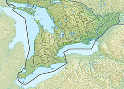
Location of the mouth of Percy Creek in southern Ontario
EtymologyNamed after Elizabeth Percy, Duchess of Northumberland
Location
Country Canada
Province Ontario
Region Central Ontario
County Northumberland
Municipalities
Physical characteristics
SourceUnnamed marsh
  location Alnwick/Haldimand
  coordinates 44°10′30″N78°03′26″W / 44.17495257031138°N 78.05734823780516°W / 44.17495257031138; -78.05734823780516
  elevation255 m (837 ft)
Mouth Trent River
  location
Trent Hills
  coordinates
44°15′01″N77°49′01″W / 44.25028°N 77.81694°W / 44.25028; -77.81694 [1]
  elevation
116 m (381 ft)
Basin features
River system Great Lakes Basin
Tributaries 
  right Burnley Creek

Percy Creek is a stream in the municipalities of Trent Hills and Alnwick/Haldimand, Northumberland County, in Central Ontario, Canada. It is in the Great Lakes Basin and is a right tributary of the Trent River. [1] [2] [3] [4] Percy Creek is named after Elizabeth Percy, Duchess of Northumberland.
Contents

Course

Percy Creek begins at an unnamed marsh, about 2 kilometres (1.2 mi) south of the community of Roseneath, in geographic Alnwick Township in the municipality of Alnwick/Haldimand. It flows northeast through several portions of the lands of the Alderville First Nation, passes into geographic Percy Township in the municipality of Trent Hills, and reaches its northernmost point north of the community of Brickley. It then heads south, flowing through Dartford Pond and over its impounding dam (with a fish ladder), then under the bridge for County Road 24 at the community of Dartford, then turns east. Percy Creek passes under County Road 25, over a small dam, takes in the right tributary Burnley Creek, turns north, heads into geographic Seymour Township, passes under County Road 30, and reaches its mouth at the Trent River at the community of Meyersburg. [2] The Trent River flows to the Bay of Quinte on Lake Ontario.

Related Research Articles

<span class="mw-page-title-main">Northumberland County, Ontario</span> County in Ontario, Canada

Northumberland County is an upper-tier level of municipal government situated on the north shore of Lake Ontario, east of Toronto in Central Ontario. The Northumberland County headquarters are located in Cobourg.

<span class="mw-page-title-main">York River (Ontario)</span> River in Ontario, Canada

The York River is a river in Renfrew County, Hastings County and Haliburton County in Ontario, Canada. The river is in the Saint Lawrence River drainage basin, and flows from the southern extension of Algonquin Provincial Park to the Madawaska River.

<span class="mw-page-title-main">Indian River (Muskrat River watershed)</span> River in Ontario, Canada

The Indian River is a river in Renfrew County and Nipissing District in Eastern and Northeastern Ontario, Canada. It is in the Saint Lawrence River drainage basin, and is a left tributary of the Muskrat River.

<span class="mw-page-title-main">Otonabee River</span> River in Ontario, Canada

The Otonabee River is a river in Peterborough County in Central Ontario, Canada. The river flows from Katchewanooka Lake, at the north end of the community of Lakefield, through the city of Peterborough to Rice Lake. It is in the Great Lakes Basin and forms part of the Trent-Severn Waterway.

<span class="mw-page-title-main">Opeongo River</span> River in Ontario, Canada

The Opeongo River is a river in the Saint Lawrence River drainage basin in Nipissing District in northeastern Ontario, Canada. The river is entirely within Algonquin Provincial Park and Opeongo River Provincial Park, except for a small portion around Victoria Lake, and is a left tributary of the Madawaska River.

<span class="mw-page-title-main">Maitland River</span> River in Ontario, Canada

The Maitland River is a river in Huron County, Perth County and Wellington County in Southwestern Ontario, Canada. The river is in the Great Lakes Basin and empties into Lake Huron at the town of Goderich. It is 150 kilometres (93 mi) long, and is named after Sir Peregrine Maitland, Lieutenant-Governor of Upper Canada from 1818 to 1828. It was formerly known as the Menesetung River.

<span class="mw-page-title-main">Trent Hills</span> Township in Ontario, Canada

The Municipality of Trent Hills is a township municipality in Northumberland County in Central Ontario, Canada. It is on the Trent River and was created in 2001 through the amalgamation of the municipalities of Campbellford/Seymour, Percy Township and Hastings. Thereafter it was known in brief as Campbellford/Seymour, Percy, Hastings.

<span class="mw-page-title-main">Crowe River</span> River in Ontario, Canada

The Crowe River is a river in the counties of Haliburton, Hastings, Northumberland and Peterborough in southern Ontario, Canada. It is in the Lake Ontario drainage basin and is a tributary of the Trent River.

<span class="mw-page-title-main">Warkworth, Ontario</span> Place in Ontario, Canada

Warkworth is a community in the municipality of Trent Hills, Northumberland in Central Ontario, Canada. Originally known as Percy Mills, the village of Warkworth was incorporated in 1857, and became part of Trent Hills when the latter was formed in 2001. Warkworth is named after Warkworth, Northumberland.

<span class="mw-page-title-main">Alnwick/Haldimand</span> Township in Ontario, Canada

The Township of Alnwick/Haldimand is a township in central Ontario, Canada, in Northumberland County, situated between Lake Ontario and Rice Lake. It was formed in 2001 by the merger of Alnwick Township in the north and Haldimand Township in the south. Alderville First Nation is an autonomously governed First Nation contained within the township boundaries, in two non-contiguous sections along County Roads 45 and 18.

Percy, Ontario was a former incorporated township and now a geographic township located in Northumberland County, Ontario, Canada. It is currently part of the Municipality of Trent Hills.

Redstone Lake is a lake located in geographic Guilford Township in the Municipality of Dysart et al, Haliburton County in Central Ontario, Canada. It is in the Great Lakes Basin and is part of the Gull River system. At its longest, it is approximately 6.5km.

The Nipissing River is a river in the Saint Lawrence River drainage basin in the Unorganized South Part of Nipissing District in northeastern Ontario, Canada. The river is entirely within Algonquin Provincial Park, and is a left tributary of the Petawawa River.

<span class="mw-page-title-main">Blanche River (Lake Timiskaming)</span> River in Ontario, Canada

The Blanche River is a river in the Saint Lawrence River drainage basin in Timiskaming District in northeastern Ontario, Canada. The river is a tributary of Lake Timiskaming and its name is from the French for the colour "white".

The Indian River is a river in Peterborough County in Central Ontario, Canada. It is in the Great Lakes Basin, and is a tributary of Rice Lake.

Koshlong Creek is a river in geographic Glamorgan Township in the municipality of Highlands East, Haliburton County in Central Ontario, Canada. The river is in the Great Lakes Basin and is a left tributary of the Burnt River.

<span class="mw-page-title-main">Black River (Abitibi River tributary)</span> River in Ontario, Canada

The Black River is a river in Cochrane District and Timiskaming District in Northeastern Ontario, Canada. It is part of the James Bay drainage basin, and is a right tributary of the Abitibi River. The municipality of Black River-Matheson is named after the river.

The Irondale River is a river in Haliburton County in Central Ontario, Canada. It is part of the Great Lakes Basin, and is a left tributary of the Burnt River.

Percy Creek is a stream in the western part of Sudbury District in Northeastern Ontario, Canada. It is in the Great Lakes Basin and is a right tributary of the Batchawana River.

Burnley Creek is a stream in the municipalities of Trent Hills and Alnwick/Haldimand, Northumberland County, in Central Ontario, Canada. It is in the Great Lakes Basin and is a right tributary of Percy Creek.

References

  1. 1 2 "Percy Creek". Geographical Names Data Base . Natural Resources Canada . Retrieved 2018-06-15.
  2. 1 2 "CLAIMaps IV". Ontario Ministry of Northern Development and Mines. 2016. Retrieved 2018-06-15.
  3. Map 6 (PDF) (Map). 1 : 700,000. Official road map of Ontario. Ministry of Transportation of Ontario. 2016-01-01. Retrieved 2018-06-15.
  4. Restructured municipalities - Ontario map #5 (Map). Restructuring Maps of Ontario. Ontario Ministry of Municipal Affairs and Housing. 2006. Retrieved 2018-06-15.

See also