
The Haute Route, is the name given to a route undertaken on foot or by ski touring between the Mont Blanc in Chamonix, France, and the Matterhorn, in Zermatt, Switzerland.

Arolla is a village in the municipality of Evolène in the canton of Valais in Switzerland.
Val d'Hérens is an alpine valley in the Valais canton of Switzerland. It was formed by the Hérens glacier, which retreated at the end of the last ice age. It is now the valley of the Borgne river, a tributary of the Rhone

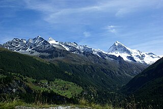
Mont Collon is a mountain of the Swiss Pennine Alps in the canton of Valais. Its glaciated north face dominates the view south from the village of Arolla.

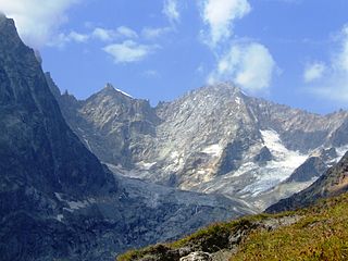
Mont Dolent is a mountain in the Mont Blanc massif and lies on the border between Italy, Switzerland and France.
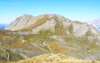
The Col Ferret is an Alpine pass between the canton of Valais and the Aosta Valley. It is crossed by the route of the Tour du Mont Blanc. Close to it stands the Petit Col Ferret, at an elevation of 2,490 metres (8,170 ft), which separates the Mont Blanc Massif from the Pennine Alps.

Mont Fort is a mountain of the Pennine Alps, located near Verbier in the Swiss canton of Valais. It lies on the range between the valleys of Bagnes and Nendaz, north of the Rosablanche. With a height of 3,328 metres (10,919 ft) above sea level, Mont Fort is the highest summit north of the Col de Louvie.

Le Portalet is a mountain of the Mont Blanc massif, located west of Praz de Fort in the canton of Valais. It lies on the range between the glaciers of Trient and Saleina. It has two important subsidiary summits: Grand Clocher du Portalet and Petit Clocher du Portalet. The latter forms a needle and is particularly hard to climb.
The Petit Vélan is a mountain of the Swiss Pennine Alps, located south of Bourg-Saint-Pierre in the canton of Valais. It lies NW of Mont Vélan.

L'Evêque is a mountain of the Pennine Alps, overlooking the Col Collon in the canton of Valais, south of Mont Collon. With a height of 3,716 meters above sea level, it is one of the highest summits in the Arolla valley.

Mont Brulé is a mountain of the Pennine Alps, located on the Swiss-Italian border, east of the Col Collon. On its northern side it overlooks the upper Arolla Glacier.

The Arolla Glacier is a 4 km (2.5 mi) long glacier (2005) situated in the Pennine Alps in the canton of Valais in Switzerland. In 1973 it had an area of 13.17 km2 (5.08 sq mi).

The Petit Grépillon is a mountain of the Mont Blanc Massif, located on the border between Italy and Switzerland. It lies on the range south-east of Mont Dolent, between the glaciers of Pré de Bard and Dolent (Valais).

Col Collon is a high mountain pass across the central Pennine Alps, connecting Arolla in the Swiss canton of Valais to Bionaz in the Italian region of Aosta Valley.
The Bornes Massif is a mountainous massif in the north French Prealps in the département of Haute-Savoie. It has 20 peaks higher than 2000 m and is a popular destination for winter sports. The Massif is the source of the celebrated cheese Reblochon.
The Petit Col Ferret is an Alpine pass between the canton of Valais and the Aosta Valley.
The Col de Chermotane is an Alpine pass located in the Swiss canton of Valais. With an elevation of 3,037 metres above sea level, the Col de Chermotane is the lowest pass between the valleys of Bagnes and Hérens. The pass lies a few kilometres north of the main chain of the Alps and is covered by the Otemma Glacier. It connects Chanrion to Arolla, both in the upper part of their valley.
Mont Mort is a mountain of the Pennine Alps, located on the border between Switzerland and Italy. It is located on the main chain of the Alps, just south-east of the Great St Bernard Pass.

Valpelline is one of the side valleys of the Aosta Valley in north-west Italy. It shares its name with one of the communes within its territory (Valpelline).
The Mont Froid is a 2,822 m high mountain of the northern Cottian Alps.

