Piedra, Colorado

Last updated
Piedra, Colorado
Hinsdale County Colorado Incorporated and Unincorporated areas Piedra Highlighted 0858960.svg
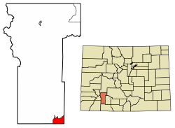
Location of the Piedra CDP in Hinsdale County, Colorado.
Usa edcp location map.svg
Red pog.svg
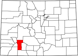
Piedra
Location of the Piedra CDP in the United States.
Coordinates: 37°26′30″N107°10′06″W / 37.4417952°N 107.1684271°W / 37.4417952; -107.1684271 (Piedra CDP, Colorado) Coordinates: 37°26′30″N107°10′06″W / 37.4417952°N 107.1684271°W / 37.4417952; -107.1684271 (Piedra CDP, Colorado) [1]
Country Flag of the United States.svg  United States
State Flag of Colorado.svg  Colorado
County Hinsdale County
Government
[2]
  Type unincorporated community
Area
[1]
  Total11.6 sq mi (30.098 km2)
  Land11.6 sq mi (30.098 km2)
  Water0.000 sq mi (0.000 km2)
Elevation
[2]
7,844 ft (2,391 m)
Population
 (2020)
  Total31 [3]
  Density2.67/sq mi (1.03/km2)
Time zone UTC-7 (MST)
  Summer (DST) UTC-6 (MDT)
ZIP Code [4]
Area code(s) 970
GNIS feature [2] Piedra CDP

Piedra is an unincorporated community and a census-designated place (CDP) located in and governed by Hinsdale County, Colorado, United States. The population of the Piedra CDP was 31 at the United States Census 2020. [5] The Pagosa Springs post office (Zip Code 81147) serves the area. [4]

Contents

History

The Piedra Post Office was established in 1879, and remained in operation until 1927. [6] Piedra is a name derived from Spanish meaning "stone". [7]

Geography

The Piedra CDP occupies the southeast corner of Hinsdale County in the valley of the Piedra River within San Juan National Forest. It is at the southern edge of the San Juan Mountains. The CDP is 18 miles (29 km) west of Pagosa Springs.

The Piedra CDP has an area of 7,437 acres (30.098 km2), all land. [1]

Demographics

The United States Census Bureau initially defined the Piedra CDP for the United States Census 2010.

Piedra CDP, Colorado
YearPop.±%
2010 28    
2020 31+10.7%
Source: United States Census Bureau

See also

Related Research Articles

Strasburg, Colorado Census Designated Place in Colorado, United States

Strasburg is an unincorporated town, a post office, and a census-designated place (CDP) located in and governed by Adams and Arapahoe counties, Colorado, United States. The CDP is a part of the Denver–Aurora–Lakewood, CO Metropolitan Statistical Area. The Strasburg post office has the ZIP Code 80136. At the United States Census 2010, the population of the Strasburg CDP was 2,447, while the population of the 80136 ZIP Code Tabulation Area was 4834 including adjacent communities.

Byers, Colorado Census Designated Place in Colorado, United States

Byers is an unincorporated town, a post office, and a census-designated place (CDP) located in and governed by Arapahoe County, Colorado, United States. The CDP is a part of the Denver–Aurora–Lakewood, CO Metropolitan Statistical Area. The Byers post office has the ZIP Code 80103. At the United States Census 2010, the population of the Byers CDP was 1,160, while the population of the 80103 ZIP Code Tabulation Area was 2,458 including adjacent areas.

Arboles, Colorado Census Designated Place in Colorado, United States

Arboles is an unincorporated town, a post office, and a census-designated place (CDP) located in and governed by Archuleta County, Colorado, United States. The Arboles post office has the ZIP code 81121. At the United States Census 2010, the population of the Arboles CDP was 280, while the population of the 81121 ZIP Code Tabulation Area was 270. The town's name means "trees" in Spanish.

Kittredge, Colorado Census Designated Place in Colorado, United States

Kittredge is an unincorporated town, a post office, and a census-designated place (CDP) located in and governed by Jefferson County, Colorado, United States. The CDP is a part of the Denver–Aurora–Lakewood, CO Metropolitan Statistical Area. The Kittredge post office has the ZIP code 80457. At the United States Census 2010, the population of the Kittredge CDP was 1,304, while the population of the 80457 ZIP Code Tabulation Area was 612.

Padroni, Colorado Census Designated Place in Colorado, United States

Padroni is an unincorporated town, a census-designated place (CDP), and a post office located in and governed by Logan County, Colorado, United States. The CDP is a part of the Sterling, CO Micropolitan Statistical Area. The Padroni post office has the ZIP Code 80745. At the United States Census 2010, the population of the Padroni CDP was 76, while the population of the 80745 ZIP Code Tabulation Area was 156 including adjacent areas.

Clifton, Colorado Census Designated Place in Colorado, United States

Clifton is an unincorporated town, a post office, and a census-designated place (CDP) located in and governed by Mesa County, Colorado, United States. The CDP is a part of the Grand Junction, CO Metropolitan Statistical Area. The Clifton post office has the ZIP Code 81520. At the United States Census 2010, the population of the Clifton CDP was 19,889, while the population of the 81520 ZIP Code Tabulation Area was 13,447.

Avondale, Colorado Census Designated Place in Colorado, United States

Avondale is an unincorporated town, a post office, and a census-designated place (CDP) located in and governed by Pueblo County, Colorado, United States. The CDP is a part of the Pueblo, CO Metropolitan Statistical Area. The Avondale post office has the ZIP Code 80106. At the United States Census 2010, the population of the Avondale CDP was 674, while the population of the 80106 ZIP Code Tabulation Area was 1,560 including adjacent areas.

Conejos, Colorado Census Designated Place in Colorado, United States

Conejos is an unincorporated town, a post office, a census-designated place (CDP), and the county seat of Conejos County, Colorado, United States. The Conejos post office has the ZIP Code 81129. At the United States Census 2010, the population of the Conejos CDP was 58, while the population of the 81129 ZIP Code Tabulation Area was 156 including adjacent areas. Conejos is the only unincorporated county seat in the State of Colorado.

Cope, Colorado Census Designated Place in Colorado, United States

Cope is an unincorporated town, a post office, and a census-designated place (CDP) located in and governed by Washington County, Colorado, United States. The Cope post office has the ZIP Code 80812. At the United States Census 2010, the population of the 80812 ZIP Code Tabulation Area was 275 including adjacent areas.

Gardner, Colorado Census Designated Place in Colorado, United States

Gardner is an unincorporated town, a post office, and a census-designated place (CDP) located in and governed by Huerfano County, Colorado, United States. The Gardner post office has the ZIP Code 81040. At the United States Census 2010, the population of the 81040 ZIP Code Tabulation Area was 536 including adjacent areas.

Hasty, Colorado Census Designated Place in Colorado, United States

Hasty is an unincorporated town, a post office, and a census-designated place (CDP) located in and governed by Bent County, Colorado, United States. The Hasty post office has the ZIP code 81044. At the United States Census 2010, the population of the Hasty CDP was 144, while the population of the 81044 ZIP Code Tabulation Area was 224 including adjacent areas.

Howard, Colorado Census Designated Place in Colorado, United States

Howard is an unincorporated town, a post office, and a census-designated place (CDP) located in and governed by Fremont County, Colorado, United States. The CDP is a part of the Cañon City, CO Micropolitan Statistical Area. The Howard post office has the ZIP Code 81233. At the United States Census 2010, the population of the Howard CDP was 723, while the population of the 81233 ZIP Code Tabulation Area was 823 including adjacent areas.

Kirk, Colorado Census Designated Place in Colorado, United States

Kirk is an unincorporated town, a post office, and a census-designated place (CDP) located in and governed by Yuma County, Colorado, United States. The Kirk post office has the ZIP Code 80106. At the United States Census 2010, the population of the Kirk CDP was 59, while the population of the 80106 ZIP Code Tabulation Area was 207 including adjacent areas.

Orchard, Colorado Census Designated Place in Colorado, United States

Orchard is an unincorporated town, a post office, and a census-designated place (CDP) located in and governed by Morgan County, Colorado, United States. The CDP is a part of the Fort Morgan, CO Micropolitan Statistical Area. The Orchard post office has the ZIP Code 80649. At the United States Census 2010, the population of the Orchard CDP was 90, while the population of the 80649 ZIP Code Tabulation Area was 299 including adjacent areas.

Phippsburg, Colorado CDP in Colorado, United States

Phippsburg is an unincorporated town, a post office, and a census-designated place (CDP) located in and governed by Routt County, Colorado, United States. The CDP is a part of the Steamboat Springs, CO Micropolitan Statistical Area. The Phippsburg post office has the ZIP Code 80469. At the United States Census 2010, the population of the Phippsburg CDP was 204, while the population of the 80469 ZIP Code Tabulation Area was 337 including adjacent areas.

Snyder, Colorado Census Designated Place in Colorado, United States

Snyder is an unincorporated town, a post office, and a census-designated place (CDP) located in and governed by Morgan County, Colorado, United States. The CDP is a part of the Fort Morgan, CO Micropolitan Statistical Area. The Snyder post office has the ZIP Code 80750. At the United States Census 2010, the population of the Snyder CDP was 132, while the population of the 80750 ZIP Code Tabulation Area was 412 including adjacent areas.

Vernon, Colorado Census Designated Place in Colorado, United States

Vernon is an unincorporated town, a post office, and a census-designated place (CDP) located in and governed by Yuma County, Colorado, United States. The Vernon post office has the ZIP Code 80755. At the United States Census 2010, the population of the Vernon CDP was 29, while the population of the 80755 ZIP Code Tabulation Area was 163 including adjacent areas.

Weldona, Colorado Census Designated Place in Colorado, United States

Weldona is an unincorporated town, a post office, and a census-designated place (CDP) located in and governed by Morgan County, Colorado, United States. The CDP is a part of the Fort Morgan, CO Micropolitan Statistical Area. The Weldona post office has the ZIP Code 80653. At the United States Census 2010, the population of the Weldona CDP was 139, while the population of the 791 ZIP Code Tabulation Area was 4,232 including adjacent areas.

Weston, Colorado Census Designated Place in Colorado, United States

Weston is an unincorporated town, a post office, and a census-designated place (CDP) located in and governed by Las Animas County, Colorado, United States. The Weston post office has the ZIP Code 81091. At the United States Census 2010, the population of the Weston CDP was 55, while the population of the 81091 ZIP Code Tabulation Area was 812 including adjacent areas.

Cathedral, Colorado Census Designated Place in Colorado, United States

Cathedral is an unincorporated community and a census-designated place (CDP) located in and governed by Hinsdale County, Colorado, United States. The population of the Cathedral CDP was 14 at the United States Census 2010. The Powderhorn post office serves the area.

References

  1. 1 2 3 "State of Colorado Census Designated Places - BAS20 - Data as of January 1, 2020". United States Census Bureau . Retrieved December 22, 2020.
  2. 1 2 3 "U.S. Board on Geographic Names: Domestic Names". United States Geological Survey . Retrieved December 19, 2020.
  3. https://data.census.gov/cedsci/profile?g=1600000US0858960
  4. 1 2 "Zip Code 81147 Map and Profile". zipdatamaps.com. 2020. Retrieved December 22, 2020.
  5. "2010: DEC Summary File 1". United States Census Bureau . Retrieved December 22, 2020.
  6. "Post offices". Jim Forte Postal History. Retrieved 7 July 2016.
  7. Dawson, John Frank. Place names in Colorado: why 700 communities were so named, 150 of Spanish or Indian origin. Denver, CO: The J. Frank Dawson Publishing Co. p. 41.