Capitol City was founded in 1877 by George Lee and was originally named Galena City. The Capitol City, Colorado, post office operated from May 18, 1877, until October 30, 1920.[3] At its peak, the city boasted around 800 citizens and its founders wished it had become the capital of Colorado. In order to try and garner interest, Lee changed the name to Capitol City as he had also dreamed of becoming the state's governor. Today only the post office, a structure called "Lee's Smelter Stack", some rubble buildings, and a few brickkilns remain. There are private homes and private land surrounding the site.[4]
Lee built a beautiful home here with brick hauled from Pueblo at $1 per brick. It reportedly had a generous living room, theater with an orchestral pit and a few guest ballrooms. In addition to his house, he built the Henson Creek smelter and sawmill. The original 200-acre town site had everything needed, including a few hotels, restaurants, bars, a post office, schoolhouse, cabins, a sawmill and mining smelters. The richest year was in 1877, when the town boasted a population of 800. When the cost of silver dropped, so did the residents. Lawsuits and difficult transportation also sped up the town's downfall.[4]
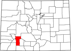
Geography
The city is located on Engineer Pass, a part of the Alpine 4×4 Loop, a national scenic byway. The town can be accessed via Lake City, which is situated 9mi (14.5km) to the East on CO-20. The site can be easily accessed by 2WD automobiles between June and November.[4]
This page is based on this Wikipedia article Text is available under the CC BY-SA 4.0 license; additional terms may apply. Images, videos and audio are available under their respective licenses.