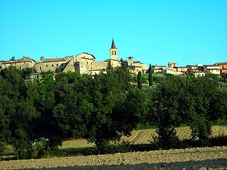
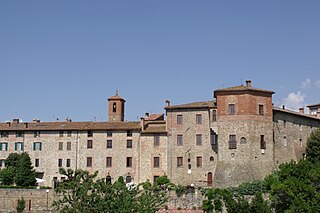
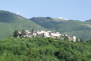
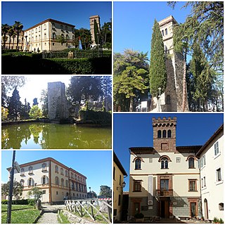
Piegaro

Last updated
Piegaro
Comune
Comune di Piegaro
Piegaro-Stemma.png
Coat of arms
Italy provincial location map 2015.svg
Red pog.svg
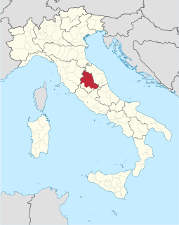
Piegaro
Location of Piegaro in Italy
Coordinates: 42°58′N12°5′E / 42.967°N 12.083°E / 42.967; 12.083
Country Italy
Region Umbria
Province Perugia (PG)
Frazioni Acquaiola Gratiano, Castiglion Fosco, Cibottola, Colle Baldo, Gaiche, Greppolischieto, Ierna Vignaie, Macereto, Oro, Pietrafitta, Pratalenza
Government
  Mayor Andrea Caporali
Area
  Total 99.0 km2 (38.2 sq mi)
Elevation 356 m (1,168 ft)
Population (2007)
  Total 3,718
  Density 38/km2 (97/sq mi)
Demonym(s) Piegaresi
Time zone CET (UTC+1)
  Summer (DST) CEST (UTC+2)
Postal code06066
Dialing code 075
Website Official website

Piegaro is a comune (municipality) in the Province of Perugia in the Italian region Umbria, located about 30 km southwest of Perugia. Piegaro borders the following municipalities: Città della Pieve, Marsciano, Montegabbione, Monteleone d'Orvieto, Paciano, Panicale, Perugia, San Venanzo.

<i>Comune</i> third-level administrative divisions of the Italian Republic

The comune is a basic administrative division in Italy, roughly equivalent to a township or municipality.

Province of Perugia Province of Italy

The Province of Perugia is the larger of the two provinces in the Umbria region of Italy, comprising two-thirds of both the area and population of the region. Its capital is the city of Perugia. The province covered all of Umbria until 1927, when the province of Terni was carved out of its southern third. The province of Perugia has an area of 6,334 km² covering two-thirds of Umbria, and a total population of about 660,000. There are 59 comunes in the province. The province has numerous tourist attractions, especially artistic and historical ones, and is home to the Lake Trasimeno, the largest lake of Central Italy. It historically the ancestral origin of the Umbri, while later it was a Roman province and then part of the Papal States until the late 19th century.

Italy republic in Southern Europe

Italy, officially the Italian Republic, is a European country consisting of a peninsula delimited by the Italian Alps and surrounded by several islands. Located in the middle of the Mediterranean sea and traversed along its length by the Apennines, Italy has a largely temperate seasonal climate. The country covers an area of 301,340 km2 (116,350 sq mi) and shares open land borders with France, Slovenia, Austria, Switzerland and the enclaved microstates of Vatican City and San Marino. Italy has a territorial exclave in Switzerland (Campione) and a maritime exclave in the Tunisian sea (Lampedusa). With around 60 million inhabitants, Italy is the fourth-most populous member state of the European Union.

Related Research Articles

Castel Ritaldi Comune in Umbria, Italy

Castel Ritaldi is a comune (municipality) in the Province of Perugia in the Italian region Umbria, located about 40 km southeast of Perugia.

Città della Pieve Comune in Umbria, Italy

Città della Pieve is a comune (municipality) in the Province of Perugia in the Italian region Umbria, located about 50 km (31 mi) southwest of Perugia.

Collazzone Comune in Umbria, Italy

Collazzone is a comune (municipality) in the Province of Perugia in the Italian region Umbria, located about 25 km south of Perugia. As of 31 December 2004, it had a population of 3,108 and an area of 55.8 km².

Costacciaro Comune in Umbria, Italy

Costacciaro is a comune (municipality) in the Province of Perugia in the Italian region Umbria, located about 40 km northeast of Perugia. It is a medieval burgh, which, after the rule of Perugia and Gubbio, became part of the Papal States in the 15th century.

Giano dellUmbria Comune in Umbria, Italy

Giano dell'Umbria is a comune (municipality) in the Province of Perugia in the Italian region Umbria, located about 35 km southeast of Perugia.

Gualdo Cattaneo Comune in Umbria, Italy

Gualdo Cattaneo is a comune (municipality) in the Province of Perugia in the Italian region Umbria, located about 25 km southeast of Perugia.

Lisciano Niccone Comune in Umbria, Italy

Lisciano Niccone is a comune (municipality) in the Province of Perugia in the Italian region Umbria, located about 25 km northwest of Perugia.

Monte Santa Maria Tiberina Comune in Umbria, Italy

Monte Santa Maria Tiberina is a comune (municipality) in the province of Perugia in the Italian region Umbria, located about 40 km northwest of Perugia.

Paciano Comune in Umbria, Italy

Paciano is a comune (municipality) in the Province of Perugia in the Italian region Umbria, located about 30 km southwest of Perugia. As of 31 December 2004, it had a population of 974 and an area of 16.8 km².

Panicale Comune in Umbria, Italy

Panicale is a comune (municipality) in the Province of Perugia in the Italian region Umbria. Located on the eastern slope of Mount Petrarvella, in the southeast of Valdichiana, it overlooks Lake Trasimeno and it is about 35 km far from Perugia.

Poggiodomo Comune in Umbria, Italy

Poggiodomo is a comune (municipality) in the Province of Perugia in the Italian region Umbria, located about 80 km southeast of Perugia.

SantAnatolia di Narco Comune in Umbria, Italy

Sant'Anatolia di Narco is a comune (municipality) in the Province of Perugia in the Italian region Umbria, located about 60 km southeast of Perugia. It is a medieval town commanded by a 12th-century castle, with a 14th-century line of walls.

Scheggia e Pascelupo Comune in Umbria, Italy

Scheggia e Pascelupo is a comune (municipality) in the Province of Perugia in the Italian region Umbria, located about 40 km northeast of Perugia. The municipal seat is located in the main village of Scheggia, just below Scheggia Pass on Route SS/SR 3, following the ancient Via Flaminia.

Scheggino Comune in Umbria, Italy

Scheggino is a comune (municipality) in the Province of Perugia in the Italian region Umbria, located about 60 km southeast of Perugia. As of 31 December 2004, it had a population of 460 and an area of 35.2 km².

Tuoro sul Trasimeno Comune in Umbria, Italy

Tuoro sul Trasimeno is a comune (municipality) in the province of Perugia in the Italian region Umbria, located about 25 km northwest of Perugia.

Vallo di Nera Comune in Umbria, Italy

Vallo di Nera is a comune (municipality) in the Province of Perugia in the Italian region Umbria, located about 60 km southeast of Perugia.

Valtopina Comune in Umbria, Italy

Valtopina is a comune (municipality) in the Province of Perugia in the Italian region Umbria, located about 30 km east of Perugia. As of 31 December 2004, it had a population of 1,399 and an area of 40.5 km².

Montegabbione Comune in Umbria, Italy

Montegabbione is a comune (municipality) in the Province of Terni in the Italian region Umbria, located about 35 km southwest of Perugia and about 60 km northwest of Terni.

San Venanzo Comune in Umbria, Italy

San Venanzo is a comune (municipality) in the Province of Terni in the Italian region Umbria, located about 30 km (19 mi) southwest of Perugia and about 45 km (28 mi) northwest of Terni.

Avigliano Umbro Comune in Umbria, Italy

Avigliano Umbro is a comune (municipality) in the Province of Terni in the Italian region Umbria, located about 50 km south of Perugia and about 20 km northwest of Terni. As of 2011 census its population was of 2,568.

References