Perugia is the capital city of Umbria in central Italy, crossed by the River Tiber. The city is located about 164 km (102 mi) north of Rome and 148 km (92 mi) southeast of Florence. It covers a high hilltop and part of the valleys around the area.

Spoleto is an ancient city in the Italian province of Perugia in east-central Umbria on a foothill of the Apennines. It is 20 km (12 mi) south of Trevi, 29 km (18 mi) north of Terni, 63 km (39 mi) southeast of Perugia; 212 km (132 mi) southeast of Florence; and 126 km (78 mi) north of Rome.

Fabriano is a town and comune of Ancona province in the Italian region of the Marche, at 325 metres (1,066 ft) above sea level. It lies in the Esino valley 44 kilometres (27 mi) upstream and southwest of Jesi; and 15 kilometres (9 mi) east-northeast of Fossato di Vico and 36 kilometres (22 mi) east of Gubbio. Its location on the main highway and rail line from Umbria to the Adriatic make it a mid-sized regional center in the Apennines. Fabriano is the headquarters of the giant appliance maker Indesit.

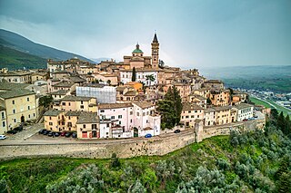
Trevi is an ancient town and comune (municipality) in Umbria, Italy, on the lower flank of Mount Serano overlooking the wide plain of the Clitunno river system. Located in the Province of Perugia, it is 10 km (6 mi) SSE of Foligno and 20 km (12 mi) north of Spoleto. It is one of I Borghi più belli d'Italia.

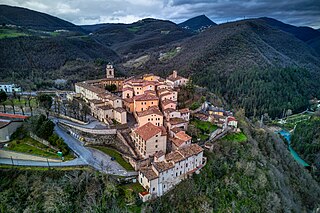
Monteleone di Spoleto, is a town and comune of Italy, in the province of Perugia in southeast Umbria at 978 meters (3,209 ft) above sea-level overhanging the upper valley of the Corno River. It is one of the more remote towns in Umbria, on a mountain road from Norcia and Cascia to Leonessa and Rieti in the Lazio. It is one of I Borghi più belli d'Italia.

Bettona is an ancient town and comune of Italy, in the province of Perugia in central Umbria at the northern edge of the Colli Martani range. It is 5 km (3 mi) E of Torgiano and 12 km (7 mi) SW of Assisi. It is one of I Borghi più belli d'Italia. Passaggio, Colle, and Cerreto are frazioni of the comune.

Nocera Umbra is a town and comune in the province of Perugia, Italy, 15 kilometers north of Foligno, at an altitude of 520 m above sea-level. The comune, covering an area of 157.19 km2, is one of the largest in Umbria. It is one of I Borghi più belli d'Italia.

Acquasparta is a town and comune in the province of Terni. It is located on a hill above the Naia Valley and the river of the same name, facing the Monti Martani mountain range. It is one of I Borghi più belli d'Italia. It also sits between two hot springs, the Amerino and the Furapane.
Sant'Angelo in Pontano is a comune (municipality) in the Province of Macerata in the Italian region Marche, located about 60 kilometres (37 mi) south of Ancona and about 25 kilometres (16 mi) south of Macerata. It stands in pleasant position with a panoramic view over the adjacent valleys of Ete Morto river and Tenna river.

Poggiodomo is a comune (municipality) in the Province of Perugia in the Italian region Umbria, located about 80 km southeast of Perugia.

Preci is a comune (municipality) in the Province of Perugia in the Italian region Umbria, located about 60 km southeast of Perugia. It is one of I Borghi più belli d'Italia.

Sant'Anatolia di Narco is a comune (municipality) in the Province of Perugia in the Italian region Umbria, located about 60 km southeast of Perugia, in the middle Valnerina valley. It is a medieval town commanded by a 12th-century castle, with a 14th-century line of walls.

Scheggino is a comune (municipality) in the Province of Perugia in the Italian region Umbria, located about 60 km southeast of Perugia. As of January 2020, it had a population of 464 and an area of 35.2 km2.

Sellano is a comune (municipality) in the Province of Perugia in the Italian region Umbria, located about 50 km southeast of Perugia. As of 31 December 2018, it had a population of 1,048 and an area of 85.7 km².

Sigillo is a comune (municipality) in the province of Perugia in the Italian region Umbria, located about 35 km northeast of Perugia.

Arrone is a comune (municipality) in the Province of Terni in the Italian region Umbria, located about 70 km southeast of Perugia and about 10 km east of Terni in the Valnerina. It is one of I Borghi più belli d'Italia.

Ferentillo is a comune (municipality) in the Province of Terni in the Italian region Umbria, located about 60 km southeast of Perugia and about 12 km northeast of Terni. The comune, located in the valley of the Nera, is divided by the river into the burghs of Matterella and Precetto.

San Gemini is a comune (municipality) of c. 5,000 inhabitants in the province of Terni in the Italian region Umbria, located about 60 km south of Perugia and about 10 km northwest of Terni.

Ponte is a frazione of the comune of Cerreto di Spoleto in the Province of Perugia, Umbria, central Italy. It stands at an elevation of 441 metres above sea level. At the time of the Istat census of 2001 it had 125 inhabitants.

Rocchetta is a frazione of the comune of Cerreto di Spoleto in the Province of Perugia, Umbria, central Italy. It stands at an elevation of 793 metres above sea level. At the time of the Istat census of 2001 it had 41 inhabitants.


