Ridge Manor is a census-designated place (CDP) in Hernando County, Florida, United States. The population was 4,513 at the 2010 census.
Rosewood Heights is an unincorporated community and census-designated place (CDP) in Madison County, Illinois, United States. The population was 3,971 at the 2020 census. It is part of the Metro East region of the Greater St. Louis metropolitan area.

Pine Knot is an unincorporated community and census-designated place (CDP) in McCreary County, Kentucky, United States. The population was 1,380 at the 2020 census, down from 1,621 in 2010.

North Potomac is a census-designated place and unincorporated area in Montgomery County, Maryland, United States. It is located less than 5 miles (8.0 km) north of the Potomac River, and is about 20 miles (32 km) from Washington, D.C. It has a population of 23,790 as of 2020.

Smith Valley is a census-designated place (CDP) in Lyon County, Nevada, United States. The population was 1,603 at the 2010 census.

Woodsville is a census-designated place (CDP) and the largest village in the town of Haverhill in Grafton County, New Hampshire, United States, along the Connecticut River at the mouth of the Ammonoosuc River. The population was 1,431 at the 2020 census. Although North Haverhill is now the county seat of Grafton County, the village of Woodsville has traditionally been considered the county seat, as the county courthouse was originally located there. The county buildings are now located halfway between Woodsville and the village of North Haverhill to the south.

Oak Grove is an unincorporated community and census-designated place (CDP) in Clackamas County, Oregon, United States. The population was 17,290 as of the 2020 census.

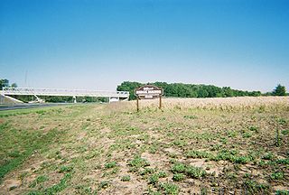
Golden Grove is a census-designated place (CDP) in Greenville County, South Carolina, United States. The population was 2,467 at the 2010 census. It is part of the Greenville–Mauldin–Easley Metropolitan Statistical Area.

Vantage is a census-designated place (CDP) in Kittitas County, Washington, United States. The population was 74 at the 2010 census.

Ayer is a census-designated place (CDP) and the primary settlement in the town of Ayer in Middlesex County, Massachusetts, United States. The population of the CDP was 2,986 at the 2020 census, out of 8,479 in the entire town.

Raymond is a census-designated place (CDP) and the main village in the town of Raymond, Rockingham County, New Hampshire, United States. The population of the CDP was 3,738 at the 2020 census, out of 10,684 in the entire town.

Pine Plains is a hamlet and census-designated place (CDP) in Dutchess County, New York, United States. The population was 1,142 at the 2020 census. It is part of the Poughkeepsie–Newburgh–Middletown, NY Metropolitan Statistical Area as well as the larger New York–Newark–Bridgeport, NY-NJ-CT-PA Combined Statistical Area.

Washington Boro is a census-designated place (CDP) in Manor Township, Lancaster County, Pennsylvania, United States, along the Susquehanna River. The ZIP code is 17582. It is served by the Penn Manor School District and is the terminus of Pennsylvania Routes 441 and 999. The population was 729 at the 2010 census.

Loudon is a census-designated place (CDP) and the main village in the town of Loudon in Merrimack County, New Hampshire, United States. The population of the CDP was 711 at the 2020 census, out of 5,576 in the entire town.
Barstow is a census-designated place (CDP) and unincorporated community in Ferry County in the U.S. state of Washington. As of the 2010 census it had a population of 59.
Curlew Lake is a census-designated place (CDP) in Ferry County, Washington that surrounds Curlew Lake northeast of Republic, Washington.
Barney's Junction is a census-designated place in Ferry County, Washington, in the United States.
Twin Lakes is a census-designated place in Ferry County, Washington, United States.
Torboy is a census-designated place in Ferry County, Washington, United States.
Pine Lake is an unincorporated community and census-designated place (CDP) in Mohave County, Arizona, United States. The population was 142 at the 2020 census.


