Podolanka | |
|---|---|
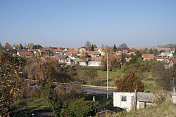 General view | |
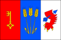 Flag  Coat of arms | |
 Podolanka Location in the Czech Republic | |
| Coordinates: 50°9′33″N14°36′4″E / 50.15917°N 14.60111°E | |
| Country | |
| Region | Central Bohemian |
| District | Prague-East |
| First mentioned | 1748 |
| Area | |
• Total | 3.30 km2 (1.27 sq mi) |
| Elevation | 232 m (761 ft) |
| Population (2025-01-01) [1] | |
• Total | 618 |
| • Density | 190/km2 (490/sq mi) |
| Time zone | UTC+1 (CET) |
| • Summer (DST) | UTC+2 (CEST) |
| Postal code | 250 73 |
| Website | www |
Podolanka is a municipality and village in Prague-East District in the Central Bohemian Region of the Czech Republic. It has about 600 inhabitants.