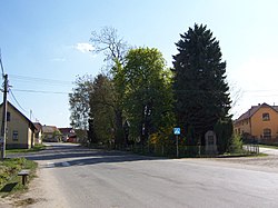
Svojetice | |
|---|---|
 Common in Svojetice | |
 Flag  Coat of arms | |
 Svojetice Location in the Czech Republic | |
| Coordinates: 49°58′17″N14°44′19″E / 49.97139°N 14.73861°E | |
| Country | |
| Region | Central Bohemian |
| District | Prague-East |
| First mentioned | 1407 |
| Area | |
• Total | 2.58 km2 (1.00 sq mi) |
| Elevation | 472 m (1,549 ft) |
| Population (2024-01-01) [1] | |
• Total | 1,323 |
| • Density | 510/km2 (1,300/sq mi) |
| Time zone | UTC+1 (CET) |
| • Summer (DST) | UTC+2 (CEST) |
| Postal code | 251 62 |
| Website | svojetice |
Svojetice is a municipality and village in Prague-East District in the Central Bohemian Region of the Czech Republic. It has about 1,300 inhabitants.