Herink

Last updated
Herink
Herink, common.jpg
Common in Herink
Flag of Herink.jpeg
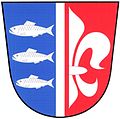
Coats of arms Herink.jpeg
Relief Map of Czech Republic.png
Red pog.svg
Herink
Location in the Czech Republic
Coordinates: 49°58′0″N14°34′30″E / 49.96667°N 14.57500°E / 49.96667; 14.57500
CountryFlag of the Czech Republic.svg  Czech Republic
Region Central Bohemian
District Prague-East
First mentioned1422
Area
  Total2.74 km2 (1.06 sq mi)
Elevation
362 m (1,188 ft)
Population
 (2024-01-01) [1]
  Total1,089
  Density400/km2 (1,000/sq mi)
Time zone UTC+1 (CET)
  Summer (DST) UTC+2 (CEST)
Postal code
251 70
Website www.herink.cz

Herink is a municipality and village in Prague-East District in the Central Bohemian Region of the Czech Republic. It has about 1,100 inhabitants. It is one of the fastest-growing municipalities in the country.

Contents

Etymology

The village was named after a settled whose surname was Hering. [2]

Geography

Herink is located about 10 kilometres (6 mi) southeast of Prague. It lies in an agricultural landscape on the border between the Prague Plateau and Benešov Uplands. The highest point is at 417 m (1,368 ft) above sea level.

History

The first written mention of Herink is from 1422. [3]

Demographics

In 2001, Herink had 72 inhabitants and therefore it is one of the fastest-growing municipalities in the country in the 21st century.

Historical population
YearPop.±%
1869166    
1880162−2.4%
1890161−0.6%
1900175+8.7%
1910154−12.0%
YearPop.±%
1921164+6.5%
1930167+1.8%
1950109−34.7%
1961111+1.8%
197093−16.2%
YearPop.±%
198088−5.4%
199175−14.8%
200172−4.0%
2011417+479.2%
20211,106+165.2%
Source: Censuses [4] [5]

Transport

Protected linden tree Herink, protected linden tree.jpg
Protected linden tree

The D0 motorway (part of the European route E50) passes through the municipal territory.

Sights

There are no protected cultural monuments in the municipality. [6]

Related Research Articles

<span class="mw-page-title-main">Káraný</span> Municipality in Central Bohemian, Czech Republic

Káraný is a municipality and village in Prague-East District in the Central Bohemian Region of the Czech Republic. It has about 800 inhabitants.

<span class="mw-page-title-main">Veleň</span> Municipality in Central Bohemian, Czech Republic

Veleň is a municipality and village in Prague-East District in the Central Bohemian Region of the Czech Republic. It has about 2,000 inhabitants.

<span class="mw-page-title-main">Zdiby</span> Municipality in Central Bohemian, Czech Republic

Zdiby is a municipality and village in Prague-East District in the Central Bohemian Region of the Czech Republic. It has about 4,000 inhabitants.

<span class="mw-page-title-main">Brázdim</span> Municipality in Central Bohemian, Czech Republic

Brázdim is a municipality in Prague-East District in the Central Bohemian Region of the Czech Republic. It has about 700 inhabitants.

<span class="mw-page-title-main">Čestlice</span> Municipality in Central Bohemian, Czech Republic

Čestlice is a municipality and village in Prague-East District in the Central Bohemian Region of the Czech Republic. It has about 700 inhabitants. It is known for Aquapalace Prague, which is the largest water park in the country, and for an extensive commercial zone.

<span class="mw-page-title-main">Svinařov</span> Municipality in Central Bohemian, Czech Republic

Svinařov is a municipality and village in Kladno District in the Central Bohemian Region of the Czech Republic. It has about 700 inhabitants.

<span class="mw-page-title-main">Horoušany</span> Municipality in Central Bohemian, Czech Republic

Horoušany is a municipality and village in Prague-East District in the Central Bohemian Region of the Czech Republic. It has about 2,000 inhabitants.

<span class="mw-page-title-main">Kamenice (Prague-East District)</span> Municipality in Central Bohemian, Czech Republic

Kamenice is a municipality and village in Prague-East District in the Central Bohemian Region of the Czech Republic. It has about 5,100 inhabitants.

<span class="mw-page-title-main">Horoměřice</span> Municipality in Central Bohemian, Czech Republic

Horoměřice is a municipality and village in Prague-West District in the Central Bohemian Region of the Czech Republic. It has about 5,400 inhabitants, which makes it the most populous municipality in the country without the town status.

<span class="mw-page-title-main">Jesenice (Prague-West District)</span> Town in Central Bohemian, Czech Republic

Jesenice is a town in Prague-West District in the Central Bohemian Region of the Czech Republic. It has about 10,000 inhabitants.

<span class="mw-page-title-main">Okrouhlo</span> Municipality in Central Bohemian, Czech Republic

Okrouhlo is a municipality and village in Prague-West District in the Central Bohemian Region of the Czech Republic. It has about 800 inhabitants.

<span class="mw-page-title-main">Průhonice</span> Municipality in Central Bohemian, Czech Republic

Průhonice is a municipality and village in Prague-West District in the Central Bohemian Region of the Czech Republic. It has about 2,800 inhabitants. It is known for Průhonice Park, which has been included in the UNESCO list of World Heritage Sites.

<span class="mw-page-title-main">Kanice (Brno-Country District)</span> Municipality in South Moravian, Czech Republic

Kanice is a municipality and village in Brno-Country District in the South Moravian Region of the Czech Republic. It has about 1,100 inhabitants.

<span class="mw-page-title-main">Ketkovice</span> Municipality in South Moravian, Czech Republic

Ketkovice is a municipality and village in Brno-Country District in the South Moravian Region of the Czech Republic. It has about 600 inhabitants.

<span class="mw-page-title-main">Lažánky (Brno-Country District)</span> Municipality in South Moravian, Czech Republic

Lažánky is a municipality and village in Brno-Country District in the South Moravian Region of the Czech Republic. It has about 900 inhabitants.

<span class="mw-page-title-main">Podolí (Brno-Country District)</span> Municipality in South Moravian, Czech Republic

Podolí is a municipality and village in Brno-Country District in the South Moravian Region of the Czech Republic. It has about 1,400 inhabitants.

<span class="mw-page-title-main">Popovice (Brno-Country District)</span> Municipality in South Moravian, Czech Republic

Popovice is a municipality and village in Brno-Country District in the South Moravian Region of the Czech Republic. It has about 400 inhabitants.

<span class="mw-page-title-main">Přibyslavice (Brno-Country District)</span> Municipality in South Moravian, Czech Republic

Přibyslavice is a municipality and village in Brno-Country District in the South Moravian Region of the Czech Republic. It has about 500 inhabitants.

<span class="mw-page-title-main">Tetčice</span> Municipality in South Moravian, Czech Republic

Tetčice is a municipality and village in Brno-Country District in the South Moravian Region of the Czech Republic. It has about 1,100 inhabitants.

<span class="mw-page-title-main">Březina (former Blansko District)</span> Municipality in South Moravian, Czech Republic

Březina is a municipality and village in Brno-Country District in the South Moravian Region of the Czech Republic. It has about 1,100 inhabitants.

References

  1. "Population of Municipalities – 1 January 2024". Czech Statistical Office. 2024-05-17.
  2. Profous, Antonín (1947). Místní jména v Čechách I: A–H (in Czech). p. 612.
  3. "Historie obce" (in Czech). Obec Herink. Retrieved 2024-01-30.
  4. "Historický lexikon obcí České republiky 1869–2011 – Okres Praha-východ" (in Czech). Czech Statistical Office. 2015-12-21. pp. 3–4.
  5. "Population Census 2021: Population by sex". Public Database. Czech Statistical Office. 2021-03-27.
  6. "Výsledky vyhledávání: Kulturní památky, obec Herink". Ústřední seznam kulturních památek (in Czech). National Heritage Institute. Retrieved 2024-07-19.