
The Société des établissements de plein air du Québec, also known as Sépaq, is the agency of the Government of Quebec that manages parks and wildlife reserves. Sépaq falls under the authority of the Minister of Développement durable, de l'Environnement et des Parcs and its head office is located in Quebec City. It employs about 3400 people.
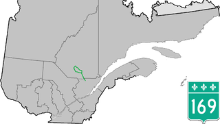
Route 169 begins south of Lac Saint-Jean, Quebec, Canada, at Route 175. It proceeds north to Lac Saint-Jean at Alma and encircles the lake, returning to Alma and its terminus in Hebertville.

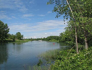
The Peribonka River is a river emptying in Sainte-Monique, in Lac-Saint-Jean-Est Regional County Municipality, in the Saguenay-Lac-Saint-Jean area in Quebec, Canada. It is 451 kilometres (280 mi) long and drains an area of 28,200 square kilometres (10,900 sq mi). It drains into Lac Saint-Jean at Pointe-Taillon National Park and is the largest tributary of this lake. The town of Péribonka is located on the north shore of Lac St-Jean at the river's mouth.

Gaspésie National Park is a provincial park located south of the town of Sainte-Anne-des-Monts, Quebec, Canada in the inland of the Gaspé peninsula. The park contains the highest peak of the Appalachian Mountains in Canada, Mont Jacques-Cartier, 1,270 metres (4,170 ft) above sea level. In addition, the park contains the only population of Caribou found south of the Saint Lawrence River in Canada.

Jacques-Cartier National Park is a provincial park located 50 kilometres (31 mi) north of Quebec City. The park aims to protect wildlife in the Laurentian massif. It lies within the Eastern forest-boreal transition ecoregion.
Bic National Park is an 33.2-square-kilometre (8,200-acre) national park of Quebec, Canada, located on the south shore of the St. Lawrence River, near the villages of Le Bic and Saint-Fabien, southwest of Rimouski. It was founded on October 17, 1984, and is home to large populations of harbour seals and grey seals. Its highest point is Pic Champlain at 346 metres (1,135 ft). Slightly less than half of the park is a coastal marine environment.
The Îles-de-Boucherville National Park is a provincial park along the Saint Lawrence river in the province of Quebec.

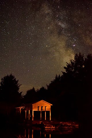
Mont-Orford National Park is a national park in Orford, Quebec, Canada that is maintained and protected by the Sépaq. a provincial body.
Mont-Saint-Bruno Provincial Park is a small national park of Quebec located near the municipality of Saint-Bruno-de-Montarville, 15 kilometres (9.3 mi) to the east of Montréal on the south shore of the Saint Lawrence River. The park, with an area of 8.84 square kilometres (3.41 sq mi), notably includes Mont Saint-Bruno, one of the Monteregian Hills which peaks at 218 metres (715 ft). The mountain is shared with the Ski Mont Saint-Bruno ski resort, a quarry and a small Canadian Forces training camp. Despite its relatively small size, the mountain is known for its rich fauna and flora. Situated at the heart of the old signory of Montarville, its many lakes have permitted the construction and exploitation of many water mills, contributing to the region's economical success. A building from one of those mills, the "Vieux Moulin", still stands to this day and is used as a rest area for skiers and hikers in different seasons.

Plaisance National Park is a provincial park located near Plaisance in the province of Quebec, Canada. The park was established on March 22, 2002 and covers an area of 28.3 square kilometres (10.9 sq mi).
Oka National Park(Parc national d'Oka) is a small provincially administered park, located within the village of Oka and between Pointe-Calumet on one side and Saint-Placide on the other side. on the north shore of Lac des Deux Montagnes in Quebec, Canada. The Park is home to one of the largest heronries in Quebec and the historical site of Calvaire d'Oka shrine which dates from 1740.

Saguenay Fjord National Park is a provincial park located in Quebec, Canada. In the regions of Saguenay–Lac-Saint-Jean, Charlevoix, Côte-Nord, and Bas-Saint-Laurent, the park is situated along the eastern end of the Saguenay River and adjoins the Saguenay–St. Lawrence Marine Park for over 100 km (60 mi.).

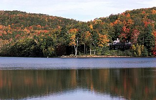
Lake Walker is a lake in Quebec, Canada. It is located in the Sept-Rivières Regional County Municipality in the region of Côte-Nord, about 30 km northwest of Port-Cartier.

Lac-Témiscouata National Park is a provincial park located in Quebec, Canada south of the Saint Lawrence River, near the border with New Brunswick. It contains Lake Témiscouata, which is "the second-largest lake south of the Saint Lawrence River" within some unspecified area, perhaps within Quebec, with a length of around 40 km (25 mi). Touladi River can also be found within the park's boundaries.

Lake Walker National Park is a proposed national park in the province of Quebec, Canada, centered on the 33 kilometres (21 mi) long Lake Walker.
The Pasteur River is a river in Quebec, Canada, to the north of the lower Saint Lawrence River. It is a tributary of the Aux Rochers River in the Lac-Walker territory of Côte-Nord. For most of its length it flows through the proposed Lake Walker National Park. The lower section of the river includes the 21 kilometres (13 mi) long Lake Pasteur.
A regional park, in Québec, is an area designated by a regional county municipality (MRC), or equivalent territory, for the dual purposes of recreation and promoting of nature conservation.
The parc national d'Opémican is a national park of Quebec (Canada) located south of Abitibi-Témiscamingue, between Laniel and Témiscaming. The park is 252 kilometres (156.59 mi) in size and was established on 19 December 2013. It ensures the protection of the characteristic landscape of the Southern Laurentians.

Montagne du Fourneau is a mountain in the Lac-Témiscouata National Park in Quebec, Canada. It owes its name to the fact that during the first half of the 19th century, the mountain's limestone deposits were used to fuel a lime kiln at Fort Ingall. It was then used as forest land by the owners of the Madawaska Seignory. The unconceded lands of the seigneury were acquired by the Quebec government in 1969.


