Ponquogue Parkway

Last updated

Ponquogue Cswy Shield.svg

Ponquogue Parkway

Route information
Maintained by NYSDOT
HistoryFormerly proposed parkway
Major junctions
South endOcean Pkwy Shield.svg Ocean Parkway in Tiana Beach
North endPossible endpoints:
NY-27.svg NY 27 in Hampton Bays
Southern Pkwy Shield.svg Southern State Parkway extension in Hampton Bays
Location
Country United States
State New York
Counties Suffolk
Highway system

In 1938, after the destruction to Fire Island from the Long Island Express hurricane, Robert Moses and W. Earle Andrews, both part of the Long Island State Park Commission, proposed reconstruction of the island. This proposal included an extension of the Ocean Parkway out from its terminus at Captree State Park across Fire Island to Westhampton. This new parkway, which would boast 22 feet (6.7 m) wide roadways, would have connections back to the mainland at Smith Point County Park and Ponquogue with parkway spurs across Shinnecock Bay and the Great South Bay. The new spur at Ponquogue, deemed the Ponquogue Parkway, would have marked the eastern terminus of the new Ocean Parkway extension. The proposal lived until the cut-back to Smith Point County Park in 1962 for environmental issues with such a construction, ending any proposal for a parkway in the area of Hampton Bays.

Contents

History

After the destruction caused to Fire Island because of the 1938 Long Island Express hurricane, Robert Moses, director of the Long Island State Park Commission (LISPC) proposed reconstruction of Fire Island to restrain future damage from other natural disasters. The $9.3 million proposal, designed by Moses and W. Earle Andrews, would bring 35,000,000 cubic yards (940,000,000 cu ft) of sand to bolster Fire Island. This sand would create a complete fill from Fire Island Inlet to the United States Coast Guard station at Shinnecock. These new fills would be approximately 80 feet (24 m) wide and would also go to working on Moriches Inlet and Shinnecock Inlet. Sand would also be dredged from the Great South Bay, Moriches Bay and Shinnecock Bay to boost the effort of shoring Fire Island. To control erosion on Fire Island, Moses and Andrews proposed a brand new 30 feet (9.1 m) wide two-lane parkway over the fill. The 22 feet (6.7 m) wide concrete lanes and the 8 feet (2.4 m) turf shoulders would help prevent the beach erosion along the island. [1]

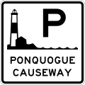
In the need for these new parkways, Moses and Andrews also proposed two parkway spurs across the Great South Bay and Shinnecock Bay. These parkway spurs, which would use bascule lift bridges, were to connect to the William Floyd Parkway (current-day CR 46) and Ponquogue Avenue (current-day CR 32), which would cross their respective bodies of water and terminate at a junction with Montauk Highway (NY 27A) in Shirley and Hampton Bays. Deemed locally as the Ponquogue Parkway, [2] but also considered an extension of the Ocean Parkway, the new 47.5 miles (76.4 km) parkway proposal would also bring forth three new parks into the New York State Parks system: Smith Point (replacing the current-day Smith Point County Park), Point O'Woods (in the namesake community) and Quogue. Fire Island State Park would also be rebuilt. [1] Within that year, Andrews sliced over $6 million off of the project, eliminating a bridge over Fire Island Inlet along with the state parks at Quogue and Point O'Woods. The other 1938 change would be a new turnoff in Hampton Bays rather than construction out to Southampton and NY 27A. This money would be paid for by Suffolk Count and by a grant from the Public Works Administration. [3]

This proposal was opposed to by locals due to its costs in 1938, but raised again in 1944 by Moses due to the belief that no storms would ever hit the area again. In 1962, Moses brought, with support of a 15-member commission that approved a $137 million (1962 USD) shoreline plan from Tottenville, Staten Island to Montauk, a truncated proposal that would extend the Ocean Parkway across most of Fire Island to a junction in Smith Point County Park rather than all the way out to Shinnecock. Residents of Fire Island argued that the time it would take to construct the new parkway would take too long and should invest in a temporary solution for protection of the island. At that time, the group funding the project stated that all it would need to construct this new parkway was approval of the New York State Legislature. Suffolk County and the state also intended to withhold funds from any project that did not have the parkway extension. [4]

Exit list for proposed parkway

The entire route is in Suffolk County. All exits are unnumbered.

Locationmi [2] kmDestinationsNotes
Fire Island 0.00.0West plate.svg
Ocean Pkwy Shield.svg
Ocean Parkway west
Eastern terminus of proposed Ocean Parkway extension across Fire Island
Shinnecock Bay Ponquogue Bridge
Hampton Bays 47.576.4Local streets
1.000 mi = 1.609 km; 1.000 km = 0.621 mi

Related Research Articles

<span class="mw-page-title-main">Suffolk County, New York</span> County in New York, United States

Suffolk County is the easternmost county in the U.S. state of New York. It comprises the eastern two-thirds of Long Island, bordered to its west by Nassau County, to its east by Gardiners Bay and the Atlantic Ocean, to its north by Long Island Sound, and to its south by Great South Bay.

<span class="mw-page-title-main">Hampton Bays, New York</span> Hamlet and census-designated place in New York, United States

Hampton Bays is a hamlet and census-designated place (CDP) in the Town of Southampton in Suffolk County, on Long Island, in New York. It is considered as part of the region of Long Island known as The Hamptons. The population was 13,603 at the 2010 census.

<span class="mw-page-title-main">Fire Island</span> Island in New York

Fire Island is the large center island of the outer barrier islands parallel to the South Shore of Long Island in the U.S. state of New York.

<span class="mw-page-title-main">Robert Moses Causeway</span>

The Robert Moses Causeway is an 8.10-mile-long (13.04 km) parkway in Suffolk County, New York on Long Island. It is named for the master builder and urban planner Robert Moses. The parkway, originally known as the Captree Causeway, connects West Islip on Long Island to the barrier beach islands, such as Captree Island, Jones Beach Island, and the western tip of Fire Island, to the south. It is designated New York State Route 908J (NY 908J), an unsigned reference route.

<span class="mw-page-title-main">Fire Island National Seashore</span> National park system unit in New York, United States

Fire Island National Seashore (FINS) is a United States National Seashore that protects a 26-mile (42 km) section of Fire Island, an approximately 30-mile (48 km) long and 0.5-mile (0.80 km) wide barrier island separated from Long Island by the Great South Bay. The island is part of New York State's Suffolk County and the Outer Barrier.

<span class="mw-page-title-main">New York State Route 27</span> State highway on Long Island, New York, United States

New York State Route 27 (NY 27) is a 120.58-mile (194.05 km) long state highway that runs east–west from Interstate 278 (I-278) in the New York City borough of Brooklyn to Montauk Point State Park on Long Island, New York. Its two most prominent components are Sunrise Highway and Montauk Highway, the latter of which includes the Montauk Point State Parkway. NY 27 acts as the primary east–west highway on southern Long Island east of the interchange with the Heckscher State Parkway in Islip Terrace. The entire route in Suffolk, Nassau, and Queens counties were designated by the New York State Senate as the POW/MIA Memorial Highway. The highway gives access to every town on the South Shore. NY 27 is the easternmost state route in the state of New York, as well as the longest highway on Long Island.

<span class="mw-page-title-main">Smith Point County Park</span>

Smith Point County Park is a beachfront park facing the Atlantic Ocean on the east end of Fire Island, along the central south shore of Long Island, near Shirley, New York, United States. It is the largest park owned by Suffolk County.

<span class="mw-page-title-main">South Shore (Long Island)</span> Southern edge of Long Island in New York state

The South Shore of Long Island, in the U.S. state of New York, is the area along Long Island's Atlantic Ocean shoreline.

Shinnecock Inlet is the easternmost of five major inlets connecting bays to the Atlantic Ocean through the narrow 100-mile-long (160 km) Outer Barrier that stretches from New York City to Southampton, New York on the south shore of Long Island. It splits Westhampton Island from the peninsula extending from Southampton Village. The inlet was formed by the 1938 New England hurricane, which killed several people when it permanently broke through the island in Hampton Bays, New York. The name comes from the Shinnecock Indian Nation.

<span class="mw-page-title-main">Heckscher State Parkway</span> An 8.24-mile-long (13.26 km) parkway on Long Island, New York, in the United States

The Heckscher State Parkway is an 8.24-mile (13.26 km) controlled-access parkway on Long Island, New York, in the United States. The parkway is located entirely within the Suffolk County town of Islip. Although it officially begins at the south end of the Sagtikos State Parkway in West Islip, it remains signed as Southern State Parkway until it intersects with Sunrise Hwy in Islip Terrace. The section signed as Southern State Pkwy proceeds east as a six-lane parkway through Brentwood and Central Islip, loosely paralleling New York State Route 27 (NY 27). At Islip Terrace, the Heckscher Parkway turns southward, crossing NY 27 where it becomes signed as Heckscher State Parkway. The parkway comprises the eastern portion of New York State Route 908M (NY 908M), an unsigned reference route, with the Southern State Parkway occupying the western section. In order to avoid confusion, the highway is signed as an extension of the Southern State Parkway west of the NY 27 interchange.

<span class="mw-page-title-main">Outer Barrier</span> String of barrier islands dividing Long Island from the Atlantic Ocean

The Outer Barrier, also known as the Long Island and New York City barrier islands, refers to the string of barrier islands that divide the lagoons south of Long Island, New York from the Atlantic Ocean. These islands include Long Beach Barrier Island, Barnum Island, Jones Beach Island, Fire Island and Westhampton Island. The outer barrier extends 75 miles (121 km) along the South Shore of Long Island, from the Rockaway Peninsula in New York City to the east end of Shinnecock Bay in Suffolk County.

<span class="mw-page-title-main">County Route 46 (Suffolk County, New York)</span> County road in Suffolk County, New York, US

County Route 46 (CR 46) is a major county road in eastern Suffolk County, New York, in the United States. It runs south-to-north from CR 75 in Smith Point County Park to New York State Route 25A (NY 25A) near the border of Shoreham and Wading River. The road is known as the William Floyd Parkway along its entire length, and is named after William Floyd, a Long Island native and a signer of the United States Declaration of Independence. Despite its "parkway" designation within the State of New York, the road is open to commercial vehicles.

<span class="mw-page-title-main">Moriches Inlet</span>

Moriches Inlet is an inlet connecting Moriches Bay and the Atlantic Ocean, in Suffolk County, New York. The name Moriches comes from Meritces – a Native American who owned land on Moriches Neck.

<span class="mw-page-title-main">Cupsogue Beach County Park</span>

Cupsogue Beach County Park is a 296-acre (1.20 km2) park at the eastern end of Fire Island and the western end of Westhampton Island, known locally as Dune Road, one of Long Island's easternmost barrier islands. The Atlantic Ocean, Moriches Inlet and Moriches Bay surround the park.

References

  1. 1 2 W. Earle Andrews (1938). Report on plan to restore and protect Fire island (Report). Long Island State Park Commission.
  2. 1 2 Cohen, Lon S. (June 27, 2007). "The Best Shore Dive On Long Island at the Old Ponquogue Bridge". Hamptons.com. Retrieved December 27, 2012.
  3. "Fire Island Plan Ready for Board". The New York Times. October 31, 1938. p. 36.
  4. Phillips, McClandlish (July 28, 1962). "State Unit Votes Shorefront Plan". The New York Times. p. 1.