Loop Parkway

Last updated

Loop Pkwy Shield.svg

Loop Parkway

Loop Parkway
Loop Parkway highlighted in red
Route information
Maintained by NYSDOT
Length2.65 mi [1]  (4.26 km)
ExistedOctober 27, 1934 [2] –present
Major junctions
West endLido Boulevard in Point Lookout
East endMeadowbrook Pkwy Shield.svg Meadowbrook State Parkway at Jones Beach
Location
Country United States
State New York
Counties Nassau
Highway system

The Loop Parkway (also known as the Loop) is a 2.65-mile (4.26 km) controlled-access parkway in Nassau County, New York, in the United States. It serves the barrier islands south of Long Island itself, beginning on Long Beach Barrier Island at an intersection with Lido Boulevard in Point Lookout. From here, it heads generally east–west across Alder and Meadow islands to an interchange with the Meadowbrook State Parkway on Jones Island, a part of Jones Beach State Park located just north of Jones Beach Island. The islands served by the Loop Parkway are separated by narrow channels of water, all of which connect to Jones Inlet. The parkway is maintained by the New York State Department of Transportation (NYSDOT) and inventoried by the department as New York State Route 908C (NY 908C), an unsigned reference route.

Contents

The highway was built in 1934 as the Long Beach Loop Causeway, funded with money from the Reconstruction Finance Corporation. It was completed six months ahead of schedule and officially opened on October 27, 1934, by Robert Moses, then a candidate for Governor of New York, and New York City Mayor Fiorello LaGuardia. The plans to fund the highway included the implementation of tolls, which went into effect on January 2, 1935. These tollbooths, once considered the murder site of Sonny Corleone in Mario Puzo's The Godfather , were closed in 1978 as part of Governor Hugh Carey's efforts to establish that year's state budget.

Route description

The Loop Parkway westbound approaching Lido Boulevard in Point Lookout Loop Parkway at Point Lookout.jpg
The Loop Parkway westbound approaching Lido Boulevard in Point Lookout

The Loop Parkway begins at an at-grade intersection with Lido Boulevard on the eastern end of Long Beach Barrier Island in the neighborhood of Point Lookout. It proceeds north as a four-lane divided highway, crossing over Reynolds Channel to reach Alder Island, one of several islands comprising Jones Beach State Park. Here, the road slowly bends eastward as it runs across the marshy island. Two U-turn ramps are built into the median near the western end of the island, serving as the only intersections or interchanges of any kind on Alder Island. [3]

The Loop Parkway heads east from Alder Island, traversing Long Creek on a drawbridge leading to Meadow Island. The road quickly continues northeast across the island with no connections via interchanges or intersections. [3]

At the eastern edge of the island, the highway reaches Swift Creek, another channel separating Meadow Island from Jones Island. The parkway crosses the waterway and immediately enters a trumpet interchange with the Meadowbrook State Parkway. The right-of-way of the Loop Parkway connects to and from the northbound direction of the Meadowbrook Parkway while two other ramps provide access to the southbound Meadowbrook Parkway. [3] The Loop Parkway handled an average of 30,520 vehicles per day in 2011 according to estimates made by NYSDOT. Traffic along the highway has steadily increased since 2003, when the department recorded a daily average of 24,740 vehicles. [1]

History

Construction

The Loop Parkway, originally envisioned as the Long Beach Loop Causeway, was conceived as part the original design for the Long Island Parkway System, developed by Robert Moses and the Long Island State Park Commission (LISPC) in 1924. Moses wanted a parkway system to alleviate congestion on "unattractive" local roads. The system was designed to connect several parks that were under construction at the time, including Jones Beach State Park, Bethpage State Park and Sunken Meadow State Park. In 1927, the parkway system was linked to parkways within New York City's boroughs of Brooklyn and Queens, and in 1929, Jones Beach State Park and the Ocean Parkway opened, providing access to the mainland via the Jones Beach Causeway (now part of the Wantagh State Parkway). [4]

The Loop Parkway eastbound at the junction with the Meadowbrook in Freeport Loop Parkway at Meadowbrook.jpg
The Loop Parkway eastbound at the junction with the Meadowbrook in Freeport

In May 1933, construction began on the Meadowbrook State Parkway and the Long Beach Loop Causeway. It was financed by the Reconstruction Finance Corporation in Washington D.C., which loaned $5,050,000 (1933 USD) to the LISPC for the new parkways. [5] It was proposed that the loan would be repaid in 25 years. [6] The two highways would be connected by way of a trumpet interchange on Jones Island, [5] with a total of 10,100,000 cubic yards (7,700,000 m3) of hydraulic fill was used to build both parkways, and a new channel for boats heading to South Oyster Bay was constructed as part of the projects. [6] The roadway of the 2.5-mile (4.0 km) Loop Causeway would be made of macadam pavement and be 44 feet (13 m) wide and help connect mainland Long Island to Jones Beach and Long Beach. [7]

Both roadways were expected to be completed by January 1, 1935. [6] They were ultimately completed in October 1934, six months ahead of schedule. [8] The Long Beach Loop Causeway was opened to extreme fanfare on October 27, 1934, as was the Meadowbrook State Parkway with parades celebrating the event were held in Freeport and Rockville Centre, and they were attended by Robert Moses, at the time a candidate for Governor of New York, and Fiorello LaGuardia, the Mayor of New York City. [2]

Tolls

Long Creek Bridge Loop Parkway - Long Creek Bridge from the water 01 (9338748477).jpg
Long Creek Bridge

When the Jones Beach State Park Authority was given the loan by the Reconstruction Finance Corporation in March 1933, a toll was planned for both the Meadowbrook Causeway and the Long Beach Loop Causeway to help repay the loan. [7] Tollbooths were constructed, and a 25-cent toll (equivalent to $6in 2023) went into effect on both roadways on January 2, 1935. On that day, the supervisor with the LISPC reported that 300 people used the highway. [9]

In 1975, the Jones Beach Parkway Authority increased the toll on the Southern State Parkway to 25 cents, while the Loop Parkway retained its 25 cent toll. The change faced immediate criticism from the New York State Legislature, and the Democratic members tried to rescind the toll hike. The power Robert Moses still had in a deal with the State of New York made sure that only his authority could choose when to raise and rollback tolls. However, the deals never prohibited the state from buying out the bonds the authority had themselves and thus take over the roads maintained by the Jones Beach Parkway Authority. Governor Hugh Carey had yet to craft the $12 billion state budget for 1978, and he proposed a deal to forgo the $24 million debt that the agency had accumulated and eliminate the toll on the Loop Parkway by taking over the roads. [10]

After the governor and his department decided that the state could do without the $3.8 million that the toll would produce each year, a bill permitting the state to take over the Loop Parkway was passed on March 31, 1978. The removal of the tolls helped Governor Carey gain enough support to pass that year's state budget. [10] The decision to eliminate the Loop Parkway tolls was influenced by Long Beach Supervisor Hannah Komanoff, who also unsuccessfully fought to have the tollbooth on the Atlantic Beach Bridge removed in 1979. [11]

The tollbooths on the Wantagh State Parkway, where Sonny Corleone was supposedly murdered Jones Beach Toll Plaza.jpg
The tollbooths on the Wantagh State Parkway, where Sonny Corleone was supposedly murdered

In Mario Puzo's 1969 novel, The Godfather , Sonny Corleone was in the process of running to go and settle a years-long dispute with Carlo Rizzi when he drove his 1941 Lincoln Continental across Jones Beach from the Wantagh State Parkway (mentioned as the Jones Beach Causeway) towards the "causeway that would take him over the water from Long Beach". However, when Corleone approached the toll on the Jones Beach Causeway, the toll-taker fumbled his money and soon two men approached him with guns along with a fake toll-taker from another booth. All three men shot Corleone and flew back via car to the Meadowbrook State Parkway and into Long Beach via the Loop Parkway. [12] A common misconception is that the murder occurred on either the Loop or the Meadowbrook parkways; however, the book specifies that the event occurred at the tollbooth on the Wantagh State Parkway. [13] Some of Puzo's descriptions in this scene in the novel contradict one another (for example, there was never an outbound toll on the Wantagh), so it is possible Puzo either had forgotten the exact layout of the road system, or simply remade it in his own liking for the sake of the narrative. [14]

Exit list

The entire route is in Nassau County. All exits are unnumbered.

Locationmi [1] [15] kmDestinationsNotes
Point Lookout 0.000.00Lido Boulevard Point Lookout, Long Beach Western terminus; at-grade intersection
Reynolds Channel 0.150.24Bridge
Long Creek 1.502.41Drawbridge
Jones Beach State Park 2.654.26South plate.svg
Meadowbrook Pkwy Shield.svg
Meadowbrook State Parkway south Jones Beach
Eastbound exit and westbound entrance; exit M10 on Meadowbrook Parkway
North plate.svg
Meadowbrook Pkwy Shield.svg
Meadowbrook State Parkway north Mineola
Eastern terminus
1.000 mi = 1.609 km; 1.000 km = 0.621 mi

Related Research Articles

<span class="mw-page-title-main">Robert Moses</span> American urban planner (1888–1981)

Robert Moses was an American urban planner and public official who worked in the New York metropolitan area during the early to mid-20th century. Moses is regarded as one of the most powerful and influential people in the history of New York City and New York State. The grand scale of his infrastructure projects and his philosophy of urban development influenced a generation of engineers, architects, and urban planners across the United States.

<span class="mw-page-title-main">Jones Beach State Park</span> State park in New York, United States

Jones Beach State Park is a state park in the U.S. state of New York. It is located in southern Nassau County on Jones Beach Island, a barrier island linked to Long Island by the Meadowbrook State Parkway, Wantagh State Parkway, and Ocean Parkway. The park was created during Robert Moses' administration as President of the Long Island State Park Commission as part of the development of parkways on Long Island.

<span class="mw-page-title-main">Jones Beach Island</span>

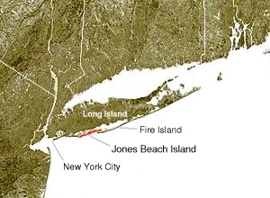
Jones Beach Island is one of the outer barrier islands off the southern coast of Long Island in the U.S. state of New York.

<span class="mw-page-title-main">Robert Moses Causeway</span>

The Robert Moses Causeway is an 8.10-mile (13.04 km) state parkway in Suffolk County, New York on Long Island. It is named for the master builder and urban planner Robert Moses. The parkway, originally known as the Captree Causeway, connects West Islip on Long Island to the barrier beach islands, such as Captree Island, Jones Beach Island, and the western tip of Fire Island, to the south. It is designated New York State Route 908J (NY 908J), an unsigned reference route.

<span class="mw-page-title-main">Meadowbrook State Parkway</span> Highway in Nassau County, New York

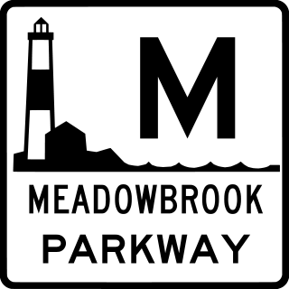
The Meadowbrook State Parkway is a 12.52-mile (20.15 km) controlled-access parkway in Nassau County, New York, in the United States. Its southern terminus is at a full cloverleaf interchange with the Bay and Ocean parkways in Jones Beach State Park. The parkway heads north, crossing South Oyster Bay and intersecting Loop Parkway before crossing onto the mainland and connecting to the Southern State Parkway in North Merrick. It continues north to the hamlet of Carle Place, where the Meadowbrook Parkway ends at exit 31A of the Northern State Parkway. The Meadowbrook Parkway is designated New York State Route 908E (NY 908E), an unsigned reference route. Most of the road is limited to non-commercial traffic, like most parkways in the state of New York; however, the portion south of Merrick Road is open to commercial traffic.

<span class="mw-page-title-main">New York State Route 27</span> State highway on Long Island, New York, United States

New York State Route 27 (NY 27) is a 120.58-mile (194.05 km) long state highway that runs east–west from Interstate 278 (I-278) in the New York City borough of Brooklyn to Montauk Point State Park on Long Island, New York. Its two most prominent components are Sunrise Highway and Montauk Highway, the latter of which includes the Montauk Point State Parkway. NY 27 acts as the primary east–west highway on southern Long Island east of the interchange with the Heckscher State Parkway in Islip Terrace. The entire route in Suffolk, Nassau, and Queens counties were designated by the New York State Senate as the POW/MIA Memorial Highway. The highway gives access to every town on the South Shore. NY 27 is the easternmost state route in the state of New York, as well as the longest highway on Long Island.

<span class="mw-page-title-main">Wantagh State Parkway</span> Highway in Nassau County, New York

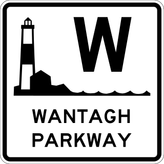
The Wantagh State Parkway is a 13.33-mile (21 km) controlled-access parkway on Long Island, New York, in the United States. It links the Ocean Parkway in Jones Beach State Park with the Northern State Parkway in Westbury. The parkway is located approximately 30 miles (48 km) east of Manhattan and 14 miles (23 km) east of the Nassau–Queens border.

<span class="mw-page-title-main">Southern State Parkway</span> Limited-access highway in Long Island, NY

The Southern State Parkway is a 25.53-mile (41.09 km) controlled-access parkway on Long Island, New York, in the United States. The parkway begins at an interchange with the Belt and Cross Island parkways in Elmont, in Nassau County, and travels east to an interchange with the Sagtikos State Parkway in West Islip, Suffolk County, where it becomes the Heckscher State Parkway. The Southern State Parkway comprises the western portion of unsigned New York State Route 908M (NY 908M), with the Heckscher Parkway occupying the eastern section.

<span class="mw-page-title-main">Northern State Parkway</span> Highway in New York

The Northern State Parkway is a 28.88-mile (46.48 km) controlled-access parkway on Long Island in the U.S. state of New York. The western terminus is at the Queens–Nassau County line in Lake Success – west of which the parkway continues westward into New York City as the Grand Central Parkway. The eastern terminus is at New York State Route 347 (NY 347) and NY 454 in Hauppauge, in Suffolk County. As its name implies, the parkway services communities along the northern half of the island. The parkway is designated New York State Route 908G (NY 908G) – an unsigned reference route – and has been ceremoniously named Purple Heart Way since 2011.

<span class="mw-page-title-main">Ocean Parkway (Long Island)</span> Highway in New York

The Ocean Parkway is a 15.59-mile (25.09 km) limited-access parkway that traverses Jones Beach Island between Jones Beach State Park and Captree State Park on Long Island, New York, United States. It begins at the southern terminus of the Meadowbrook State Parkway and heads east across Jones Beach Island, intersecting the south end of the Wantagh State Parkway before ending just past the southern terminus of the Robert Moses Causeway.

<span class="mw-page-title-main">Bethpage State Parkway</span>

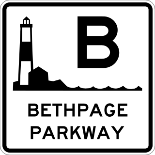
The Bethpage State Parkway is a 2.49-mile (4.01 km) controlled-access parkway in Nassau County on Long Island, New York, in the United States. It begins at a trumpet interchange with the Southern State Parkway in North Massapequa and serves Boundary Avenue, NY 24, and Central Avenue before terminating at a traffic circle with Plainview Road and a local park road in Bethpage State Park. The parkway is designated as New York State Route 907E (NY 907E), an unsigned reference route. It is also ceremoniously designated as the Philip B. Healey Memorial Parkway for Assemblyman Philip B. Healey (1921–1996).

<span class="mw-page-title-main">Heckscher State Parkway</span> An 8.24-mile-long (13.26 km) parkway on Long Island, New York, in the United States

The Heckscher State Parkway is an 8.24-mile (13.26 km) controlled-access parkway on Long Island, New York, in the United States. The parkway is located entirely within the Suffolk County town of Islip. Although it officially begins at the south end of the Sagtikos State Parkway in West Islip, it remains signed as the Southern State Parkway until it intersects with NY 27 in Islip Terrace. The section signed as the Southern State Parkway proceeds east as a six-lane parkway through Brentwood and Central Islip, loosely paralleling New York State Route 27 (NY 27). At Islip Terrace, the Heckscher Parkway turns southward, crossing NY 27 where it becomes signed as the Heckscher State Parkway. The parkway comprises the eastern portion of New York State Route 908M (NY 908M), an unsigned reference route, with the Southern State Parkway occupying the western section. In order to avoid confusion, the parkway is signed as an extension of the Southern State Parkway west of the NY 27 interchange.

<span class="mw-page-title-main">Sagtikos State Parkway</span> Limited-access parkway in Suffolk County

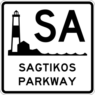
The Sagtikos State Parkway is a 5.14-mile (8.27 km) controlled-access parkway in Suffolk County on Long Island, New York, in the United States. It begins at an interchange with the Southern State and Heckscher Parkways in the hamlet of West Islip and goes north to a large cloverleaf interchange with the Northern State Parkway in the Town of Smithtown, where the Sagtikos ends and the road becomes the Sunken Meadow State Parkway. The parkway comprises the southern half of New York State Route 908K (NY 908K), an unsigned reference route, with the Sunken Meadow State Parkway forming the northern portion.

<span class="mw-page-title-main">Sunken Meadow State Parkway</span>

The Sunken Meadow State Parkway is a 6.19-mile (9.96 km) controlled-access parkway in Suffolk County, on Long Island, New York.

The Bay Parkway is a 3.26-mile (5.25 km) limited-access parkway entirely within Jones Beach State Park in Nassau County, New York, in the United States. The western terminus is at a loop near the western edge of Jones Inlet. The eastern terminus is at the Jones Beach Amphitheater east of an interchange with the Wantagh State Parkway. The parkway is primarily a service road for the park, providing access to the boat basin, fishing piers, and many of the parking lots along the beach. However, the parkway also has an interchange with the Meadowbrook State Parkway and Ocean Parkway.

<span class="mw-page-title-main">Outer Barrier</span> String of barrier islands dividing Long Island from the Atlantic Ocean

The Outer Barrier, also known as the Long Island and New York City barrier islands, refers to the string of barrier islands that divide the lagoons south of Long Island, New York from the Atlantic Ocean. These islands include Long Beach Barrier Island, Barnum Island, Jones Beach Island, Fire Island and Westhampton Island. The outer barrier extends 75 miles (121 km) along the South Shore of Long Island, from the Rockaway Peninsula in New York City to the east end of Shinnecock Bay in Suffolk County.

<span class="mw-page-title-main">Parkways in New York</span> Highway system

The majority of parkways in the US state of New York are part of a statewide parkway system owned by several public and private agencies but mostly maintained by the New York State Department of Transportation (NYSDOT). A handful of other roads in the Hudson Valley and on Long Island are also known as parkways but are not part of the state system. The roads of the state parkway system were among the first expressways to be constructed. These highways were not divided and allowed no driveway cuts, but did have intersections for some of the streets they crossed. A small section of the privately financed Long Island Motor Parkway was the first expressway to begin operation as a toll road and the first highway to use bridges and overpasses to eliminate intersections.

The Long Island State Park Commission, also known as LISPC, is a government agency on Long Island, in the state of New York, headquartered at Belmont Lake State Park in North Babylon. Originally a standalone agency, it is now a regional subdivision of the New York State Office of Parks, Recreation, and Historic Preservation.

<span class="mw-page-title-main">Jones Beach State Park, Causeway and Parkway System</span> United States historic place

The Jones Beach State Park, Causeway and Parkway System is a national historic district located in Nassau County, New York, United States.

<span class="mw-page-title-main">New York State Route 135</span> State highway in Nassau County, New York, US

New York State Route 135 (NY 135) is a 10.8-mile (17.4 km) freeway in eastern Nassau County, New York, in the United States. The route connects Seaford with Syosset. The highway runs from Merrick Road in Seaford to NY 25 in Syosset. In between, NY 135 passes through Bethpage and Plainview and serves Bethpage State Park. The highway is ceremoniously designated as the Ralph J. Marino Expressway; however, it is more commonly known as the Seaford–Oyster Bay Expressway.

References

  1. 1 2 3 "2011 Traffic Volume Report for New York State" (PDF). New York State Department of Transportation. September 25, 2012. p. 257. Archived from the original (PDF) on July 12, 2015. Retrieved April 8, 2013.
  2. 1 2 "Jones Beach Link Opened by Moses". The New York Times . October 28, 1934. p. 3.
  3. 1 2 3 Microsoft; Nokia. "overview map of the Loop Parkway" (Map). Bing Maps . Microsoft. Retrieved September 21, 2012.
  4. "The Long Island Parkway System". The Museums at Stony Brook . New York State Department of Transportation. 1985. Retrieved September 21, 2012.
  5. 1 2 "Aerial View of the Meadowbrook Causeway". The New York Times. October 21, 1934. p. XX8.
  6. 1 2 3 "New Causeway to Link Long Island Resort Centres". The New York Times. April 9, 1933. p. RE2.
  7. 1 2 "Jones Beach Loan Explained by R.F.C". The New York Times. March 24, 1933. p. 11.
  8. "More Extensions to Queens Parks". The New York Times. August 12, 1934. p. RE2.
  9. "Jones Beach Toll Starts". The New York Times. January 3, 1935. p. 25.
  10. 1 2 Dionne Jr., E.J. (April 16, 1978). "A 10-Cent Issue Takes Its Toll". The New York Times. p. 414.
  11. Fischler, Marcelle S. (December 31, 2000). "Legacies They Left: 16 Long Islanders Who Made Their Mark: Hannah Komanoff". The New York Times. p. 9. Retrieved September 21, 2012.
  12. Puzo, Mario (1969). The Godfather. G. P. Putnam's Sons. pp. 253–254. ISBN   0451217403 . Retrieved September 21, 2012.
  13. Noah, Timothy (April 24, 2007). "Sopranos Final Season". Slate . Retrieved September 21, 2012.
  14. Berkun, Todd (March 25, 2011) Where Was Sonny Corleone Killed and Where Was It Shot? LI & NY Places that are no more. Retrieved 2021-07-27.
  15. Google (January 6, 2016). "Loop Parkway" (Map). Google Maps . Google. Retrieved January 6, 2016.
Template:Attached KML/Loop Parkway
KML is from Wikidata