Related Research Articles
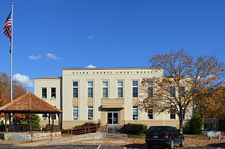
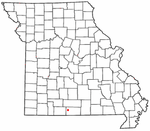
Ozark County is a county in the southern portion of the U.S. state of Missouri. As of the 2020 census, the population was 8,553. The largest city and county seat is Gainesville. The county was organized as Ozark County, named after the Ozark Mountains, on January 29, 1841. It was renamed Decatur County, after Commodore Stephen Decatur, from 1843 to 1845, after which the name Ozark County was restored.
Thornfield is an unincorporated community in Ozark County, Missouri, United States. It is located 15 miles (24 km) northwest of Gainesville, on Route 95 at the Little North Fork of the White River on the edge of the Mark Twain National Forest between Wasola to the northeast and Longrun to the southwest. Hammond, the site of the historic Hammond Mill, lies on the Little North Fork 2.5 miles (4.0 km) southeast of Thornfield. Thornfield has a post office with ZIP code 65762.

Howards Ridge is an unincorporated community in southeastern Ozark County in the southern Missouri Ozarks, United States. It is located seven miles southeast of Gainesville and 2.15 miles north of the Arkansas border, at the intersection of Ozark County routes J and T. The community is at an elevation of 880 feet and lies two and a half miles west of Norfork Lake.

Pawhuska Township is one of eleven townships in Camden County, Missouri, USA. As of the 2000 census, its population was 5,617.

Whites Creek is an Ozark stream in Douglas County, Missouri. It is a tributary of Hunter Creek.
Ozark Township is an inactive township in Oregon County, in the U.S. state of Missouri.
Barren Fork Township is an inactive township in Ozark County, in the U.S. state of Missouri.
Big Creek Township is an inactive township in Ozark County, in the U.S. state of Missouri.
Dawt Township is an inactive township in Ozark County, in the U.S. state of Missouri.
Jackson Township is an inactive township in Ozark County, in the U.S. state of Missouri.
Lick Creek Township is an inactive township in Ozark County, in the U.S. state of Missouri.
Longrun Township is an inactive township in Ozark County, in the U.S. state of Missouri.
Richland Township is an inactive township in Ozark County, in the U.S. state of Missouri.
Spring Creek Township is an inactive township in Ozark County, in the U.S. state of Missouri.
Thornfield Township is an inactive township in Ozark County, in the U.S. state of Missouri.
Ozark Township is a defunct township in Webster County, in the U.S. state of Missouri.
East Ozark Township was a township in Webster County, in the U.S. state of Missouri. In 2022, it was divided into Hubble and Osage townships along Route 38.
Northview Township is a township in Webster County, in the U.S. state of Missouri.
Bayou I Township is an inactive township in Ozark County, in the U.S. state of Missouri.
Bayou II Township is an inactive township in Ozark County, in the U.S. state of Missouri.
References
- ↑ U.S. Geological Survey Geographic Names Information System: Pontiac Township, Ozark County, Missouri
- ↑ "Ozark County Place Names, 1928–1945". The State Historical Society of Missouri. Archived from the original on June 24, 2016. Retrieved February 7, 2017.
Municipalities and communities of Ozark County, Missouri, United States | ||
|---|---|---|
| City |  | |
| Villages | ||
| Townships | ||
| CDPs | ||
| Other communities | ||
| Ghost towns | ||
36°31′2″N92°33′12″W / 36.51722°N 92.55333°W
| | This Ozark County, Missouri state location article is a stub. You can help Wikipedia by expanding it. |