Kernersville is a town in Forsyth County and the largest suburb of Winston-Salem. The town is located in the U.S. state of North Carolina. A small portion of the town is also in Guilford County. The population was 26,481 at the 2020 census, up from 23,123 in 2010. Kernersville is located at the center of the Piedmont Triad metropolitan area, between Greensboro to the east, High Point to the south, and Winston-Salem to the west. Some of the farmland surrounding the town has been sold and turned into large middle-to-upper-class housing developments.

Fort Raleigh National Historic Site preserves the location of Roanoke Colony, the first English settlement in the present-day United States. The site was preserved for its national significance in relation to the founding of the first English settlement in North America in 1587. The colony, which was promoted and backed by entrepreneurs led by Englishman Sir Walter Raleigh, failed sometime between 1587 and 1590 when supply ships failed to arrive on time. When next visited, the settlement was abandoned with no survivors found. The fate of the "Lost Colony" was a celebrated mystery, although most modern academic sources agree that the settlers likely assimilated into local indigenous tribes.

This is a list of structures, sites, districts, and objects on the National Register of Historic Places in North Carolina:

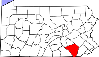
This is a list of the National Register of Historic Places listings in Lancaster County, Pennsylvania.

This is a list of the National Register of Historic Places listings in Georgetown County, South Carolina.

This list includes properties and districts listed on the National Register of Historic Places in Wake County, North Carolina. Click the "Map of all coordinates" link to the right to view an online map of all properties and districts with latitude and longitude coordinates in the table below.

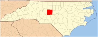
This list includes properties and districts listed on the National Register of Historic Places in Forsyth County, North Carolina. Click the "Map of all coordinates" link to the right to view an online map of all properties and districts with latitude and longitude coordinates in the table below.

This list includes properties and districts listed on the National Register of Historic Places in Sampson County, North Carolina. Click the "Map of all coordinates" link to the right to view a Google map of all properties and districts with latitude and longitude coordinates in the table below.

This list includes properties and districts listed on the National Register of Historic Places in Rockingham County, North Carolina. Click the "Map of all coordinates" link to the right to view an online map of all properties and districts with latitude and longitude coordinates in the table below.

This list includes properties and districts listed on the National Register of Historic Places in Edgecombe County, North Carolina, United States. Click the "Map of all coordinates" link to the right to view a Google map of all properties and districts with latitude and longitude coordinates in the table below.

This list includes properties and districts listed on the National Register of Historic Places in Watauga County, North Carolina. Click the "Map of all coordinates" link to the right to view an online map of all properties and districts with latitude and longitude coordinates in the table below.

This list includes properties and districts listed on the National Register of Historic Places in Macon County, North Carolina. Click the "Map of all coordinates" link to the right to view a Google map of all properties and districts with latitude and longitude coordinates in the table below.

This list includes properties and districts listed on the National Register of Historic Places in Jackson County, North Carolina. Click the "Map of all coordinates" link to the right to view a Google map of all properties and districts with latitude and longitude coordinates in the table below.

This list includes properties and districts listed on the National Register of Historic Places in Randolph County, North Carolina. Click the "Map of all coordinates" link to the right to view a Google map of all properties and districts with latitude and longitude coordinates in the table below.

This list includes properties and districts listed on the National Register of Historic Places in Northampton County, North Carolina. Click the "Map of all coordinates" link to the right to view an online map of all properties and districts with latitude and longitude coordinates in the table below.

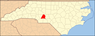
This list includes properties and districts listed on the National Register of Historic Places in Stanly County, North Carolina. Click the "Map of all coordinates" link to the right to view an online map of all properties and districts with latitude and longitude coordinates in the table below.

The Cathedral of All Souls, also referred to as All Souls Cathedral, is an Episcopal cathedral located in Asheville, North Carolina, United States of America. All Souls was built by George Washington Vanderbilt II, the grandson of railroad baron, Cornelius Vanderbilt, in 1896, to serve as the local parish church for Biltmore Village, which had been developed near his Biltmore Estate. The Right Reverend José Antonio McLoughlin is the current bishop seated at the cathedral.

This list includes properties and districts listed on the National Register of Historic Places in Swain County, North Carolina. Click the "Map of all coordinates" link to the right to view an online map of all properties and districts with latitude and longitude coordinates in the table below.

This list includes properties and districts listed on the National Register of Historic Places in Yadkin County, North Carolina. Click the "Map of all coordinates" link to the right to view a Google map of all properties and districts with latitude and longitude coordinates in the table below.

This list includes properties and districts listed on the National Register of Historic Places in Montgomery County, North Carolina. Click the "Map of all coordinates" link to the right to view an online map of all properties and districts with latitude and longitude coordinates in the table below.


