Post road

Last updated

Old Albany Post Road in Philipstown, New York, a section that remains unpaved and has been listed on the National Register of Historic Places Old Albany Post Road.jpg
Old Albany Post Road in Philipstown, New York, a section that remains unpaved and has been listed on the National Register of Historic Places

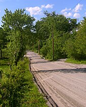
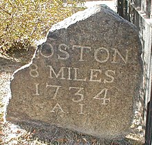
A post road is a road designated for the transportation of postal mail. In past centuries, only major towns had a post house and the roads used by post riders or mail coaches to carry mail among them were particularly important ones or, due to the special attention given them, became so. In various centuries and countries, post road became more or less equivalent to main road, royal road, or highway. The 20th century spread of postal service blurred the distinction.

Contents

Asia

Great Post Road (Dutch : De Grote Postweg), from Anyer to Panarukan, Indonesia, was a notable post road in Asia, built during the governancy of Herman Willem Daendels of Dutch East Indies from 1808 to 1811.

Europe

1563 post road map of Europe Postkurse 1563.jpg
1563 post road map of Europe

Notable post roads in Europe include:

North America

The following are notable posts roads in Canada and the U.S.

Canada

Chemin du Roy was built between Montreal (Repentigny) and Quebec City from 1731 to 1737, for mail and as a means of travel for the key settlements in New France [1] /Lower Canada. It was later incorporated as Quebec Route 2 and is now part of Quebec Route 138.

Two notable post roads built in the late 1700s and early 1800s were Dundas Road (The Governor's Road) and Kingston Road (Lakeshore Road or York Road) to provide a route for mail and stagecoaches between key settlements in Upper Canada. [2]

The latter route, which became The Provincial Highway in 1917 (Ontario Highway 2 c. 1923), and the former which became a Dundas Highway in 1920 (Ontario Highway 5 in 1925), were the beginning of the provincial highway system in Ontario.[ citation needed ]

United States

In what was to later become the United States, post roads developed as the primary method of communicating information across and between the colonies.[ citation needed ]

The Articles of Confederation authorized the national government to create post offices but not post roads. [3] Adoption of the U.S. Constitution changed this, as Article I, Section Eight, known as the Postal Clause, specifically authorizes Congress the enumerated power "to establish post offices and post roads." This was generally interpreted liberally, to include all public highways. U.S. Supreme Court justice Joseph Story defended the broad interpretation that had become dominant in his influential Commentaries on the Constitution of the United States (1833). [3]

18th century milestone on the Boston Post Road Upper Post Road MP 8.jpg
18th century milestone on the Boston Post Road

Notable American post roads built for the purpose include:

Related Research Articles

<span class="mw-page-title-main">Lower Canada</span> 1791–1841 British colony in North America

The Province of Lower Canada was a British colony on the lower Saint Lawrence River and the shores of the Gulf of Saint Lawrence (1791–1841). It covered the southern portion of the current Province of Quebec and the Labrador region of the current Province of Newfoundland and Labrador.

<span class="mw-page-title-main">Boston Post Road</span> Road in the northeast United States

The Boston Post Road was a system of mail-delivery routes between New York City and Boston, Massachusetts, that evolved into one of the first major highways in the United States.

<span class="mw-page-title-main">Yonge Street</span> Historic road in Ontario, Canada

Yonge Street is a major arterial route in the Canadian province of Ontario connecting the shores of Lake Ontario in Toronto to Lake Simcoe, a gateway to the Upper Great Lakes.

<span class="mw-page-title-main">Ontario Provincial Highway Network</span> Highway network of Ontario, Canada

The Provincial Highway Network consists of all the roads in Ontario maintained by the Ministry of Transportation of Ontario (MTO), including those designated as part of the King's Highway, secondary highways, and tertiary roads. Components of the system—comprising 16,900 kilometres (10,500 mi) of roads and 2,880 bridges —range in scale from Highway 401, the busiest highway in North America, to unpaved forestry and mining access roads. The longest highway is nearly 2,000 kilometres (1,200 mi) long, while the shortest is less than a kilometre. Some roads are unsigned highways, lacking signage to indicate their maintenance by the MTO; these may be remnants of highways that are still under provincial control whose designations were decommissioned, roadway segments left over from realignment projects, or proposed highway corridors.

<span class="mw-page-title-main">Ontario Highway 2</span> Former Ontario provincial highway

King's Highway 2, commonly referred to as Highway 2, is the lowest-numbered provincially maintained highway in the Canadian province of Ontario, and was originally part of a series of identically numbered highways which started in Windsor, stretched through Quebec and New Brunswick, and ended in Halifax, Nova Scotia. Prior to the 1990s, Highway 2 travelled through many of the major cities in Southern Ontario, including Windsor, Chatham, London, Brantford, Hamilton, Burlington, Mississauga, Toronto, Oshawa, Belleville, Kingston and Cornwall, amongst many other smaller towns and communities.

<span class="mw-page-title-main">Quebec City–Windsor Corridor</span> Region in Canada

The Quebec City–Windsor Corridor is the most densely populated and heavily industrialized region of Canada. As its name suggests, the region extends between Quebec City in the northeast and Windsor, Ontario, in the southwest, spanning 1,150 kilometres (710 mi). With more than 18 million people, it contains about half of the country's population, three of Canada's four largest metropolitan areas and seven of Canada's twelve largest metropolitan areas, all based on the 2016 census. Its relative importance to Canada's economic and political infrastructure renders it akin to the Northeast megalopolis in the United States. The name was first popularized by Via Rail, which runs frequent passenger rail service in the region in its service area known as "The Corridor".

<span class="mw-page-title-main">Quebec Route 138</span> Highway in Quebec

Route 138 is a major highway in the Canadian province of Quebec, following the entire north shore of the Saint Lawrence River past Montreal to the temporary eastern terminus in Kegashka on the Gulf of Saint Lawrence. The western terminus is in Elgin, at the border with New York State south-west of Montreal. Part of this highway is known as the Chemin du Roy, or King's Highway, which is one of the oldest highways in Canada.

<span class="mw-page-title-main">Quebec Autoroute 35</span> Highway in Quebec

Autoroute 35 (A-35) is an Autoroute in the region of Montérégie, Quebec, Canada. Constructed in the 1960s, the A-35 links Saint-Jean-sur-Richelieu with Montreal via the A-10. The A-35 is also the primary route for traffic between Montreal and Boston, although it ends 13.4 km (8.3 mi) short of the U.S. border. South of its current terminus in Saint-Sébastien, the A-35 continues as two-lane Route 133 to the border. An extension of A-35 to meet Interstate 89 at Saint-Armand will complete a nearly 500 km (310 mi) limited-access highway link between Montreal and Boston. It had been scheduled to open in 2017, but construction was on hold and now will be completed up to the Canada-US border by 2023.

<span class="mw-page-title-main">South Dundas</span> Municipality in Ontario, Canada

South Dundas is a municipality in eastern Ontario, Canada, in the United Counties of Stormont, Dundas and Glengarry along the north shore of the St. Lawrence River. It is located approximately 100 kilometres south of Ottawa and is midway between Kingston and Montreal, Quebec.

Cootes Drive, formerly known as the Dundas Diversion, is a city street in Hamilton, Ontario. The route connects York Boulevard and King Street in Dundas with Main Street to the southeast, and is considered one of the first divided highways in Canada. Originally constructed as the Dundas Diversion, the route served to bypass several sharp turns along the nearby Highway 8, as well as to demonstrate the new dual highway concept that would soon thereafter evolve into the 400-series highway network. Construction began in 1936, and the route opened on the weekend of September 11, 1937.

<span class="mw-page-title-main">Albany Post Road</span>

The Albany Post Road was a post road – a road used for mail delivery – in the U.S. state of New York. It connected New York City and Albany along the east side of the Hudson River, a service now performed by U.S. Route 9 (US 9).

<span class="mw-page-title-main">Islington-City Centre West</span> Neighbourhood in Toronto, Ontario, Canada

Islington-City Centre West is a commercial and residential neighbourhood in Toronto, Ontario, Canada. One of four central business districts outside Downtown Toronto, it is bounded by Rathburn Road to the north, Islington Avenue to the east, Bloor Street to the south, Mimico Creek to the west.

<span class="mw-page-title-main">Chemin du Roy</span> Road in western Quebec

The Chemin du Roy is a historic road along the north shore of the St. Lawrence River in Quebec. The road begins in Repentigny and extends almost 280 kilometres (170 mi) eastward towards Quebec City, its eastern terminus. Most of the Chemin du Roy today follows along the present-day Quebec Route 138. The modern expressway that replaces both Route 138 and the Chemin du Roy through most of its course is Quebec Autoroute 40.

<span class="mw-page-title-main">Quebec Route 338</span> Highway in Quebec

Route 338 is a provincial highway located in the Montérégie region of Quebec west of Montreal. The highway runs from the Ontario Border near Rivière-Beaudette as a continuation of Stormont, Dundas and Glengarry County Road 2 and ends at Vaudreuil-Dorion at the junction of Autoroute 20 which the 338 acts as an alternate and service route parallel to A-20 although through several villages along the Saint Lawrence River. Before the 1970s, this road was named "Route 2", as part of an interprovincial Route 2 that stretched from Windsor, Ontario to Halifax, Nova Scotia.

<span class="mw-page-title-main">Old Albany Post Road</span> Oldest dirt road in the United States

Old Albany Post Road is a 6.6-mile (10.6 km) dirt road in Philipstown, New York, one of the oldest unpaved roads still in use in the United States. It runs mostly north-south through the southeastern corner of the town, near the Putnam Valley town line. Starting from an intersection with Sprout Brook Road at Continental Village just north of the Putnam-Westchester county line, it ends at an oblique junction with US 9 east of Garrison.

Article I, Section 8, Clause 7 of the United States Constitution, known as the Postal Clause or the Postal Power, empowers Congress "To establish Post Offices and post Roads." The Post Office has the constitutional authority to designate mail routes. The Post Office is also empowered to construct or designate post offices with the implied authority to carry, deliver, and regulate the mail of the United States as a whole. The Postal Power also includes the power to designate certain materials as non-mailable, and to pass statutes criminalizing abuses of the postal system

The Middle Road was the name for a historic highway in the Canadian province of Ontario, which served to link the cities of Toronto and Hamilton. The name was used between 1931 and 1939, after which the road became the northern section of the Queen Elizabeth Way. It borrowed the name of Middle Road from a concession road in Toronto Township between 1st Concession South and 2nd Concession South during the early 1800s.

<span class="mw-page-title-main">Dundas Street</span> Major arterial road in southwestern Ontario

Dundas Street is a major historic arterial road in Ontario, Canada. The road connects the city of Toronto with its western suburbs and several cities in southwestern Ontario. Three provincial highways—2, 5, and 99—followed long sections of its course, although these highway segments have since been downloaded to the municipalities they passed through. Originally intended as a military route to connect the shipping port of York to the envisioned future capital of London, Ontario, the street today connects Toronto landmarks such as Yonge–Dundas Square and the city's principal Chinatown to rural villages and the regional centres of Hamilton and London.

References

  1. de Boisclerc, Lanouiller (September 16, 2013). "History: Last August I travelled by carriage from Montreal to Québec in four and a half days". Le Chemin du Roy. Retrieved August 23, 2015.
  2. Fitzgerald, G.J. (July 26, 1975). "Heritage Highway Link". Montreal Gazette . Retrieved August 23, 2015.
  3. 1 2 Story, Justice Joseph (1833). "Article 1, Section 8, Clause 7". Commentaries on the Constitution of the United States. Vol. 3:§§ 1119–42, 1144–45. Boston: University of Chicago Press. Retrieved October 28, 2008.