
Boykins is a town in Southampton County, Virginia, United States. The population was 564 at the 2010 census.

Buildings, sites, districts, and objects in Virginia listed on the National Register of Historic Places:

Union Corner is an unincorporated community in Berkeley County, West Virginia, United States.

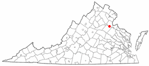
Hale's Ford is a small unincorporated community located in the northeastern corner of Franklin County, Virginia about 25 miles (40 km) from Roanoke. It is most notable as the location of the Burroughs Farm, the tobacco plantation where the famed educator and orator Booker T. Washington was born into slavery in 1856. His mother Jane was an enslaved black woman held by the Burroughs and his father was a white planter who lived nearby. After the American Civil War ended, Jane took her children to West Virginia to rejoin her husband, who had been sold there as a slave before the war.
Owens is a small unincorporated crossroads community at the intersection of Dahlgren Road, Windsor Drive, and Owens Drive in King George County, Virginia, United States. State Routes 206 and 218 meet at this intersection, with 206 going east towards U.S. Route 301 and Dahlgren, 218 going south towards US 301 and Colonial Beach and 206 and 218 joined together going west towards Arnolds Corner and Fredericksburg. The eastern part of the community is within the Dahlgren census-designated place.
This is a list of the National Register of Historic Places listings in Albemarle County, Virginia.
This is a list of the National Register of Historic Places listings in Arlington County, Virginia.
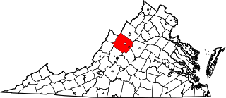
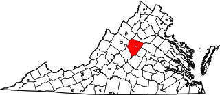
This is a list of the National Register of Historic Places listings in Augusta County, Virginia.

This is a list of the National Register of Historic Places listings in Richmond, Virginia.
This is a list of the National Register of Historic Places listings in Fredericksburg, Virginia.

This is a list of the National Register of Historic Places listings in Spotsylvania County, Virginia.

This is a list of the National Register of Historic Places listings in Henry County, Virginia.

Tulls Corner is an unincorporated community in Somerset County, Maryland, United States. Tulls Corner is located at the intersection of Tulls Corner Road and L. Q. Powell Road, south-southeast of Marion Station.

This is a list of the National Register of Historic Places listings in Surry County, Virginia.
This is a list of the National Register of Historic Places listings in Salem, Virginia.
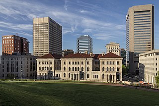
The Lewis F. Powell Jr. United States Courthouse, also known as the U.S. Post Office and Customhouse, is a historic custom house, post office and courthouse located in Richmond, Virginia. Originally constructed in 1858, it was for decades a courthouse for the United States District Court for the Eastern District of Virginia and the United States Court of Appeals for the Fourth Circuit. A new federal district courthouse opened in 2008, but the Powell Courthouse still houses the Fourth Circuit. The United States Congress renamed the building for Supreme Court justice Lewis F. Powell Jr., in 1993. It is listed on the National Register of Historic Places as U.S. Post Office and Customhouse.
Simons Corner is an unincorporated community in Richmond County, in the U.S. state of Virginia.
Oak Corner is an unincorporated community in Caroline County, in the U.S. state of Virginia.
Sprouses Corner is an unincorporated community in Buckingham County, in the U.S. state of Virginia.

Estouteville is a historic home located near Powell Corner, Albemarle County, Virginia. The main house was begun in 1827, and consists of a two-story, seven-bay central block, 68 feet by 43 feet, with two 35 feet by 26 feet, three-bay, single-story wings. It is constructed of brick and is in the Roman Revival style. A Tuscan cornice embellishes the low hipped roofs of all three sections, each of which is surmounted by tall interior end chimneys. The interior plan is dominated by the large Great Hall, a 23-by-35-foot richly decorated room. Also on the property are a contributing kitchen / wash house; a square frame dairy ; a square, brick smokehouse, probably built in the mid-19th century, also covered with a pyramidal roof; and a frame slave quarters.


