Rada is an unincorporated community in Hampshire County in the U.S. state of West Virginia. Rada is located on U.S. Highway 220/West Virginia Route 28 between Junction and Purgitsville in southwest Hampshire County along Mill Creek. It lies at an intersection of US 220/WV 28 with Rada Road.

Hebron is an unincorporated community on Glady Creek in Marion County, West Virginia, United States. It takes its name from the Hebron Church there.
Tilhance Creek is a 10.4-mile-long (16.7 km) tributary stream of Back Creek in Berkeley County of West Virginia's Eastern Panhandle.

Black River is a 78.8-mile-long (126.8 km) river in the U.S. state of Michigan, flowing mostly northward through four Northern Michigan counties: Otsego, Montmorency, Presque Isle, and Cheboygan. The Black River flows into the Cheboygan River at 45°36′13″N84°27′47″W, just south of the city of Cheboygan, and then into Lake Huron. The main branch of the Black River rises in Charlton Township in east-central Otsego County near the boundary with Montmorency County. The East Branch of the Black River rises less than a mile to the east in Vienna Township in Montmorency County. The other major tributaries, Canada Creek, Tomahawk Creek and the Rainy River all rise in northern Montmorency County.

Seneca Creek is a 19.6-mile-long (31.5 km) tributary of the North Fork of the South Branch of the Potomac River located entirely within Pendleton County, West Virginia, USA.

Stiltner was a small unincorporated community that developed at the mouth of Brush Creek, a tributary of Twelvepole Creek, in Wayne County, West Virginia, United States.

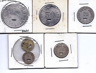
Hot Coal or Hotcoal was an unincorporated community and coal town located along the Winding Gulf Creek in Raleigh County, West Virginia, United States. Originally, it was named Patterson and later acquired the name Hot Coal. It was the next community past Big Stick on County Route 3/2. Although, the community now no longer exists, the Winding Gulf Bank, now the National Bank at Beckley, resided at Hot Coal and was moved to Beckley on January 1, 1914. Hot Coal at one time had a Post Office

Quick is a small unincorporated community in Kanawha County, West Virginia, United States. It is located along Indian Creek Road. The community is where Whitoak Fork and Blue Creek come together and meet. It is also where the abandoned railroad that follows Blue Creek joins the road, and follows it all the way to the community of Hitop, along Pond Fork. Its post office is closed.

Looneyville is an unincorporated community on Flat Creek of the Pocatalico River in Roane County, West Virginia, United States. It is located on West Virginia Route 36. The community is named for Robert Looney, a pioneer settler. The post office was established in 1870.

Alpoca is an unincorporated community in Wyoming County, West Virginia, United States, along Barkers Creek and West Virginia Route 10. The Alpoca Post Office has been closed.
Sturgeon River is a 63.6-mile-long (102.4 km) river in the U.S. state of Michigan, flowing mostly southward through Alger County and Delta County counties on the Upper Peninsula.

Brush Creek is an unincorporated community and coal town in Boone County, West Virginia. Their post office has closed.

Booher is an unincorporated community in Tyler County, West Virginia, United States, along Indian Creek. Its post office is closed.

Ronda is an unincorporated community and coal town in Kanawha County, West Virginia, United States, along Cabin Creek. Its post office is closed.

Ward is an unincorporated community and coal town in Kanawha County, West Virginia, United States. Its post office is closed. Ward is approximately 3 miles (4.8 km) northeast of Cedar Grove, along Kellys Creek.

New Thacker was an unincorporated community and coal town located in Mingo County, West Virginia, United States. Their Post Office has been closed.

Republic is an unincorporated community in Kanawha County, West Virginia, United States, along Cabin Creek. It was also known as Jochin. Its post office is closed.

Arnold Creek is a tributary of Middle Island Creek, 10.9 miles (17.5 km) long, in West Virginia in the United States. Via Middle Island Creek and the Ohio River, it is part of the watershed of the Mississippi River, draining an area of 34.7 square miles (90 km2) in a rural region on the unglaciated portion of the Allegheny Plateau.

Bays is a settlement in Nicholas County, West Virginia, United States on the border of Braxton and Webster Counties. It is at the intersection of Mill Creek Road and Old Turnpike Road. Its post office has been closed.


