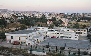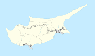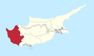
Paphos International Airport is a joint civil-military public airport located 6.5 km (4.0 mi) southeast of the city of Paphos, Cyprus. It is the country's second largest airport, after Larnaca International Airport. Paphos Airport is commonly used by tourists on vacation in western Cyprus, providing access to popular resorts such as Coral Bay, Limassol and Paphos itself.

Geroskipou is a coastal town in Cyprus, east of Paphos. Its current population is approximately 7,000 and it is the second largest municipality in the Paphos District. Yeroskipou, with its remarkable five-domed Byzantine church of Agia Paraskevi, and its Folk Art Museum, is a popular tourist destination. It is known especially for the production of Turkish Delight or "lokum". The town is the only place in the world which has protected geographical indication (PGI) for the popular dessert.

Agia Varvara is a village located in the Paphos District of Cyprus. Prior to 1974, the village was largely inhabited by Turkish Cypriots. Afterwards, the Turkish Cypriot population was relocated to Karavas, Trachoni, Pentageia, Famagusta and Morphou and was partially replaced by displaced Greek Cypriots from the north.

Vroisha or Frodisia is a deserted village in the Nicosia District of Cyprus, in the Paphos Forest. Before 1964, it was inhabited exclusively by Turkish Cypriots. Vroisha was deserted between 15 and 18 March 1964. Soon after, the Forestry Commission of the Republic of Cyprus razed the village to the ground. The village has been known as Vroişa for hundreds of years; sometime after 1974, the Republic of Cyprus changed its official name to "Frodisia".

Mandria is a village in the Paphos District of Cyprus, located 2 km east of Timi. Mandria is thought to have been founded around 500 years ago by Turkish Cypriots who originally called it 'green plain' ('Yeşilova').

Faleia is a village in the Paphos District of Cyprus, located 3 km south of Agios Fotios. Prior to 1974, it was inhabited exclusively by about 200 Turkish Cypriots. As of 2011, only 2 people lived in Faleia. The village is now in a desolate state.

Vretsia is an abandoned Turkish Cypriot village in the Paphos District of Cyprus, located 4 kilometres (2.5 mi) east of Koilineia. After the 1974 war, the Turkish-Cypriot natives of the village were forced to abandon the village and emigrate to the north of Cyprus.

Kourtaka is an abandoned Turkish Cypriot village in the Paphos District of Cyprus, located 8 km west of Ayios Photios.

Lapithiou is an abandoned village in the Paphos District of Cyprus, located 3 km south of Pano Panagia. Before 1974 it was mainly inhabited by Turkish Cypriots, whom abandoned the village and settled mainly in the occupied parts of Cyprus and London; after the Turkish invasion of Cyprus in 1974. Currently the houses in the village are rented out to foreign and local tourists by the government of Cyprus.

Terra is a village in the Paphos District of Cyprus, located 1 km north of Kritou Terra. Prior to 1974, the village was inhabited exclusively by Turkish Cypriots. In 1973, 329 Turkish Cypriots were living in Terra. As of 2011, it had a population of 36, none of whom were Turkish Cypriots.

Karamoullides is a village in the Paphos District of Cyprus, located 4 km (2.5 mi) south of Polis. Before 1974, it was a Turkish Cypriot village with 103 inhabitants in 1973. The inhabitants were relocated to Katokopia and Nikitas and were replaced partially by displaced Greek Cypriots from the north.

Androlykou is a Turkish Cypriot village in the Paphos District of Cyprus, located 5 km southwest of Polis Chrysochous.

Sarama is a deserted Turkish Cypriot village in the Paphos District of Cyprus, located 7 km south of Lysos. The village was devastated by an earthquake, which appears to be the reason it was deserted, although an insect destructive to the corn crop was reported to be affecting farmers of the village in 1879. Thermal springs in the vicinity indicate powerful hydrothermal activity.

Istinjon is a deserted Turkish Cypriot village in the Paphos District of Cyprus, located 5 km south of Lysos. Most of its inhabitants fled during an attack and siege by Greek Cypriot forces that began on 25 July 1974. The village remains a ghost village in ruins.

Zacharia is an abandoned Turkish Cypriot village in the Paphos District of Cyprus, located 4 km south of Lysos.

The Cyprus Air Command is the armed air wing of the National Guard. This force is equipped with attack and anti-tank helicopters, surface-to-air missile systems and integrated radar systems.

Neo Chorio is a village in the Paphos District of Cyprus, about 8 km west of Polis. Until 1958, it had a mixed Greek- and Turkish Cypriot population with a Greek Cypriot majority. Amid the intercommunal violence, the Turkish Cypriot inhabitants of Neo Chorio fled to Androlykou, a nearby Turkish Cypriot village. In 1975, following the Turkish invasion of the previous year and subsequent division of the island, most Turkish Cypriots of Neo Chorio resettled in Myrtou, now in Northern Cyprus. In 2011, Neo Chorio had a population of 519.
The 1974–75 Cypriot Second Division was the 20th season of the Cypriot second-level football league. APOP Paphos FC won their 4th title.


