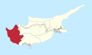
Paphos District is one of the six districts of Cyprus and it is situated in the western part of Cyprus. Its main town and capital is Paphos. The entire district is controlled by the internationally recognized government of Cyprus. There are four municipalities in Paphos District: Paphos, Yeroskipou, Peyia, and Polis Chrysochous.

Polis is a town at the north-west end of the island of Cyprus, at the centre of Chrysochous Bay, and on the edge of the Akamas peninsula nature reserve.
Peristerona(Greek: Περιστερώνα) is a small village located in the Paphos District of Cyprus, 9 km south of Polis. Hidden among the mountains of the area, the settlement of Peristerona Paphou maintains the traditional elements of Cypriot architecture, while there are plenty of those who build their country houses or hotel units in the area, encouraging foreigners and locals to visit the settlement. The village overlooks from above the vast peninsula of Akamas and the dam of Evretos.
Stroumpi or Stroumbi is a small village in central Paphos District, Cyprus, and halfway between Paphos and Polis. The name of the village is said to derive from its founder, a man called "Stroumpos", or the shape of the surrounding hills. The village is known for its annual "Dionysia" wine festival named after Dionysos, the ancient Greek god of wine, that takes place next to central square where the Ayias Sophias church is located at the end of August. A now-defunct "Dionysos" volleyball team was based in Stroumpi and played in the Cypriot top league.
Psathi is a village in the Paphos District of Cyprus, located 3 km west of Agios Dimitrianos. Psathi is located at 488m above sea level.
Polemi is a village in the Paphos District of Cyprus.
Dhrousha is a village in the Paphos District of Cyprus, located 10 km south of Polis Chrysochous. It's located at 640 m above sea level.

Giolou is a village in the Paphos District of Cyprus, located 20 km North of Paphos and 15 km South of Polis Chrysochous. At an altitude of about 300 meters from the sea, the settlement of Giolou is connected to the southwest and north to the main road that leads to Polis Chrysochous and Latsi, which in fact led to the identification of its name with the Turkish Cypriot word “yiol” and later with the wind god, Aeolus. The most prevalent version for the origins of its name, however, mentions the name of the feudal owner who had the village in his possession during the Byzantium era or during the period of the Frankish rule.
Loukrounou is an abandoned village in the Paphos District of Cyprus, located 3 km north of Miliou.

Kritou Terra is a village in the Paphos District of Cyprus, located 3 km east of Dhrousha. Kritou Terra is located 479 m above sea level. It receives 630 mm of rainfall annually. Situated in the area of Laona, as the wider area is called and in a landscape surrounded by high mountain peaks and to the north overlooking the Gulf of Chrysochous, Kritou Terra is built at an altitude of 465 meters, is one of the ampelochoria of the island and is considered one of the most beautiful and picturesque villages of the province. It has fantastic climatic conditions and because it’s located by the third biggest spring in Cyprus it’s green all year round.
Philousa Chrysochous is a village in the Paphos District of Cyprus, located 12 km southeast of Polis Chrysochous. Is located at 427 metres (1,401 ft) above sea level. Located next to Lake Evretos, Filousa Chrysochous is adjacent to the village of Tremithousa of Paphos and is one of the small communities of the island, but it has many of the natural beauties of the Cypriot countryside. Specifically, the settlement is built on a green hillside with carob trees, olive and fruit trees, and overlooks from above the villages of the area. The village lies close to Simou, Zacharia and Sarama Village. The two abandoned villages of Evretou and Trimithousa are also nearby. Filousa Village was at one at the centre of 5 surrounding Turkish Cypriot villages in the area.

Choli is a village in the Paphos District of Cyprus, located 7 km south of Polis Chrysochous. It is home to three churches: the late fifteenth- to early sixteenth-century Arkhángelos Mikaïl church, the fifteenth-century Panayía Odhiyítria Orthodox church and the twelfth-century St George church.
Goudi is a village in the Paphos District of Cyprus, located 6 km south of Polis Chrysochous on the Chrysochou River. It is spread out over a mild hillside between 60 and 120 meters above sea level.
Karamoullides is a village in the Paphos District of Cyprus, located 4 km (2.5 mi) south of Polis. Before 1974, it was a Turkish Cypriot village with 103 inhabitants in 1973. The inhabitants were relocated to Katokopia and Nikitas and were replaced partially by displaced Greek Cypriots from the north.

Chrysochou is a village in the Paphos District of Cyprus, located 3 km south of Polis Chrysochous.
Fasli is an abandoned Turkish Cypriot village in the Paphos District of Cyprus, located 2 km south of Androlikou.

Tremithousa Chrysochous is an abandoned village in the Paphos District of Cyprus, located 6 km southwest of Lysos and about 11 kilometers southeast of Polis Chrysochous.
Makounta is a village in the Paphos District of Cyprus, located 2 km south of Argaka. Overlooking the bay of Polis Chrysochous, Makounda is adjacent to Argaka, and nearby there is also a motocross track. Makounta is located 87 m above sea level.

Argaka is a village in the Paphos District of Cyprus, located 7 km northeast of Polis Chrysochous. From a geological perspective, it is located upon the calcareous sandstones, the sands, and the marls of the Pleistocene period as well as the lavas and the magma rocks . From a morphological aspect, what stand out are the coastal, alluvial plain, one or two marine terraces, and a slope that steadily ascends up to 500 metres. Several streams flow down from the slope toward the sea, indeed with a relatively large one flowing next to the village. The river of Makounta, upon which the Argaka – Makounta dam was constructed, is located southeast of the village.

Neo Chorio is a village in the Paphos District of Cyprus, about 8 km west of Polis. Until 1958, it had a mixed Greek- and Turkish Cypriot population with a Greek Cypriot majority. Amid the intercommunal violence, the Turkish Cypriot inhabitants of Neo Chorio fled to Androlykou, a nearby Turkish Cypriot village. In 1975, following the Turkish invasion of the previous year and subsequent division of the island, most Turkish Cypriots of Neo Chorio resettled in Myrtou, now in Northern Cyprus. In 2011, Neo Chorio had a population of 519. Since July 1998, Neo Chorio has also been home to Anassa Hotel, a luxury 5* beach resort owned by the Thanos Hotels Group.