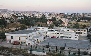
Paphos, also spelled as Pafos, is a coastal city in southwest Cyprus and the capital of Paphos District. In classical antiquity, two locations were called Paphos: Old Paphos, today known as Kouklia, and New Paphos. It is the fourth-largest city in the country, after Nicosia, Limassol and Larnaca, with an urban population of 63,600 in 2018.

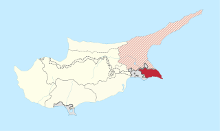
The Famagusta District, or simply Famagusta, is one of the six districts of Cyprus. Its capital city is Famagusta.

The Kyrenia District, or simply Kyrenia, is one of the six districts of Cyprus. Its capital city is Kyrenia. It is the smallest of Cyprus's districts, and is the only one controlled in its entirety by the unrecognised de facto state of Northern Cyprus, where the same territory is administered as the de facto Girne District, a distinct entity.

The Larnaca District, or simply Larnaca, is one of the six districts of Cyprus. Its capital is Larnaca. It is bordered on the east by Famagusta District, on the north by Nicosia District and on the west by Limassol District.

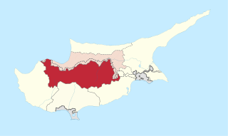
The Nicosia District, or simply Nicosia, is one of the six districts of Cyprus. Its main town is the island country's capital city, Nicosia. The de-facto TRNC-controlled northern part of the district is the Lefkoşa District of the unrecognized Turkish Republic of Northern Cyprus.

Polis is a town at the north-west end of the island of Cyprus, at the centre of Chrysochous Bay, and on the edge of the Akamas peninsula nature reserve.

Geroskipou is a coastal village in Cyprus, east of Paphos. Its current population is approximately 7,000 and it is the second largest municipality in the Paphos District. Yeroskipou, with its remarkable five-domed Byzantine church of Agia Paraskevi, and its Folk Art Museum, is a popular tourist destination. It is known especially for the production of the confectionery "lokum". The town is the only place in the world which has protected geographical indication (PGI) for the popular dessert.
Agia Marina may refer to several locations:

Tsada is a relatively big village 8 km North of Paphos city center. Although the proximity between them, the 612 m elevation difference gives to the Tsada area a totally different identity. It receives 610 millimetres (24 in) of precipitation annually. The climate is much cooler all year long and it also is one of the few areas in the Paphos District that snows almost every year by the end of January. Tsada was the home village of EOKA member Evagoras Pallikarides. Although the history of the village can be counted 500 years ago, there is no significant architectural character, and only a few residences were reconstructed in the traditional way. The Melisovouno hill between Tsada and Koili village hosts Paphos television and radio antenna.
Fyti is a village in the Paphos District of Cyprus. It is situated on a plateau 25 km north-east of Paphos and 20 km south-east of Polis. There are several small villages within a 3 km radius of Fyti, including Lasa, Kritou Marottou and Anadiou, all residing at an average altitude of 680 m.
Stroumpi or Stroumbi is a small village in central Paphos District, Cyprus, and halfway between Paphos and Polis. The name of the village is said to derive from its founder, a man called "Stroumpos", or the shape of the surrounding hills. The village is known for its annual "Dionysia" wine festival named after Dionysos, the ancient Greek god of wine, that takes place next to central square where the Ayias Sophias church is located at the end of August. A now-defunct "Dionysos" volleyball team was based in Stroumpi and played in the Cypriot top league.
Statos–Agios Fotios is a community consisting of two villages, Statos and Agios Fotios, in the Paphos District of Cyprus. The two are located about 4 km south-south-west of Pano Panagia. As of 2011, their combined population was 243.
Psathi is a village in the Paphos District of Cyprus, located 3 km west of Agios Dimitrianos. Psathi is located at 488m above sea level.

Kritou Terra is a village in the Paphos District of Cyprus, located 3 km east of Dhrousha. Kritou Terra is located 479 m above sea level. It receives 630 mm of rainfall annually. Situated in the area of Laona, as the wider area is called and in a landscape surrounded by high mountain peaks and to the north overlooking the Gulf of Chrysochous, Kritou Terra is built at an altitude of 465 meters, is one of the ampelochoria of the island and is considered one of the most beautiful and picturesque villages of the province. It has fantastic climatic conditions and because it’s located by the third biggest spring in Cyprus it’s green all year round.
Terra is a village in the Paphos District of Cyprus, located 1 km north of Kritou Terra. Prior to 1974, the village was inhabited exclusively by Turkish Cypriots. In 1973, 329 Turkish Cypriots were living in Terra. As of 2011, it had a population of 36.
Philousa Kelokedharon is a village in the Paphos District of Cyprus, located 4 km east of Arminou. The village of Filousa Kelokedaron is located in the province of Pafos. It is 40 km from the cities of Pafos and Limassol. Filousa Kelokedaron is one of the first villages of the Darizou valley, 15 km southwest of Platres, in the area of Omodos - Arsos. It is adjacent to the villages of Pretori, Kedares and Agios Nikolaos.
Androlykou is a Turkish Cypriot village in the Paphos District of Cyprus, located 5 km southwest of Polis Chrysochous.

Neo Chorio is a village in the Paphos District of Cyprus, about 8 km west of Polis. Until 1958, it had a mixed Greek- and Turkish Cypriot population with a Greek Cypriot majority. Amid the intercommunal violence, the Turkish Cypriot inhabitants of Neo Chorio fled to Androlykou, a nearby Turkish Cypriot village. In 1975, following the Turkish invasion of the previous year and subsequent division of the island, most Turkish Cypriots of Neo Chorio resettled in Myrtou, now in Northern Cyprus. In 2011, Neo Chorio had a population of 519. Since July 1998, Neo Chorio has also been home to Anassa Hotel, a luxury 5* beach resort owned by the Thanos Hotels Group.

The Limassol District, or simply Limassol or Lemesos, is one of the six districts of Cyprus. As of 2021, it had a population of 262,238, 75,7% of which was urban The district's capital city is Limassol. Part of the British Overseas Territory of Akrotiri and Dhekelia forms an enclave on the Akrotiri Peninsula, under the sovereignty of the United Kingdom.
Pittokopos is a locality in Dhrousha in Cyprus, in the Paphos District.


