Šentjur na Polju is a small village on the left bank of the Sava River in the Municipality of Sevnica in central Slovenia. The area is part of the historical region of Styria. The municipality is now included in the Lower Sava Statistical Region.

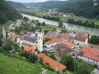
Loka pri Zidanem Mostu is a village on the left bank of the Sava River in the Municipality of Sevnica in central Slovenia. The area is part of the historical region of Styria. The municipality is now included in the Lower Sava Statistical Region.

Dolnje Brezovo is a small village on the left bank of the Sava River in the Municipality of Sevnica in central Slovenia. The area is part of the historical region of Lower Styria. The municipality is now included in the Lower Sava Statistical Region.
Čelovnik is a dispersed settlement in the hills north of Loka pri Zidanem Mostu in the Municipality of Sevnica in central Slovenia. The area is part of the historical region of Styria. The municipality is now included in the Lower Sava Statistical Region.

Gornje Brezovo is a settlement in the Municipality of Sevnica in central Slovenia. It lies on the left bank of the Sava River east of Sevnica. The area is part of the historical region of Styria. The municipality is now included in the Lower Sava Statistical Region.
Kamenica is a small village northeast of Krmelj in the Municipality of Sevnica in central Slovenia. The area is part of the historical region of Lower Carniola. The municipality is now included in the Lower Sava Statistical Region. Until 2001, the settlement included the area of now autonomous settlement of Kamenško.
Lončarjev Dol is a settlement in the hills east of Sevnica in east-central Slovenia. The area is part of the historical region of Styria. The entire Municipality of Sevnica is now included in the Lower Sava Statistical Region.
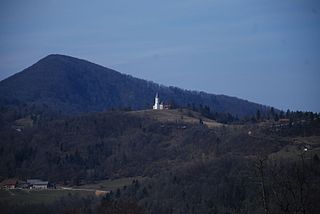
Metni Vrh is a dispersed settlement in the hills north of Sevnica in east-central Slovenia. The area is part of the historical region of Lower Styria. The Municipality of Sevnica is now included in the Lower Sava Statistical Region.
Okroglice is a settlement in the hills northeast of Loka pri Zidanem Mostu in the Municipality of Sevnica in east-central Slovenia. The area is part of the historical region of Styria. The municipality is now included in the Lower Sava Statistical Region.
Radež is a settlement in the hills above the left bank of the Sava River in the Municipality of Sevnica in east central Slovenia. The area is part of the historical region of Styria. The municipality is now included in the Lower Sava Statistical Region.

Račica is a settlement east of Loka pri Zidanem Mostu on the left bank of the Sava River in the Municipality of Sevnica in east-central Slovenia. The area is part of the historical region of Styria. The municipality is now included in the Lower Sava Statistical Region.
Slap is a small settlement above the left bank of the Sava River north of Loka pri Zidanem Mostu in the Municipality of Sevnica in east-central Slovenia. The area is part of the historical region of Styria. The municipality is now included in the Lower Sava Statistical Region.
Stržišče is a settlement in the hills northeast of Sevnica in east-central Slovenia. The area is part of the historical region of Styria. The Municipality of Sevnica is now included in the Lower Sava Statistical Region.
Žirovnica is a small settlement in the hills north of Loka pri Zidanem Mostu in the Municipality of Sevnica in east-central Slovenia. The area is part of the historical region of Styria and is now included in the Lower Sava Statistical Region with the rest of the municipality.
Žigrski Vrh is a settlement in the Municipality of Sevnica in central Slovenia. It lies in the hills above the left bank of the Sava River east of Sevnica in the historical region of Styria. The municipality is now included in the Lower Sava Statistical Region.
Vranje is a settlement in the Municipality of Sevnica in central Slovenia. It lies in the hills northeast of Sevnica in the historical region of Styria. The municipality is now included in the Lower Sava Statistical Region.

The Municipality of Škocjan, established in October 1994, is a municipality in the traditional region of Lower Carniola in southeastern Slovenia. The seat of the municipality is Škocjan. The Municipality of Škocjan is now included in the Southeast Slovenia Statistical Region. The majority of the municipality is part of the Novo Mesto Administrative Unit, except for the northeastern part, which belongs to the Sevnica Administrative Unit.

Križišče is a small village in the Municipality of Sevnica in southeastern Slovenia. It lies in the valley of Kamenica Creek, northwest of the road linking Sevnica and Mokronog and east of the road linking Krmelj and Šentjanž. The village became an autonomous settlement in 2008, and was formed from parts of the settlements of Gabrje and Goveji Dol. It is part of the traditional region of Lower Carniola and is included in the Lower Sava Statistical Region. One of the two roads from Krmelj to the main road linking Mokronog and Sevnica runs through the settlement. The rail line from Sevnica to Trebnje runs past the southeastern border of the settlement.
Kamenško is a small village in the Municipality of Sevnica in southeastern Slovenia. It lies on a small rise northeast of Krmelj, east of the road connecting Krmelj and Šentjanž, above and to the north of the villages of Brezje and Kamenica. Until 2001, the area was part of the settlement of Kamenica. The village is part of the traditional region of Lower Carniola and is included in the Lower Sava Statistical Region.