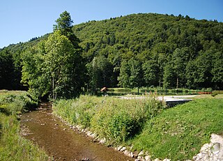
The Mirna is a river in southeastern Slovenia. The river, in which the marathon swimmer Martin Strel first learned to swim, is a right tributary of the Sava River in the province of Lower Carniola. It is 44 kilometers (27 mi) long, starts below the settlement of Velika Preska, flows through the Mirna Valley and joins the Sava at Dolenji Boštanj, opposite Sevnica. The largest settlement on the river is Mirna. The river is traversed by the Sevnica–Trebnje Railway. The river was mentioned for the first time in 1028 in relation to a 1016 document by Henry II, Holy Roman Emperor.

Preska is a small settlement in the hills northeast of Sodražica in southern Slovenia. It no longer has any permanent residents. The area is part of the traditional region of Lower Carniola and is now included in the Southeast Slovenia Statistical Region.
Velika Preska is a settlement in the hills west of Dole pri Litiji in central Slovenia. Traditionally the area was part of Lower Carniola and is now included with the rest of the Municipality of Litija in the Central Sava Statistical Region.
Preska pri Dobrniču is a small settlement just south of Dobrnič in the Municipality of Trebnje in eastern Slovenia. The area is part of the traditional region of Lower Carniola and is now included in the Southeast Slovenia Statistical Region.

Preska nad Kostrevnico is a settlement in the Municipality of Šmartno pri Litiji in central Slovenia. It lies in the hills east of Velika Kostrevnica in the historical region of Lower Carniola. The municipality is now included in the Central Slovenia Statistical Region.
Dolnje Brezovo is a small village on the left bank of the Sava River in the Municipality of Sevnica in central Slovenia. The area is part of the historical region of Lower Styria. The municipality is now included in the Lower Sava Statistical Region.
Kamenica is a small village northeast of Krmelj in the Municipality of Sevnica in central Slovenia. The area is part of the historical region of Lower Carniola. The municipality is now included in the Lower Sava Statistical Region. Until 2001, the settlement included the area of now autonomous settlement of Kamenško.
Žurkov Dol is a settlement in the hills above Sevnica in central Slovenia. The area is part of the historical region of Styria. The Municipality of Sevnica is now included in the Lower Sava Statistical Region.
Lončarjev Dol is a settlement in the hills east of Sevnica in east-central Slovenia. The area is part of the historical region of Styria. The entire Municipality of Sevnica is now included in the Lower Sava Statistical Region.
Metni Vrh is a dispersed settlement in the hills north of Sevnica in east-central Slovenia. The area is part of the historical region of Lower Styria. The Municipality of Sevnica is now included in the Lower Sava Statistical Region.
Orehovo is a settlement in the Municipality of Sevnica in central Slovenia. It lies on the left bank of the Sava River northwest of Sevnica. The area was traditionally part of Lower Styria. The municipality is now included in the Lower Sava Statistical Region.
Otavnik is a settlement southeast of Tržišče in the Municipality of Sevnica in east-central Slovenia. The area is part of the historical region of Lower Carniola. The municipality is included in the Lower Sava Statistical Region.
Prešna Loka is a small settlement in the hills northeast of Sevnica in the historical region of Styria in east-central Slovenia. The Municipality of Sevnica is part of the Lower Sava Statistical Region.
Srednik is a dispersed settlement in the hills north of Šentjanž in the Municipality of Sevnica in east-central Slovenia. The area is part of the historical region of Lower Carniola and is now included in the Lower Sava Statistical Region.
Žigrski Vrh is a settlement in the Municipality of Sevnica in central Slovenia. It lies in the hills above the left bank of the Sava River east of Sevnica in the historical region of Styria. The municipality is now included in the Lower Sava Statistical Region.
Vranje is a settlement in the Municipality of Sevnica in central Slovenia. It lies in the hills northeast of Sevnica in the historical region of Styria. The municipality is now included in the Lower Sava Statistical Region.
Telčice is a small settlement in the Municipality of Sevnica in central Slovenia. It lies north of Škocjan in the historical region of Lower Carniola. The municipality is now included in the Lower Sava Statistical Region.

Telče is a settlement east of Tržišče in the Municipality of Sevnica in east-central Slovenia. The area is part of the historical region of Lower Carniola. The municipality is now included in the Lower Sava Statistical Region.

Križišče is a small village in the Municipality of Sevnica in southeastern Slovenia. It lies in the valley of Kamenica Creek, northwest of the road linking Sevnica and Mokronog and east of the road linking Krmelj and Šentjanž. The village became an autonomous settlement in 2008, and was formed from parts of the settlements of Gabrje and Goveji Dol. It is part of the traditional region of Lower Carniola and is included in the Lower Sava Statistical Region. One of the two roads from Krmelj to the main road linking Mokronog and Sevnica runs through the settlement. The rail line from Sevnica to Trebnje runs past the southeastern border of the settlement.
Kamenško is a small village in the Municipality of Sevnica in southeastern Slovenia. It lies on a small rise northeast of Krmelj, east of the road connecting Krmelj and Šentjanž, above and to the north of the villages of Brezje and Kamenica. Until 2001, the area was part of the settlement of Kamenica. The village is part of the traditional region of Lower Carniola and is included in the Lower Sava Statistical Region.


