
The Lower Sava Valley is a region in southeastern Slovenia on the border with Croatia. It has three major urban centers: Brežice, Krško, and Sevnica. Its borders are almost identical with those of the Lower Sava statistical region.

Spodnje Dule is a settlement in the hills northwest of Leskovec pri Krškem in the Municipality of Krško in eastern Slovenia. The area was traditionally part of Lower Carniola and is now included with the rest of the municipality in the Lower Sava Statistical Region.
Spodnje Pijavško is a settlement on the right bank of the Sava River in the Municipality of Krško in eastern Slovenia. The area was traditionally part of Lower Carniola and is now included with the rest of the municipality in the Lower Sava Statistical Region.
Spodnje Grušovje is a settlement in the Municipality of Slovenske Konjice in eastern Slovenia. The area is part of the traditional region of Styria. The municipality is now included in the Savinja Statistical Region. The A1 Slovenian motorway runs through the settlement.
Spodnje Duplice is a small settlement in the Municipality of Grosuplje in central Slovenia. It lies in the hills just east of Grosuplje in the historical region of Lower Carniola. The municipality is now included in the Central Slovenia Statistical Region.

Spodnje Brezovo is a village west of Višnja Gora in the Municipality of Ivančna Gorica in central Slovenia. The area is part of the historical region of Lower Carniola and is included in the Central Slovenia Statistical Region.
Dolnje Brezovo is a small village on the left bank of the Sava River in the Municipality of Sevnica in central Slovenia. The area is part of the historical region of Lower Styria. The municipality is now included in the Lower Sava Statistical Region.
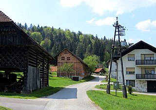
Drožanje is a settlement just north of Sevnica in east-central Slovenia. The area is part of the historical region of Styria. The Municipality of Sevnica is now included in the Lower Sava Statistical Region.

Gornje Brezovo is a settlement in the Municipality of Sevnica in central Slovenia. It lies on the left bank of the Sava River east of Sevnica. The area is part of the historical region of Styria. The municipality is now included in the Lower Sava Statistical Region.
Kamenica is a small village northeast of Krmelj in the Municipality of Sevnica in central Slovenia. The area is part of the historical region of Lower Carniola. The municipality is now included in the Lower Sava Statistical Region. Until 2001, the settlement included the area of now autonomous settlement of Kamenško.
Lončarjev Dol is a settlement in the hills east of Sevnica in east-central Slovenia. The area is part of the historical region of Styria. The entire Municipality of Sevnica is now included in the Lower Sava Statistical Region.
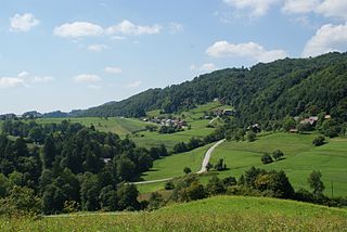
Metni Vrh is a dispersed settlement in the hills north of Sevnica in east-central Slovenia. The area is part of the historical region of Lower Styria. The Municipality of Sevnica is now included in the Lower Sava Statistical Region.
Podgorica is a dispersed settlement in the Municipality of Sevnica in east-central Slovenia. It lies on the slope of Mount Lisca north of Sevnica in the historical region of Styria. The municipality is now included in the Lower Sava Statistical Region.

Spodnje Vodale is a settlement east of Tržišče in the Municipality of Sevnica in east-central Slovenia. The municipality is now included in the Lower Sava Statistical Region. The area was traditionally part Lower Carniola.
Stržišče is a settlement in the hills northeast of Sevnica in east-central Slovenia. The area is part of the historical region of Styria. The Municipality of Sevnica is now included in the Lower Sava Statistical Region.
Žigrski Vrh is a settlement in the Municipality of Sevnica in central Slovenia. It lies in the hills above the left bank of the Sava River east of Sevnica in the historical region of Styria. The municipality is now included in the Lower Sava Statistical Region.
Vranje is a settlement in the Municipality of Sevnica in central Slovenia. It lies in the hills northeast of Sevnica in the historical region of Styria. The municipality is now included in the Lower Sava Statistical Region.

Križišče is a small village in the Municipality of Sevnica in southeastern Slovenia. It lies in the valley of Kamenica Creek, northwest of the road linking Sevnica and Mokronog and east of the road linking Krmelj and Šentjanž. The village became an autonomous settlement in 2008, and was formed from parts of the settlements of Gabrje and Goveji Dol. It is part of the traditional region of Lower Carniola and is included in the Lower Sava Statistical Region. One of the two roads from Krmelj to the main road linking Mokronog and Sevnica runs through the settlement. The rail line from Sevnica to Trebnje runs past the southeastern border of the settlement.
Kamenško is a small village in the Municipality of Sevnica in southeastern Slovenia. It lies on a small rise northeast of Krmelj, east of the road connecting Krmelj and Šentjanž, above and to the north of the villages of Brezje and Kamenica. Until 2001, the area was part of the settlement of Kamenica. The village is part of the traditional region of Lower Carniola and is included in the Lower Sava Statistical Region.


