
Šentjur na Polju is a small village on the left bank of the Sava River in the Municipality of Sevnica in central Slovenia. The area is part of the historical region of Styria. The municipality is now included in the Lower Sava Statistical Region.

Osredek pri Trški Gori is a small settlement in the hills above the right bank of the Sava River, beyond Trška Gora in the Municipality of Krško in eastern Slovenia. The area was traditionally part of Lower Carniola. It is now included with the rest of the municipality in the Lower Sava Statistical Region.
Osredek pri Zrečah is a small settlement immediately west of the town of Zreče in northeastern Slovenia. The area was traditionally part of Styria. It is now included with the rest of the Municipality of Zreče in the Savinja Statistical Region.
Osredek pri Podsredi is a settlement in the Municipality of Kozje in eastern Slovenia. It lies in the hills south and east of Podsreda. The area is part of the historical Styria region. The municipality is now included in the Savinja Statistical Region.
Apnenik pri Boštanju is a settlement to the west of Boštanj in the Municipality of Sevnica in central Slovenia. The area is part of the historical region of Lower Carniola. The municipality is now included in the Lower Sava Statistical Region.
Drušče is a settlement in the hills south of Boštanj in the Municipality of Sevnica in central Slovenia. The area is part of the historical region of Lower Carniola. The municipality is now included in the Lower Sava Statistical Region.
Čelovnik is a dispersed settlement in the hills north of Loka pri Zidanem Mostu in the Municipality of Sevnica in central Slovenia. The area is part of the historical region of Styria. The municipality is now included in the Lower Sava Statistical Region.

Kal pri Krmelju is a small settlement in the Municipality of Sevnica in central Slovenia. The area is part of the historical region of Lower Carniola. The municipality is now included in the Lower Sava Statistical Region.
Kladje pri Krmelju is a settlement in the hills northwest of Krmelj in the historical region of Lower Carniola in central Slovenia. It belongs to the Municipality of Sevnica. The municipality is included in the Lower Sava Statistical Region.
Laze pri Boštanju is a dispersed settlement in the hills south of Boštanj in the Municipality of Sevnica in central Slovenia. The area is part of the historical region of Lower Carniola. The municipality is now included in the Lower Sava Statistical Region. It includes the hamlets of Rekštanj and Zapuže.
Okroglice is a settlement in the hills northeast of Loka pri Zidanem Mostu in the Municipality of Sevnica in east-central Slovenia. The area is part of the historical region of Styria. The municipality is now included in the Lower Sava Statistical Region.
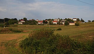
Osredek pri Krmelju is a settlement northwest of Krmelj in the Municipality of Sevnica in central Slovenia. The area is part of the historical region of Lower Carniola. The municipality is now included in the Lower Sava Statistical Region. It includes the hamlets of Rupa, Radvanca, Dobovec, Gabrje, Komatca, Oplaz, Kij, and Prinštal.
Polje pri Tržišču is a settlement in the Municipality of Sevnica in east-central Slovenia. It lies south of Krmelj in the traditional region of Lower Carniola. The municipality is now included in the Lower Sava Statistical Region.
Ponikve pri Studencu is a small settlement northeast of Studenec in the Municipality of Sevnica in east-central Slovenia. It lies in the hills above the right bank of the Sava River in an area that traditionally belonged to Lower Carniola. The municipality is now included in the Lower Sava Statistical Region.
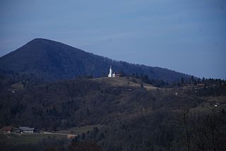
Radež is a settlement in the hills above the left bank of the Sava River in the Municipality of Sevnica in east central Slovenia. The area is part of the historical region of Styria. The municipality is now included in the Lower Sava Statistical Region.

Račica is a settlement east of Loka pri Zidanem Mostu on the left bank of the Sava River in the Municipality of Sevnica in east-central Slovenia. The area is part of the historical region of Styria. The municipality is now included in the Lower Sava Statistical Region.
Rovišče pri Studencu is a nucleated settlement in the Municipality of Sevnica in central Slovenia. The area is part of the historical region of Lower Carniola. The municipality is now included in the Lower Sava Statistical Region.
Žirovnica is a small settlement in the hills north of Loka pri Zidanem Mostu in the Municipality of Sevnica in east-central Slovenia. The area is part of the historical region of Styria and is now included in the Lower Sava Statistical Region with the rest of the municipality.

Telče is a settlement east of Tržišče in the Municipality of Sevnica in east-central Slovenia. The area is part of the historical region of Lower Carniola. The municipality is now included in the Lower Sava Statistical Region.

The Municipality of Škocjan, established in October 1994, is a municipality in the traditional region of Lower Carniola in southeastern Slovenia. The seat of the municipality is Škocjan. The Municipality of Škocjan is now included in the Southeast Slovenia Statistical Region. The majority of the municipality is part of the Novo Mesto Administrative Unit, except for the northeastern part, which belongs to the Sevnica Administrative Unit.


